The Waiau Toa / Clarence River is on northeast South Island of New Zealand. It is 230 kilometres (140 mi) long, which makes it the eighth longest river in New Zealand.
The Murchison Glacier is an 18-kilometre (11 mi) long glacier flowing through Aoraki/Mount Cook National Park in the South Island of New Zealand. Lying to the east of the Malte Brun range and west of the Liebig Range, high in the Southern Alps, it flows from the Tasman Saddle at 2,435 m mostly southwestwards to around 1,110 m. The Murchison River, which takes its meltwater, flows under the larger Tasman Glacier to the south.

The Priestley Glacier is a major valley glacier, about 96 km (60 mi) long, originating at the edge of the polar plateau of Victoria Land. The glacier drains southeast between the Deep Freeze and Eisenhower ranges to enter the northern end of the Nansen Ice Sheet.

Te Wairoa is a deserted village located close to the shore of Lake Tarawera in New Zealand's North Island. It was a Māori and European settlement founded in 1848 by the Revd Seymour Mills Spencer where visitors would stay on their way to visit the Pink and White Terraces. The village was destroyed by the eruption of the volcano Mount Tarawera on June 10, 1886. 120 people died in the eruption, many of them in other villages closer to the volcano.The site of one of these villages (Kokotaia) was instrumental in the recent rediscovery of the Pink and White Terrace locations.

The Mokau River is located in the North Island of New Zealand.

The Kori Creek is a tidal creek in the Kutch region of the Indian state of Gujarat. This region belonging to India is a part of the Indus River Delta most of which lies in Sindh, Pakistan. The Sir Creek, laying around 33 km northwest of Kori Creek, is a disputed area between India and Pakistan.

Hundalee is a rural locality in the Hurunui District of the Canterbury region of New Zealand's South Island. It straddles the Conway River, the traditional boundary between Canterbury and Marlborough and is in the Hundalee Hills.

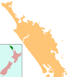
Horeke is a settlement in the upper reaches of the Hokianga Harbour in Northland, New Zealand. Kohukohu is just across the harbour. The Horeke basalts are located near the town, and can be viewed on an easy stroll through the Wairere Boulders, a commercial park.

The Karikari Peninsula on the east coast of the far north of Northland is between Rangaunu Harbour to the west, and Doubtless Bay to the southeast. It is a right-angled land mass of two relatively distinct parts. The rocky northern part, which has an east–west orientation and is approximately 17 km long, was originally an island but is now connected to the mainland by a low sandy tombolo approximately 11 km long, which has a north–south orientation. The spiritually significant Puwheke sits high above the north-facing beaches.
The Grebe River is a river in Fiordland, New Zealand. It arises north-west of Lake Monowai in an area once part of the lake but cut off by an enormous landslide about 13,000 years ago. The river now flows north, between the Townley Mountains to the west, and the Hunter Mountains to the east, and into Lake Manapouri's South Arm. Its major tributaries are Jaquiery Stream, Florence Stream, Emerald Stream, and Percy Stream, all from the west.
The Kahutara River is a river of New Zealand's South Island. It flows southeast from the Seaward Kaikoura Range, reaching the Pacific Ocean at the tiny settlement of Peketa, 7 kilometres (4 mi) southwest of Kaikoura.
The Potts River is a river of the Canterbury Region of New Zealand's South Island. It flows generally south from the southern end of the Arrowsmith Range through a steep-sided valley between the Potts Range to the west and the Big Hill Range to the east.
The Tapuwae River is a river of the Northland Region of New Zealand's North Island. Most of its length is as an arm of the drowned valley of the Hokianga Harbour, which it reaches from the north close to the small settlement of Tapuwae, five kilometres northwest of Rawene.
The Victoria River is a river of the Northland Region of New Zealand's North Island. It flows generally northwest from the Maungataniwha Range, reaching the Awanui River to the east of Kaitaia.
The Waitahuna River is a river in New Zealand, a tributary of the Clutha River.
Sae Saboua is a village and rural commune in Niger.

Argosy Glacier is a glacier about 15 nautical miles (30 km) long, flowing east through the Miller Range to enter Marsh Glacier north of Kreiling Mesa. It was named by the New Zealand Geological Survey Antarctic Expedition (1961–62).

Demorest Glacier is a glacier on the northeast side of Hemimont Plateau which flows southeast into Whirlwind Inlet between Flint Glacier and Matthes Glacier, on the east coast of Graham Land. It was discovered by Sir Hubert Wilkins on a flight of December 20, 1928, and photographed from the air by the United States Antarctic Service in 1940. It was charted by the Falkland Islands Dependencies Survey in 1947 and named for Max H. Demorest, an American glaciologist.
Wairere Boulders is a private nature reserve with geologically rare rock formations, at Wairere, in the Hokianga region of northern New Zealand. The Wairere Boulders is a popular tourist attraction in the area. Visitors can walk around the various trails, kayak down the boulder river and stay at the campsite. The property is owned by Graham and Paula Grant, who are originally from Scotland. They took over the property in 2017 and have sustainably developed the nature reserve, by extending and upgrading the trails, creating a campground, and opening a cafe. The farm is now a beef breeding enterprise, with Highland Cattle.
Hastings Point is a town located in north-eastern New South Wales, Australia, in the Tweed Shire.


