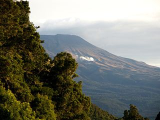
New Zealand has a large number of hot springs, known as waiariki in Māori. Many of them are used for therapeutic purposes.
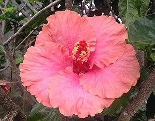
The Hibiscus Coast is a populated area on a stretch of the Hauraki Gulf coast in New Zealand's Auckland Region. It has a population of 60,000, making it the 11th most populous urban area in New Zealand, and the second most populous in the Auckland Region, behind Auckland itself.

Clinton is a small town in South Otago, in New Zealand's South Island. Handy to the Catlins, Dunedin, Lawrence, Central Otago and Tapanui. It is located on State Highway 1 approximately halfway between Balclutha and Gore, and the Main South Line railway passes through the town.

Silverdale is a village approximately 30 km north of Auckland in the North Island of New Zealand. It is located on the north bank of the Weiti River and lies to the west of the Whangaparaoa Peninsula.
Wainui is a locality in the Rodney Ward of the Auckland Region of New Zealand. Wainui is approximately 5.5 kilometres north-east of Waitoki and 10 km west of Orewa. The Wainui Stream flows south-west through the area, and exits into the Kaukapakapa River.

William Hugh Montgomery was a New Zealand politician of the Liberal Party, from the Canterbury region.
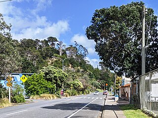
Waiwera is a small town in the north of the Auckland Region in New Zealand. Waiwera is 6 km north of Orewa, 6 km south-east of Puhoi, 23 km south-east of Warkworth and approximately 35 km from the Auckland City centre. The settlement lies at the outlet of a river also called Waiwera. Less than 1 kilometre north of the Waiwera turn-off lies the turn-off to Wenderholm Regional Park which is situated on the far side of the headland to the north of the Waiwera River outlet.

Waiwera Hot Pools is a hot springs system located in the small coastal village of Waiwera, just north of Auckland, New Zealand. They were known to the Māori people for centuries before being developed. In the 1960s and 70s overproduction and overpumping of the geothermal aquifer led to significant loss of pressure and desiccation of the springs in the late 1970. A decade later the thermal springs began to recover, although the system has not returned to the former artesian conditions.
The Puhoi River is a river of the Auckland Region of New Zealand's North Island. It flows southeast from its sources 10 kilometres (6 mi) southwest of Warkworth, passing through the town of Puhoi before reaching the coast of Whangaparaoa Bay seven kilometres north of Orewa.
The Waiwera River is a river in New Zealand, a tributary of the Clutha River.
State Highway 17 was the designation for a 32-kilometre stretch of highway in northern Auckland in the North Island of New Zealand from December 1999 to October 2012. It is now designated Urban Route 31 and consists of the Hibiscus Coast Highway, Dairy Flat Highway and Albany Expressway. It linked State Highway 1 at Puhoi in the north with SH 1 at Albany in the south. Its main destinations were the towns of Waiwera, Orewa, Red Beach, Whangaparaoa, Silverdale, Dairy Flat and the suburb of Albany. Prior to its inception as SH 17, the road was part of SH 1, and was redesignated as SH 17 as the Northern Motorway was extended northwards and took over the designation of SH 1.
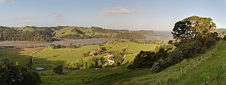
Wenderholm Regional Park is a regional park north of Auckland in New Zealand's North Island. It is situated between the estuaries of the Puhoi River and the Waiwera River, on the east coast of New Zealand's North Island and features a homestead known as Couldrey House, and a carved pouwhenua.
Waiwera South is a small settlement in the South Island of New Zealand, close to the boundary between the Otago and Southland regions. The settlement is located between Balclutha and Clinton, immediately to the south of State Highway 1, between branches of the Waiwera River and Kaihiku Stream, two minor tributaries of the Clutha River. The South Island Main Trunk railway also runs through the township. The settlement's population is around 100.

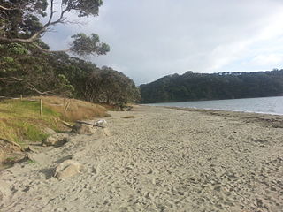
Hatfields Beach, officially Ōtānerua / Hatfields Beach, is a northern coastal suburb of Auckland, in New Zealand. It is on the Hibiscus Coast Highway about 40 kilometres north of the city centre.
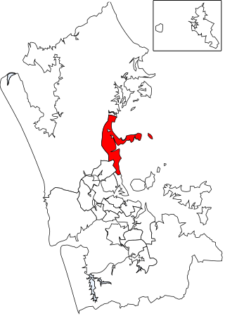
Hibiscus and Bays is a local government area in Auckland, in New Zealand's Auckland Region, governed by the Hibiscus and Bays Local Board and Auckland Council. It currently aligns with the council's Albany Ward.

The Waiwera River is a stream of the Auckland Region of New Zealand's North Island, near the township of Waiwera.
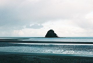
Mahurangi Island, is an island at the mouth of the Waiwera River, in the Auckland Region, New Zealand.
This page is based on this
Wikipedia article Text is available under the
CC BY-SA 4.0 license; additional terms may apply.
Images, videos and audio are available under their respective licenses.