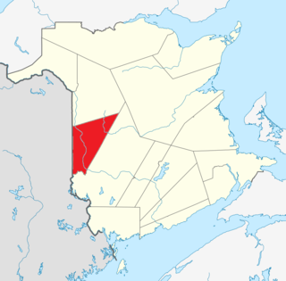
Carleton County is located in west-central New Brunswick, Canada.

Hartland is a town in Carleton County, New Brunswick, Canada.
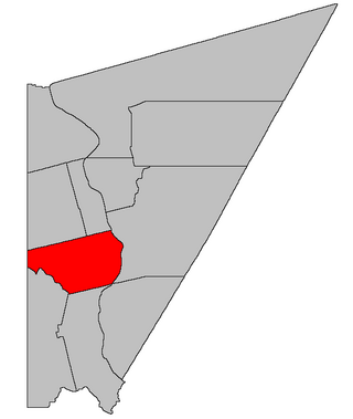
Florenceville-Bristol is a former town in the northwestern part of Carleton County, New Brunswick, Canada along the Saint John River. It held town status prior to 2023 and is now part of the town of Carleton North.

Woodstock is a town in Carleton County, New Brunswick, Canada on the Saint John River, 103 km upriver from Fredericton at the mouth of the Meduxnekeag River. It is near the Canada–United States border and Houlton, Maine and the intersection of Interstate 95 and the Trans-Canada Highway making it a transportation hub. It is also a service centre for the potato industry and for more than 26,000 people in the nearby communities of Hartland, Florenceville-Bristol, Centreville, Bath and Lakeland Ridges for shopping, employment and entertainment.

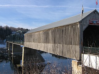
The Hartland Covered Bridge in Hartland, New Brunswick, is the world's longest covered bridge, at 1,282 feet (391 m) long. It crosses the Saint John River from Hartland to Somerville, New Brunswick, Canada. The framework consists of seven small Howe Truss bridges joined on six piers.
Somerville is a Canadian rural community in Carleton County, New Brunswick.
Peel is a Canadian rural community in Carleton County, New Brunswick. It is located on the east side of the Saint John River, 5.71 km NNW of Hartland, on the road to Stickney. It is part of Peel Parish.
Waterville is a Canadian rural community in Carleton County, New Brunswick on Route 590.
Stephen Burpee Appleby was a Canadian politician and lawyer.
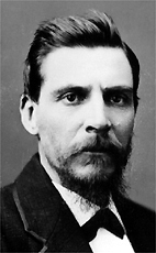
Randolph Ketchum Jones was a lawyer and political figure in New Brunswick. He represented Carleton County in the Legislative Assembly of New Brunswick from 1874 to 1878.
Avondale is a community in the Canadian province of New Brunswick. With a population of about 100, is located off the Trans-Canada Highway about 15 km from Hartland, famous for its very long covered bridge. Avondale is about an hour's drive west from Fredericton N.B. and 30 minutes from the start of Interstate 95 in Houlton, Maine.
The North Branch Meduxnekeag River is a river in Aroostook County, Maine and Carleton County, New Brunswick. From the outlet of a small pond in Maine Township 8, Range 3, WELS, the river runs about 20 miles (30 km) northeast, south, and east to the Canada–United States border, crossing into Canada at 46°16′40″N67°46′56″W. It runs about 4 miles (6 km) southeast to its confluence with the Meduxnekeag River in Wakefield, NB.

Kent is a geographic parish in the northeastern corner of Carleton County, New Brunswick, Canada.

Simonds is a geographic parish in Carleton County, New Brunswick, Canada, located north of Woodstock on the western bank of the Saint John River.
Wakefield is a geographic parish in Carleton County, New Brunswick, Canada, located north on the west bank of the Saint John River north of Woodstock.

Brighton is a geographic parish in Carleton County, New Brunswick, Canada, northeast of Woodstock, extending from the eastern bank of the Saint John River to the York County line.
Hartland Community School is a K-12 school located in Hartland, New Brunswick, Canada. Hartland Community School has around 575 students. The students in Hartland Community School are from all of Carleton County. The school logo is a garnet-colored husky.
Knowlesville is a small community in Carleton County in the Canadian province of New Brunswick. Knowlesville is in Aberdeen Parish, with a population in the 2011 Census of 981. It is located approximately 20 km east of Florenceville-Bristol, New Brunswick, along the Knowlesville Road.
Victoria Corner, New Brunswick is a community in Carleton County, New Brunswick, Canada located on the west side of the Saint John River, 3.71 km north of Wakefield, 10 miles from Woodstock, on the road to Somerville.
The Becaguimec Stream is a minor tributary of the Saint John River in the Canadian Province of New Brunswick. It rises in the hilly woods along the county line dividing Carleton County, Canada from York County, Canada in the western region of the province. Its watershed is adjacent to the South Branch of the Southwest Miramichi River, the Nashwaak River, the Keswick River and the Nackawic Stream.

