See also
Coordinates: 47°02′N55°12′W / 47.033°N 55.200°W
| This Newfoundland and Labrador location article is a stub. You can help Wikipedia by expanding it. |
Wandsworth, Newfoundland and Labrador was a settlement located southwest of Burin. It had a population of 91 in 1956.
Coordinates: 47°02′N55°12′W / 47.033°N 55.200°W
| This Newfoundland and Labrador location article is a stub. You can help Wikipedia by expanding it. |

The Gulf of Saint Lawrence is the outlet of the North American Great Lakes via the Saint Lawrence River into the Atlantic Ocean. The gulf is a semi-enclosed sea, covering an area of about 226,000 square kilometres (87,000 sq mi) and containing about 34,500 cubic kilometres (8,300 cu mi) of water, which results in an average depth of 152 metres (499 ft).
Division No. 1, Subdivision A is an unorganized subdivision on the Avalon Peninsula in Newfoundland and Labrador, Canada. It is in Division No. 1, and lies between Trinity Bay and Placentia Bay.

The Labrador Sea is an arm of the North Atlantic Ocean between the Labrador Peninsula and Greenland. The sea is flanked by continental shelves to the southwest, northwest, and northeast. It connects to the north with Baffin Bay through the Davis Strait. It has been described as a marginal sea of the Atlantic.

Burin-Placentia West was a provincial electoral district for the House of Assembly of Newfoundland and Labrador, Canada. The district was known as Placentia West prior to 1975. As of 2011 there were 7,673 eligible voters living within the district.

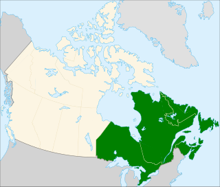
Eastern Canada is generally considered to be the region of Canada east of Manitoba, consisting of the following provinces:

The Burin Peninsula is a peninsula located on the south coast of the island of Newfoundland in the province of Newfoundland and Labrador.

Anderson's Cove was a small town on the south coast of the province of Newfoundland and Labrador.

Fortune is a Canadian town located in the province of Newfoundland and Labrador.

Baine Harbour is a Canadian community in the province of Newfoundland and Labrador.

Garnish, a town located on the west coast of the Burin Peninsula, was well known for its lumbering and now for its lobstering operations. Located on Route 213, it is 25 km along route 220 north west of Grand Bank and 18 km along Route 220 east of Marystown. The Way Office was established in 1852 and the first Waymaster was Henry Campe. Other notable people include Mayor Gregory Day and Brian Marshall. 2006 the town had a population of 578.
The Bay du Nord River is located on the south coast of the Island of Newfoundland in the Canadian province of Newfoundland and Labrador. Much of the drainage basin is contained within the Middle Ridge Wildlife Reserve and the Bay du Nord Wilderness Reserve of central Newfoundland.
Miles Cove is a town on Sunday Cove Island in the Canadian province of Newfoundland and Labrador. The town had a population of 104 in 2014, down from 140 in the Canada 2006 Census.
Morrisville is a town in the Canadian province of Newfoundland and Labrador. The town had a population of 128 in the Canada 2006 Census.
Milltown–Head of Bay d'Espoir is a town in the Canadian province of Newfoundland and Labrador. The town had a population of 749 in the Canada 2016 Census.
St. Jacques-Coomb's Cove is a town in the Canadian province of Newfoundland and Labrador. The town had a population of 669 in the Canada 2006 Census. It is located on the south coast of the island of Newfoundland on the north side of Fortune Bay, on the southern tip of the Connaigre Peninsula in what is now known as the Coast of Bays Region. The town consists of six communities, St. Jacques, English Harbour West, Mose Ambrose, Boxey, Coomb's Cove and Wreck Cove, nestled within the inlets along the coast. They all had their beginnings in the fisheries and the fisheries have always been the mainstay of employment in the communities. In recent years aquaculture was introduced in the area, providing employment for its residents.

Bay de L'Eau Island is an abandoned community in Newfoundland and Labrador.

J.T. Cheeseman Provincial Park, is a provincial park located near Channel-Port aux Basques, Newfoundland and Labrador.

Frenchman's Cove Provincial Park, is a provincial park located on the west side of the Burin Peninsula in Newfoundland and Labrador.
Division No. 1, Subdivision L is an unorganized subdivision on the Avalon Peninsula in Newfoundland and Labrador, Canada. It is in Division 1 and contains the unincorporated communities of Bareneed, Black Duck Pond, Blow Me Down, Coley's Point South, Hibb's Cove, Pick Eyes, Port de Grave, Ship Cove and The Dock
Division No. 1, Subdivision U is an unorganized subdivision on the Avalon Peninsula in Newfoundland and Labrador, Canada, in Division 1. It contains the unincorporated communities of Admiral's Cove, Bauline East, Bauline South, Burnt Cove, Devils Kitchen, Flat Rock, St. Michaels and Seal Cove.