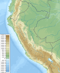
Junín Province is a province in northwestern Junín Region, in the central highlands of Peru. Its capital is the city of Junín.

Lake Acucocha is a lake in the Pasco Region in Peru. It is located in the Pasco Province, in the districts of Simón Bolívar and Tinyahuarco, approximately 27 kilometres from Tinyahuarco. It belongs to the watershed of the Mantaro River.
Huichicocha is a lake in Peru located in the Junín Region, Huancayo Province, Chongos Alto District. It is situated at a height of approximately 4,653 metres (15,266 ft), about 3.16 km long and 1.74 km at its widest point. Huichicocha lies northwest of Acchicocha, southwest of Yurajcocha and east of Coyllococha.
Yurajcocha, Tintayari or Huampuni is a lake in Peru located in the Junín Region, Huancayo Province, Chongos Alto District. It is situated at a height of approximately 4,466 metres (14,652 ft), about 5 km long and 0.84 km at its widest point. Yurajcocha lies north of Acchicocha and northeast of Huichicocha. The lake belongs to the watershed of the Mantaro River.
Ñawinqucha is a lake in Peru located in the Junín Region, Huancayo Province, Chongos Alto District. It is situated at a height of approximately 4,592 metres (15,066 ft), about 2.25 km long and 0.64 km at its widest point. Ñawinqucha lies southeast of Yuraqqucha and northeast of Aqchiqucha. It belongs to the watershed of the Mantaro River.
Coyllococha is a lake in Peru located in the Junín Region, Huancayo Province, Chongos Alto District. It is situated at a height of approximately 4,683 metres (15,364 ft), about 4.15 km long and 1.45 km at its widest point. Coyllococha lies southwest of Yurajcocha and Huichicocha. It belongs to the watershed of the Mantaro River.
Wich'iqucha is a lake in Peru. It is situated in the Junín Region, Jauja Province, Canchayllo District, west of Yuraqqucha. The lake belongs to the watershed of the Mantaro River.
Qarwaqucha is a lake in Peru located in the Junín Region, Jauja Province, Canchayllo District. It lies southeast of the peaks of Tunshu and Tukumach'ay and west of a lake named Wayllakancha (Huayllacancha). It belongs to the watershed of the Mantaro River.
Yanaqucha is a lake in Peru located in the Pasco Region, Pasco Province, Huayllay District. It is situated at a height of about 4,471 metres (14,669 ft). Yanaqucha lies between Waskaqucha in the west and Lake Junin in the east. The lake belongs to the watershed of the Mantaro River.
Yuraqqucha is a mountain in the Andes of Peru, about 5,100 metres (16,732 ft) high. It is located in the Junín Region, Yauli Province, Morococha District, and in the Lima Region, Huarochirí Province, Chicla District. Yuraqqucha lies northwest of a lake named Waqraqucha, the Antikuna mountain pass and the peak of Antikuna. Anta Q'asa, Sillaqaqa, Inka Kancha and Pukaqucha are situated west, southwest and northwest of Yuraqqucha.
Waqraqucha is a lake in Peru located in the Junín Region, Yauli Province, Suitucancha District. It is situated east of the Paryaqaqa or Waruchiri mountain range. Waqraqucha lies north of a lake named Wayllakancha (Huaylacancha) and the smaller lakes called Antaqucha (Antacocha), Wirukancha (Huirocancha) and Llaksaqucha (Yacsacocha).
Lake Chilicocha or LakeChiricocha is a lake in Peru located in the Huancavelica Region, Huancavelica Province, Acobambilla District. Lake Chilicocha lies southeast of lakes Acchicocha and Angascocha. The mountain at the western shore of Lake Chilicocha is named Wilacocha. The lake belongs to the watershed of the Mantaro River.
Yuraqqucha is a lake in Peru. It is situated in the Junín Region, Jauja Province, Canchayllo District, east of Wich'iqucha. It belongs to the watershed of the Mantaro River.
The Upamayo Dam is a dam at Lake Junin, the largest lake entirely in Peru. It is located on the border of the Junín Region, Junín Province, Ondores District, and the Pasco Region, Pasco Province, Vicco District.
Ñawinqucha is a lake in Peru located in the Junín Region, Jauja Province, Canchayllo District, northeast of the Paryaqaqa mountain range. The lake belongs to the watershed of the Mantaro River.
Antaqucha is a lake in Peru located in the Junín Region, Jauja Province, Canchayllo District. It belongs to the watershed of the Mantaro River.
Lake Azulcocha is a lake in the Pariacaca mountain range in the Andes of Peru. It is located in the Junín Region, Jauja Province, Canchayllo District. It lies northwest of Pariacaca, the highest mountain of the range. The lake belongs to the watershed of the Mantaro River.
Llaksaqucha is a lake in the Paryaqaqa mountain range in the Andes of Peru. It is located in the Junín Region, Yauli Province, Huay-Huay District. It lies northeast of Uqhu and Qayqu. The lake belongs to the watershed of the Mantaro River.
Waqraqucha is a mountain in the Cordillera Central in the Andes of Peru at a small lake of that name which reaches a height of approximately 4,400 metres (14,436 ft). It is located in the Junín Region, Jauja Province, on the border of the districts of Curicaca and Pomacancha, and in the Yauli Province, Chacapalpa District.