
Matlock is the county town of Derbyshire, England. It is situated in the south-eastern part of the Peak District, with the National Park directly to the west. The town is twinned with the French town of Eaubonne. The former spa resort of Matlock Bath lies immediately south of the town on the A6. The civil parish of Matlock Town had a population in the 2011 UK census of 9,543.

Darley Dale, also known simply as Darley, is a town and civil parish in the Derbyshire Dales district of Derbyshire, England, with a population of 5,413. It lies north of Matlock, on the River Derwent and the A6 road. The town forms part of a built up area with both Matlock and Rowsley.

Cromford is a village and civil parish in Derbyshire, England, in the valley of the River Derwent between Wirksworth and Matlock. It is 17 miles (27 km) north of Derby, 2 miles (3.2 km) south of Matlock and 0.5 miles (0.80 km) south of Matlock Bath. It is first mentioned in the 11th-century Domesday Book as Crumforde, a berewick of Wirksworth, and this remained the case throughout the Middle Ages. The population at the 2011 Census was 1,433. It is principally known for its historical connection with Richard Arkwright and the nearby Cromford Mill, which he built outside the village in 1771. Cromford is in the Derwent Valley Mills World Heritage Site.

Peak Forest is a small village and civil parish on the main road the (A623) from Chapel-en-le-Frith to Chesterfield in Derbyshire. The population of the civil parish at the 2011 census was 335.
Great Longstone with Little Longstone is one of two villages in the local government district of Derbyshire Dales in Derbyshire, England. The population as taken at the 2011 Census was 843.

Taddington is a village and civil parish in Derbyshire, England. The population of the civil parish, together with neighbouring Blackwell in the Peak and Brushfield parishes, as taken at the 2011 census, was 457. It lies over 1,100 feet (340 m) above sea level, on the former A6 road between Buxton and Bakewell, in the Derbyshire Dales district. To the east, the A6 runs through Taddington Dale, while Taddington Moor lies to the west.
Pilsley is a village and civil parish in the district of North East Derbyshire in the county of Derbyshire, England. It is located near to the town of Chesterfield. At the 2011 Census the population was 3,487.

Peak Dale is a small village in Derbyshire, England, 3 miles (4.8 km) northeast of Buxton and 1.3 miles (2.1 km) southeast of Dove Holes. The population falls within the civil parish of Wormhill.

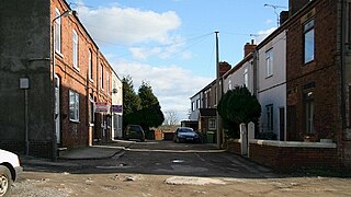
Stanley is a village located roughly halfway between Derby and Ilkeston in Derbyshire, England.

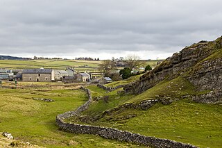
King Sterndale is a village and civil parish in Derbyshire, England. It is located in the Peak District, 4 miles east of Buxton. It has a population of about 30, increasing to 133 at the 2011 Census. The two hamlets of Cowdale and Staden also lie within the parish.
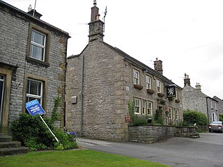
Wardlow is a parish and linear village in the Derbyshire Dales two miles from Tideswell, Derbyshire, England. The population at the 2011 census was 118. The village contains the church of the Good Shepherd and the small hamlet of Wardlow Mires, which contains a notable pub, The Three Stags' Heads.
Denby is a village in Derbyshire, England.
Grindlow is a farming hamlet of a dozen or so houses that nestles under Hucklow Edge in the Derbyshire Peak District. Although it is a separate civil parish in the Derbyshire Dales District, the Parish Council is joint with Great Hucklow, its near neighbour, and Little Hucklow. The village lies north of the A623 road as it crosses Wardlow Mires. It is a familiar stop for groups of walkers passing through from Foolow, Wardlow and Abney.

Cressbrook Dale is a dry carboniferous limestone gorge near Bakewell, Derbyshire, in the Peak District of England. The dale is cut into a plateau of farmland and lies to the south east of the village of Litton. Cressbrook village is at the foot of the valley to the south.
Little Longstone is a village and civil parish in Derbyshire, England. The village is on a minor road west of Great Longstone, just off the B6465 road from Wardlow to Ashford-in-the-Water. There is a Grade-II-listed Congregational Chapel and a public house, the Packhorse Inn, in the village. As in many small parishes, there is no parish council and local democracy is administered via a parish meeting.
Hazlebadge is a civil parish within the Derbyshire Dales district, in the county of Derbyshire, England. Largely rural, Hazlebadge's population is reported with the population of neighbouring parishes for a total of 427 residents in 2011. It is 143 miles (230 km) north west of London, 29 miles (47 km) north west of the county city of Derby, and 7 miles (11 km) east of the nearest market town of Chapel-en-le-Frith. Hazlebadge is wholly within the Peak District national park, and shares a border with the parishes of Abney and Abney Grange, Bradwell, Brough and Shatton, Great Hucklow as well as Little Hucklow. There are four listed buildings in Hazlebadge.
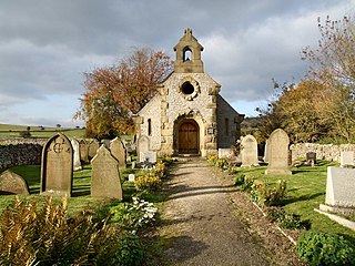
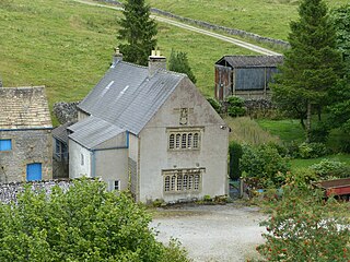
Wardlow is a civil parish in the Derbyshire Dales district of Derbyshire, England. The parish contains three listed buildings that are recorded in the National Heritage List for England. All the listed buildings are designated at Grade II, the lowest of the three grades, which is applied to "buildings of national importance and special interest". The parish contains the village of Wardlow and the surrounding countryside. The listed buildings consist of a farmhouse and attached barn, a public house, and a church with an attached school.