External links
- Map sources for Warmonds Hill
Coordinates: 52°18′16″N0°35′58″W / 52.30451°N 0.59933°W
| | This Northamptonshire location article is a stub. You can help Wikipedia by expanding it. |
Warmonds Hill is a district of Higham Ferrers (where to population is included), Northamptonshire located north west of the town centre.
It westerly border is the River Nene and A45 trunk road while its easterly border is the former A6.
Coordinates: 52°18′16″N0°35′58″W / 52.30451°N 0.59933°W
| | This Northamptonshire location article is a stub. You can help Wikipedia by expanding it. |

Oxfordshire is a landlocked county in the far west of the government statistical region of South East England. The ceremonial county borders Warwickshire to the north-west, Northamptonshire to the north-east, Buckinghamshire to the east, Berkshire to the south, Wiltshire to the south-west and Gloucestershire to the west.

Offa's Dyke Path is a long-distance footpath broadly following the Wales–England border. Officially opened on 10 July 1971, by Lord Hunt, it is one of Britain's National Trails and draws walkers from throughout the world. About 60 miles (97 km) of the 177-mile (285 km) route either follows, or keeps close company with, the remnants of Offa's Dyke, an earthwork, most of which was probably constructed in the late 8th century on the orders of King Offa of Mercia.

Windy Hills is a home rule-class city, incorporated in 1952, in eastern Jefferson County, Kentucky, United States. The population was 2,385 at the 2010 census.
Voorhout is a village and former municipality in the western Netherlands, in the province of South Holland. The former municipality covered an area of 12.59 km2 of which 0.33 km2 is covered by water, and had a population of 14,792 in 2004. Together with Sassenheim and Warmond, it became part of the Teylingen municipality on January 1, 2006. Voorhout is located in an area called the "Dune and Bulb Region".

Red Hill is a census-designated place (CDP) in Horry County, South Carolina, United States. The population was 13,223 at the 2010 census, up from 10,509 at the 2000 census.

Leominster (district) was a local government district in England from 1 April 1974 to 1 April 1998 with its administrative seat in the town of Leominster.
The ceremonial county of Lincolnshire is the second largest of the English counties and one that is predominantly agricultural in character. Despite its relatively large physical area, it has a comparatively small population. The unusually low population density that arises gives the county a very different character from the much more densely populated an urbanised counties of south-east and northern England, and is, in many ways, key to understanding the nature of the county.

Teylingen is a municipality in the western Netherlands, in the province of South Holland. It was created on 1 January 2006, through the amalgamation of Sassenheim, Voorhout, and Warmond. It is named after Teylingen Castle, located in Voorhout.
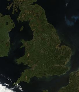
England comprises most of the central and southern two-thirds of the island of Great Britain, in addition to a number of small islands of which the largest is the Isle of Wight. England is bordered to the north by Scotland and to the west by Wales. It is closer to continental Europe than any other part of mainland Britain, divided from France only by a 33 km (21 mi) sea gap, the English Channel. The 50 km (31 mi) Channel Tunnel, near Folkestone, directly links England to mainland Europe. The English/French border is halfway along the tunnel.

Macklin is a town in Eye Hill Rural Municipality No. 382, Saskatchewan, Canada. The population was 1,415 at the 2011 Canada Census. The town is located on Highway 14 and Highway 31 about 5 km (3 mi) east of the provincial border with Alberta, and is situated near one of the most productive oil and natural gas producing fields in the province.
Kings Hill is a place in the East Midlands county of Rutland, England, near the border between civil parishes of Beaumont Chase and Uppingham.

Sugarloaf Hill is a mountain peak located in the Knockmealdown Mountains on the border between County Tipperary and County Waterford.
The A4113 road is a single-carriageway road that runs from Knighton in Powys to Bromfield in Shropshire, United Kingdom, passing through north Herefordshire.
The Kagerplassen is a small lake system in South Holland located to the northeast of Leiden. The Kaag Lakes are a popular area for boating, watersports, fishing, camping and walking. Windmills, waterfront pasture land (weilanden) with grazing animals, quaint Dutch boats and buildings and flower fields are all part of the charm of boating and walking in this area.

French Drove and Gedney Hill was a station on the Great Northern and Great Eastern Joint Railway near Gedney Hill in south Lincolnshire on the line between Spalding and March.

Midsummer Hill is situated in the range of Malvern Hills that runs approximately 13 kilometres (8 mi) north-south along the Herefordshire-Worcestershire border. It lies to the south of Herefordshire Beacon with views to Eastnor Castle. It has an elevation of 284 metres (932 ft). To the north is Swinyard Hill. It is the site of an Iron Age hill fort which spans Midsummer Hill and Hollybush Hill. The hillfort is protected as a Scheduled Ancient Monument and is owned by Natural England. It can be accessed via a footpath which leads south from the car park at British Camp on the A449 or a footpath which heads north from the car park in Hollybush on the A438.

Leavenworth Ranger Station, also known as the Wenatchee River Ranger District, in Leavenworth, Washington was built during 1937-38 by the Civilian Conservation Corps. It was designed by the United States Forest Service's Region 6 USDA Forest Svce. Architecture Group in Rustic architecture. The listing includes nine contributing buildings on a 9.9-acre (4.0 ha) area.
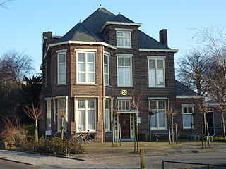
De Moerbei is a restaurant in Warmond, Netherlands. It is a fine dining restaurant that was awarded one Michelin star for the period 2009-present. The restaurant held a Bib Gourmand in the period 2000–2003.

Ledwyche Brook is a minor river in south Shropshire, England. It is sometimes referred to as the River Ledwyche and spelled variously, including "Ledwich" or "Ledwych". The brook is a tributary of the River Teme.
Eisteddfa Gurig is a hamlet located in Ceredigion on its border with Powys and situated along the A44. Its name comes from the Welsh word eisteddfa, meaning seat and the name of St Curig. This gives the meaning of Curig's seat. It is said that Curig rested on the hill here and looked down into the Wye Valley. He decided to build a church in the valley, which is still there today in the village of Llangurig.