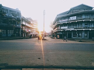
Bungoma is the capital of Bungoma County in Kenya. It was established as a trading centre in the early 20th century. It is located in Kenya's fertile Western region and at the foot of Mount Elgon, Kenya's second-tallest mountain. The town and the surrounding areas boast one of Kenya's highest average rainfalls, making Bungoma one of the nation's most important food baskets.
Bukusu is a dialect of the Masaba language spoken by the Bukusu tribe of the Luhya people of western Kenya. It is one of several ethnically Luhya dialects; however, it is more closely related to the Gisu dialect of Masaaba in eastern Uganda than it is to other languages spoken by the Luhya.

Webuye, previously named Broderick Falls, is an industrial town in western region of Kenya and home to the Tachoni people. It is located within Webuye West sub county in Bungoma County, at the slopes of chetambe hill Kenya. Located on the main road to Uganda, the town is home to the Pan African Paper Mills, the largest paper factory in the region, as well as a number of heavy-chemical and sugar manufacturers. The area is heavily populated and is used mainly for subsistence agriculture. The town has an urban population of 42,642.

Bungoma County is a county in the former Western Province of Kenya with its capital in Bungoma town. It has a population of 1,670,570 of which 812,146 are males and 858,389 are females as per the 2019 census and an area of 2,069 km2. It has nine constituencies, namely: Bumula, Kabuchai, Kanduyi, Kimilili, Mt. Elgon, Sirisia, Tongaren, Webuye East, and Webuye West.

Kericho County is one of the 47 counties in Kenya. The county seats between longitude 35°02' and 35°40' East and between the equator and latitude 0°23' South with an altitude of about 2002m above sea level. It borders Uasin Gishu County to the North West, Baringo County to the North-East, Nandi County to the North-West, Nakuru County to the East and Bomet County to the South, Kisumu County to the Northwest and Nyamira County to the West. It has a population of 901,777 and an area of 2,111 km². Its capital and largest town is Kericho.

Kakamega County is a county in the former Western Province of Kenya. It borders Vihiga County to the South, Siaya County to the West, Bungoma and Trans Nzoia counties to the North and Nandi and Uasin Gishu counties to the East. Its capital and largest town is Kakamega. The county has a population of 1,867,579 and an area of 3,033.8 km2.

Kiambu County is a county in the former Central Province of Kenya. Its capital is Kiambu and its largest town is Thika town. Kiambu County is the second most populous county in Kenya after Nairobi County. Kiambu County borders Nairobi and Kajiado Counties to the South, Machakos to the East, Murang'a to the North and North East, Nyandarua to the North West, and Nakuru to the West. It has a population of 2,417,735.

Makueni County is a county in the former Eastern Province of Kenya. Its capital town is Wote.The largest town is Wote town followed by Emali town which is also an important market and stop over for the Standard Gauge Railway (SGR). Emali town is multicultural and adds diversity to Makueni county.The county has a population of 987,653. The county lies between Latitude 1° 35' and 2° 59' South and Longitude 37° 10' and 38° 30' East. It borders Machakos County to the North, Kitui County to the East, Taita Taveta County to the South and Kajiado County to the West and covers an area of 8,008.9 km2.
Misikhu is a rural town situated on the southern slopes of Mt Elgon, in Bungoma County, Kenya. Located ten kilometres north of Webuye and towards Kitale, Misikhu serves as both an administrative and commercial hub.
The subdivisions of Kenya have been in place since 2010, replacing the old system. Under the Constitution of 2010 and other reforms to Provincial Administration the country acquired a new system of Counties. The previous Provinces were scrapped and the 46 Districts, in existence since 1992, were turned into Counties with elected governments.

The districts of Kenya were divided into 262 divisions (matarafa). Divisions of Kenya were further subdivided into locations. Today's counties of Kenya are based on the merging of some of the districts on this list and since the divisions are one level under the districts they are now the sub-counties. This is because Kenya recently changed its constitution and 47 Counties emerged. Here are the divisions listed below, by district :

Musikari Nazi Kombo is a Kenyan politician who serves as a nominated Member of Parliament.
Webuye Constituency was an electoral constituency in Kenya. It was one of five constituencies in Bungoma District. The constituency was established for the 1988 elections. It has since been divided into Webuye East Constituency and Webuye West Constituency.
Cherangany Constituency, comprises the larger Trans Nzoia East District; otherwise known as Cherangani Sub-County, with an approximate area of 556.9 square km. It is an electoral constituency in Kenya, which was established/created for the 1988 general election.

Mukurweini Constituency is an electoral constituency in Kenya, being one of six constituencies in Nyeri County. Mukurweini Constituency comprises Mukurweini division of Nyeri County, which is administratively divided into four wards; Mukurwe-ini Central, Mukurwe-ini West, Rugi and Gikondi wards. It has approximate population of 110,000. The current Member of Parliament is Hon. John Kaguchia P.G. Mukurwe-ini residents are mainly farmers; coffee and dairy farming is the main agricultural activity carried out. The area does not experience extreme weather conditions and has several scenic features. Wajee Nature Park, a bird conservancy, located in Rugi ward, Giathugu Sublocation is a bird watchers paradise where rare birds are found. The lower parts of Mukurwe-ini is endowed with ball clay deposits that used to manufacture ceramic products. Mukurwe-ini is also proud to have a vibrant industry anchored by Wakulima Dairy that packages milk under the brand name Royal Fresh.

The Tachoni is one of the tribes that occupy the western part of Kenya, its known for its gallant defense of the Chetambe in 1895 when resisting British rule. Tachoni people were masters at building forts such as Chetambe, Lumboka, and Kiliboti. It was their defiance of colonialism that led to the colonial government putting the entire region occupied by the Tachoni under administration of paramount chiefs drawn from Bunyala and Wanga communities. Sharing land with the Abanyala, the Kabras, Nandi, and Bukusu tribe. They live mainly in Webuye, Chetambe Hills, Ndivisi Matete sub-county-Lwandeti, Maturu, Mayoyo, Lukhokho, Kiliboti, Kivaywa, Chepsai, and Lugari sub-county in Kakamega County. Most Tachoni clans living in Bungoma speak the ' Olutachoni dialect which is a hybrid of the luhyia language of the luhyia people. Since they lost their original dialect during the divide and rule system used by the whites to scatter them for being resistants to their colonialism, they had to find a way to interact with their new neighbors and thats why they're subsequently mistaken as Bukusus. They spread from Kakamega county to Trans-Nzoia County, webuye especially around Kitale, Tambach in Iten Nandi in areas like kabiyet and kapsisiwa, kericho and to Uasin Gishu County near Turbo, Eldoret.
Among the Tachoni clans are Abachikha -further divided into Abakobolo, Abamuongo, Abachambai, Abamakhanga, Abacharia, and Abakabini, Abamarakalu, Abangachi -who are further divided into: Abawaila, Abakhumaya and Abawele, Abasang'alo, Abasamo, Abayumbu, Abaluu, Abarefu, Abanyangali, Abamuchembi, Abamakhuli, Abasioya, Abaabichu, Abacheo, Abamachina, Abaengele, Abamutama, Abakafusi, Abasonge, Abasaniaka, Abaabiya also known as Abakatumi, Abakubwayi, Abakamutebi, Abakamukong, Abamweya, Abalukulu, Abawande, Abatukiika, Abachimuluku. Note that the morpheme 'aba' means 'people'.
Bungoma District was a district in the Western Province of Kenya. Its capital town was Bungoma. It had an area of 2,069 km2.
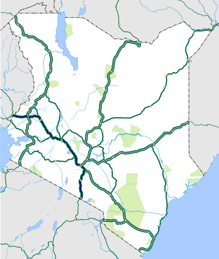
The Nairobi–Malaba Road, also Nairobi–Uganda Road or A104 Road (Kenya) is a major highway in Kenya, the largest economy in the East African Community. The road connects Nairobi, the capital and largest city in Kenya, with the border town of Malaba at the international border with Uganda.
Webuye East is a constituency in Kenya. It is one of nine constituencies in Bungoma County. The constituency is located on the eastern region of Bungoma County and comprises three wards: Mihuu, Ndivisi, and Maraka Wards. Webuye East was hived from the original Webuye Constituency together with Webuye West prior to the 2013 General Elections. The constituency is an agricultural hotspot with majority of residents farming cereals and sugarcane.

Tongaren is an electoral constituency in Kenya. Tongaren constituency politically came into existence in 2012 prior to the 2013 general election. The constituency was carved off from the then larger Kimilili Constituency. It is one of the 290 constituencies in Kenya and one of the 9 constituencies in Bungoma County. The Independent Electoral and Boundaries Commission (IEBC) registered 84,952 voters in Tongaren constituency for the August 9th 2022 general election in Kenya.