Montgomery County is a county in the east central part of the U.S. state of Missouri. As of the 2010 census, the population was 12,236. Its county seat is Montgomery City. The county was named in honor of Richard Montgomery, an American Revolutionary War general killed in 1775 while attempting to capture Quebec City, Canada.

Weedsport is a village in Cayuga County, New York, United States. The population was 1,815 at the 2010 census. The name is from Elihu and Edward Weed, merchants who helped found the village. Weedsport is in the town of Brutus, west of Syracuse. It was a port on the Erie Canal. Whitford's Airport is north of the village in the town of Cato.

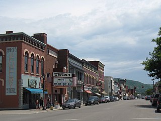
Wellsville is a village in Columbiana County, Ohio, United States, along the Ohio River. The population was 3,541 at the 2010 census. Wellsville is the southernmost point of the Salem, OH Micropolitan Statistical Area, as well as the greater Mahoning Valley.

Warrington Township is a township in York County, Pennsylvania, USA. The population was 4,532 at the 2010 census. The township is named after Warrington, England, like many townships having English names in York County. Others dispute the origin, believing it may be named after Waringstown, County Down, Ireland.
Wellsville is a village in Allegany County, New York, United States. Located in south-central wooded and rural Allegany County, it is the largest population and business center in a 30-mile (48 km) radius. The population was 4,679 at the 2010 census. The village's name is not, as some suppose, derived from the oil wells that became an important economic part of the area, but rather for Gardiner Wells, a local businessman.

Wellsville is the largest community in Allegany County, New York, United States. As of the 2010 census, the town had a population of 7,397.

The Hoover Wilderness is a wilderness area in the Inyo and Humboldt-Toiyabe National Forests. It lies to the east of the crest of the central Sierra Nevada in California, to the north and east of Yosemite National Park - a long strip stretching nearly to Sonora Pass on the north and Tioga Pass on the south.
Vanderbilt Avenue is the name of three thoroughfares in the New York City boroughs of Brooklyn, Manhattan, and Staten Island. They were named after Cornelius Vanderbilt (1794–1877), the builder of Grand Central Terminal in Midtown Manhattan.
An Off-Road Vehicle Park is an area of land that may be accessed by all-terrain vehicles such as 4x4 vehicles, Pickup Trucks, ATVs, and many other types of off-road vehicles.

Cepeda de la Mora is a town located in the province of Ávila within the autonomous community of Castile-Leon in north-western Spain.
Maryland House of Delegates District 33A is part of the greater 33rd Maryland Senate district, currently represented by Ed Reilly. Located in Anne Arundel County, the district includes the communities of Crofton, Gambrills, Odenton, Davidsonville, Millersville, and Severna Park. It is a Republican stronghold in a very liberal Maryland. The well-to-do urban community that District 33A encompasses is located in between Baltimore and Washington, D.C..The district is currently represented by Tony McConkey (R) and James King (R).
Rosemont is a neighborhood in the western part of Baltimore, Maryland. Located below North Avenue, above Franklintown Road, East of Hilton Parkway, and West of Bloomingdale Avenue it is a working class African-American neighborhood.

North Heidelberg is an unincorporated community in Berks County, Pennsylvania. It is located at the junction of Mill Road and Charming Forge Road. The township building of North Heidelberg Township is located here.

Detters Mill was a small 19th-century community in Dover Township, York County, Pennsylvania, about 2.5 miles (4.0 km) south of Wellsville, and 17 miles (27 km) southwest of Harrisburg.

The Civil War Defenses of Washington were a group of Union Army fortifications that protected the federal capital city, Washington, D.C., from invasion by the Confederate States Army during the American Civil War. The sites of some of these fortifications are within a collection of National Park Service (NPS) properties that the National Register of Historic Places identifies as the Fort Circle. The sites of other such fortifications in the area have become parts of state, county or city parks or are located on privately owned properties.
Hopewell is a settlement in Saint Andrew Parish, Jamaica.
Alagoinha do Piauí is a municipality in the state of Piauí in the Northeast region of Brazil.
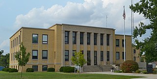
The Wellsville Local School District is a public school district serving the Wellsville area in southeastern Columbiana County in the U.S. state of Ohio.