West Branch may refer to:

Tulpehocken Creek is a 39.5-mile-long (63.6 km) tributary of the Schuylkill River in southeastern Pennsylvania in the United States, and during the American Canal Age, once provided nearly half the length of the Union Canal linking the port of Philadelphia, the largest American city and the other communities of Delaware Valley with the Susquehanna basin and the Pennsylvania Canal System connecting the Eastern seaboard to Lake Erie and the new settlements of the Northwest Territory via the Allegheny}, Monongahela. and Ohio Rivers at Pittsburgh.
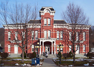
Meshoppen Creek is a tributary of the Susquehanna River in Susquehanna and Wyoming counties, Pennsylvania, in the United States. It is approximately 30.6 miles (49.2 km) long and flows through Bridgewater Township, Dimock Township, and Springville Township in Susquehanna County and Lemon Township, Washington Township, Meshoppen Township, and Meshoppen in Wyoming County. The watershed of the creek has an area of 114 square miles (300 km2). It is possible to canoe on 17.0 miles (27.4 km) of Meshoppen Creek.

Lehigh Parkway is a large public park along the Little Lehigh River in the city of Allentown, Pennsylvania, in the United States.
The Thunder Swamp Trail System is a 45-mile (72 km) network of hiking trails in Pennsylvania. It was constructed by the Youth Conservation Corps during the 1970s through the Pocono Mountains. The trail surface is challenging and is often wet, uneven and rocky.

Resica Falls Scout Reservation is a camp in East Stroudsburg, Pennsylvania operated by the Cradle of Liberty Council of the Boy Scouts of America.

Conewago Creek is an 80.2-mile-long (129.1 km) tributary of the Susquehanna River in Adams and York counties in Pennsylvania in the United States, with its watershed also draining a small portion of Carroll County, Maryland. The source is at an elevation of 1,440 feet (440 m), east of Caledonia State Park, in Franklin Township in Adams County. The mouth is the confluence with the Susquehanna River at York Haven in York County at an elevation of 259 feet (79 m).
Fishing Creek is a 29.98-mile (48.25 km) long tributary of the Susquehanna River in Columbia County, Pennsylvania, in the United States. It joins the Susquehanna River near the census-designated place of Rupert and the town of Bloomsburg. The watershed has an area of 385 square miles (1,000 km2).
Mahantango Creek is a 2.1-mile-long (3.4 km) tributary of the Susquehanna River in Snyder and Juniata counties, Pennsylvania, in the United States. Its name comes from a Delaware Indian word meaning "where we had plenty to eat". The creek flows along the border between Snyder County and Juniata County.
East Branch Fishing Creek is a tributary of Fishing Creek in Columbia County and Sullivan County, Pennsylvania, in the United States. It is 4.4 miles (7.1 km) long. The stream and its tributaries are acidic and contain aluminum. The area in the vicinity was first settled in the late 18th century.
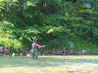
West Branch Mahantango Creek is a tributary of Mahantango Creek in Snyder County and Juniata County, in Pennsylvania, in the United States. It is approximately 18 miles (29 km) in length. The creek starts on Shade Mountain in Snyder County. It ends at its confluence with Mahantango Creek. Most of the land in the watershed is devoted to forest or agriculture. Trout and minnows have been observed in the creek, which is stocked with trout. A covered bridge was built over it in 1908.

Coles Creek is a tributary of Fishing Creek, in Columbia County, Pennsylvania and Sullivan County, Pennsylvania, in the United States. It is 6.0 miles (9.7 km) long and is the first named tributary of Fishing Creek downstream of where East Branch Fishing Creek and West Branch Fishing Creek meet to form Fishing Creek. The creek is on the edge of Columbia County and parts of its watershed are in Luzerne County.

West Branch Briar Creek is a tributary of Briar Creek, in Columbia County, Pennsylvania, in the United States. It is approximately 6.53 miles (10.51 km) long. The creek flows through North Centre Township and Briar Creek Township and has two tributaries: Cabin Run and Fester Hollow. Its watershed has an area of 12.06 square miles.

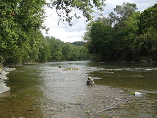
Green Creek is a tributary of Fishing Creek in Columbia County, Pennsylvania, in the United States. It is approximately 12.7 miles (20.4 km) long and flows through Jackson Township, Greenwood Township, and Orange Township. The watershed of the creek has an area of 36.8 square miles (95 km2). Green Creek has three named tributaries: Little Green Creek, Rickard Hollow, and Mud Run. The creek is not designated as an impaired waterbody and is a relatively large stream, contributing a significant amount of water to Fishing Creek. A valley known as the Greenwood Valley is located in the vicinity of Green Creek. The creek's own valley was likely affected by glaciation during the Ice Age.
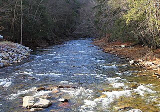
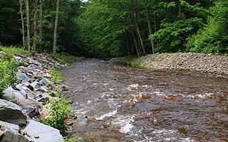
West Branch Fishing Creek is one of the northernmost major tributaries of Fishing Creek in Sullivan County, Pennsylvania and Columbia County, Pennsylvania, in the United States. It is 11.1 miles (17.9 km) long and flows through Davidson Township, Sullivan County and Sugarloaf Township, Columbia County. The creek's watershed has an area of 33.5 square miles, nearly all of which is forested land.
Sullivan Branch is a tributary of East Branch Fishing Creek in Sullivan County, Pennsylvania, in the United States. It is approximately 3.3 miles (5.3 km) long and flows through Davidson Township.

Trout Run is a tributary of East Branch Fishing Creek in Sullivan County, Pennsylvania, in the United States. It is approximately 1.5 miles (2.4 km) long and flows through Davidson Township. The watershed of the stream has an area of 0.62 square miles (1.6 km2). The stream is acidic and is considered by the Pennsylvania Department of Environmental Protection to be impaired by atmospheric deposition and metals. Rock formations in the watershed include the Catskill Formation and the Huntley Mountain Formation. Soils in the watershed include the Deep-Wellsboro-Oquaga and Oquaga soil associations.

Pennsylvania State Game Lands Number 13 are Pennsylvania State Game Lands in Columbia County and Sullivan County, in Pennsylvania, in the United States. They have an area of 49,529 acres. The game lands are mountainous and contain streams such as West Branch Fishing Creek and its tributaries. The main game animals in the area include bear, deer, grouse, turkey, and waterfowl. The game lands are adjacent to Pennsylvania State Game Lands Number 57.
Stewart Run is a tributary of the West Branch Octoraro Creek in Lancaster County, Pennsylvania, in the United States. It is approximately 4.9 miles (7.9 km) long and flows through Colerain Township and East Drumore Township.