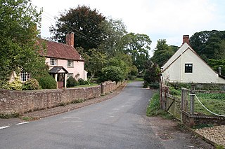
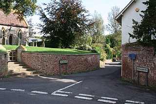
Combe Florey is a village and civil parish in Somerset, England, situated 6 miles (9.7 km) northwest of Taunton in the Somerset West and Taunton district, on the West Somerset Railway. The village has a population of 261. The parish includes the hamlet of Eastcombe which is a linear settlement along the A358 Taunton-Wiliton Road.

Ash Priors is a village and parish in Somerset, England, situated 5 miles (8.0 km) north west of Taunton in the Somerset West and Taunton district. The village has a population of 155.
Bathealton is a village and civil parish in Somerset, England, situated 3 miles (4.8 km) west of Wellington and 8 miles (12.9 km) west of Taunton in the Somerset West and Taunton district. The village has a population of 194.

Corfe is a village and civil parish in Somerset, England, situated below the Blackdown Hills 4 miles (6.4 km) south of Taunton in the Somerset West and Taunton district. The village has a population of 253.

Curland is a village and civil parish in Somerset, England, situated 6 miles (9.7 km) south of Taunton in the Somerset West and Taunton district. The village has a population of 225. The parish includes the hamlet of Abbey Hill.

Halse is a village and civil parish in Somerset, England, situated 6 miles (9.7 km) north west of Taunton in the Somerset West and Taunton district. The village has a population of 290.

Lydeard St Lawrence or St Lawrence Lydiard is a village and civil parish in Somerset, England, situated 7 miles (11.3 km) north west of Taunton in the Somerset West and Taunton district. The village has a population of 506. The parish includes the hamlets of Westowe, Hoccombe and Pyleigh, with its 16th century manor house.

Oake is a village and civil parish in Somerset, England, situated 5 miles (8.0 km) west of Taunton in the Somerset West and Taunton district. The village has a population of 765.

Orchard Portman is a village and civil parish in Somerset, England, situated 2 miles (3.2 km) south of Taunton in the Somerset West and Taunton district. The village has a population of 150.

Otterford is a village and civil parish in Somerset, England. It is situated on the Blackdown Hills, 7 miles (11.3 km) south of Taunton in the Somerset West and Taunton district. The village has a population of 356.

Pitminster is a village and civil parish in Somerset, England, situated 4 miles (6.4 km) south of Taunton in the Somerset West and Taunton district. The parish has a population of 956. The parish also includes the villages of Angersleigh, Blagdon Hill and Staplehay. The village of Blagdon is now officially known as Blagdon Hill to distinguish it from Blagdon in North Somerset. Hillside hamlets in the parish comprise Feltham and Woodram, those on the lower plain in the north are Sellicks Green which is contiguous with Blagdon Hill, Duddlestone and Poundisford.

Ruishton is a village and civil parish in Somerset, England, situated on the River Tone and A358 road 2 miles (3.2 km) east of Taunton in the Somerset West and Taunton district. The village has a population of 1,473. The parish includes the hamlet of Henlade.

Stawley is a village and civil parish in Somerset, England, situated 10 miles (16.1 km) west of Taunton in the Somerset West and Taunton district. The parish has a population of 279 and includes the village of Kittisford and the hamlets of Appley, Greenham and Tracebridge.

Stoke St Mary is a village and civil parish in Somerset, England, situated 2 miles (3.2 km) south east of Taunton in the Somerset West and Taunton district.
Tolland is a village and civil parish in Somerset, England, situated 9 miles (14.5 km) north west of Taunton, between the Brendon Hills and Quantock Hills, in the Somerset West and Taunton district. The parish has a population of 81.
Trull is a village, electoral ward and civil parish in Somerset, England, situated near Taunton. The parish which includes Dipford has a population of 2,288.

West Hatch is a hamlet and civil parish in Somerset, England, situated 5 miles (8.0 km) south east of Taunton in the Somerset West and Taunton district. It has a population of 306.
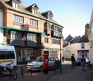
Wiveliscombe is a small town and civil parish in Somerset, England, situated 9 miles (14 km) west of Taunton in the Somerset West and Taunton district. The town has a population of 2,893. The Square, fronted by several listed structures, held the former market. The parish includes the nearby hamlet of Maundown.

Wellington Without is a civil parish in the Somerset West and Taunton district of Somerset, England.

Somerset West and Taunton is a local government district in Somerset, England. It was established on 1 April 2019 by the Somerset West and Taunton Order 2018. The council replaced the Taunton Deane and West Somerset councils, which governed the same area from 1974.
