Gloucester County is a county in the Commonwealth of Virginia. As of the 2010 census, the population was 36,858. Its county seat is Gloucester Courthouse. The county was founded in 1651 in the Virginia Colony and is named for Henry Stuart, Duke of Gloucester.

Peabody is a city in Essex County, Massachusetts, United States. The population was 51,251 at the 2010 census, and in 2016 the estimated population was 52,491. Peabody is located in the North Shore region of Massachusetts, and is known for its rich industrial history.

Acton is a town in Middlesex County, Massachusetts, United States, approximately twenty-one miles west-northwest of Boston along Route 2 west of Concord and about ten miles (16 km) southwest of Lowell. The population was 21,929 at the 2010 census. It is bordered by Westford and Littleton to the north, Concord and Carlisle to the east, Stow, Maynard, and Sudbury to the south and Boxborough to the west. Acton became an incorporated town in 1735. The town employs the Open Town Meeting form of government with a Town Manager and an elected, five-member Board of Selectmen. Acton was named the 11th Best Place To Live among small towns in the country by Money Magazine in 2015, and the 16th best in 2009 and in 2011. The local high school, Acton-Boxborough Regional High School, was named a Blue Ribbon School by the U.S. Department of Education in 2009. In 2012, U.S. News & World Report ranked Acton-Boxborough #3 among open enrollment high schools and #7 overall for STEM education in the United States.[6]
Marlborough is a city in Middlesex County, Massachusetts, United States. The population was 38,499 at the 2010 census. Marlborough became a prosperous industrial town in the 19th century and made the transition to high technology industry in the late 20th century after the construction of the Massachusetts Turnpike.

Kendall Square is a neighborhood in Cambridge, Massachusetts, U.S., with the square itself at the intersection of Main Street and Broadway. It also refers to the broad business district east of Portland Street, northwest of the Charles River, north of MIT and south of Binney Street. Kendall Square has been called "the most innovative square mile on the planet," in reference to the high concentration of entrepreneurial start-ups and quality of innovation which have emerged in the vicinity of the square since 2010.

The Boston Latin School is a first build public exam school in Boston, Massachusetts. It was established on April 23, 1635, making it both the oldest school in America and the first public school in the United States. The Public Latin School was a bastion for educating the sons of the Boston "Brahmin" elite, resulting in the school claiming many prominent New Englanders as alumni. Its curriculum follows that of the 18th century Latin school movement, which holds the classics to be the basis of an educated mind. Four years of Latin are mandatory for all pupils who enter the school in the 7th grade, three years for those who enter in the 9th. In 2007, the school was named one of the top 20 high schools in the United States by U.S. News & World Report magazine. It was named a 2011 "Blue Ribbon School of Excellence", the Department of Education's highest award. As of 2018, it is listed under the "gold medal" list, ranking 48 out of the top 100 high schools in the United States by U.S. News & World Report.

Dorchester is a Boston neighborhood comprising more than 6 square miles (16 km2) in the City of Boston, Massachusetts, United States. Originally, Dorchester was a separate town, founded by Puritans who emigrated in 1630 from Dorchester, Dorset, England to the Massachusetts Bay Colony. This dissolved municipality, Boston's largest neighborhood by far, is often divided by city planners in order to create two planning areas roughly equivalent in size and population to other Boston neighborhoods.

Byfield is a village in the town of Newbury, in Essex County, Massachusetts, United States. It borders West Newbury, Georgetown, and Rowley. It is located about 30 miles north-northeast of Boston, along Interstate 95, about 10 miles south of the border between New Hampshire and Massachusetts.

Glover School is a public elementary school on Maple Street in Marblehead, Massachusetts, US. It educates around 250 students in grades K-3. The school consists of two buildings situated on a hilly 4.78-acre (19,300 m2) site.

Peddocks Island is one of the largest islands in Boston Harbor. Since 1996 it has formed part of the Boston Harbor Islands National Recreation Area. Managed by the Department of Conservation and Recreation, the island is home to the now-defunct Fort Andrews, active in harbor defense from 1904 to the end of World War II, on its eastern end, and a group of privately owned cottages on its western end. Campsites are also on the eastern end. Ferry service between Peddocks Island and Georges Island is provided on a seasonal basis.

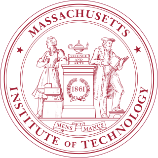
The history of the Massachusetts Institute of Technology can be traced back to the 1861 incorporation of the "Massachusetts Institute of Technology and Boston Society of Natural History" led primarily by William Barton Rogers.

Groton-Dunstable Regional High School (GDRHS) is located in Groton, Massachusetts and serves the communities of both Groton and Dunstable in the Groton-Dunstable Regional School District. While GDRHS is the only public high school located within those communities students from Groton may also attend the public Nashoba Valley Technical High School and students from Dunstable may attend the public Greater Lowell Technical High School. Approximately 810 students attend GDRHS and they are primarily graduates of Groton-Dunstable Regional Middle School. GDRHS has a primarily college preparatory curriculum with approximately 87% of its students attending four-year colleges and over 90% attending two- or four-year colleges upon graduation in 2010.

Saint Patrick School was a private Roman Catholic elementary and middle school in Pelham, New Hampshire.
The West End is a downtown neighborhood in Portland, Maine. It is located on the western side of Portland's peninsula primarily on Bramhall Hill and is noted for its architecture and history. The neighborhood is home to a large number of historic homes and parks and, in 2010, it was called "one of the best preserved Victorian neighborhoods in the country". The Western Promenade, a park laid out in 1836, overlooks the Libbytown and Stroudwater neighborhoods of Portland and beyond. Other historic structures include 68 High Street, The Gothic House, Brown House, Butler House, Ingraham House, Morrill Mansion and the Minott House.

Nazareth Academy was an independent all-girls Catholic high school in Wakefield, Massachusetts.
Charles Edward Shannon Jr. was a Massachusetts state senator. He represented the Second Middlesex district from 1991 until his death in 2005, first as a Republican and later as a Democrat. A resident of Winchester, Massachusetts, Shannon served as a Lexington policeman and a Winchester town official prior to serving in the state legislature.
Mira Angrist is a Hebrew language and Jewish culture specialist. She is the head of the Hebrew Language Program at Boston University. Angrist has taught at the Modern Languages and Comparative Literature Department in the College of Arts and Sciences at Boston University since 2008. Angrist is best known for her integration of authentic Israeli and Jewish cultural material and use of advanced technologies to stimulate classroom learning. She further specializes in writing Hebrew curricula and training Hebrew teachers.
Another Course to College (ACC) is a Pilot School located in Hyde Park, Boston, Massachusetts.