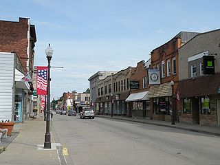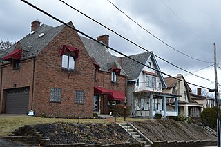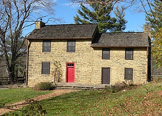
Coraopolis is a borough in Allegheny County, Pennsylvania, United States. The population was 5,677 at the 2010 census. In 1940 the population peaked at 11,086. It is a small community located to the west of Pittsburgh, along the Ohio River and to the east of the Pittsburgh International Airport. The borough is noted for its steep topography, numerous brick streets and many large, old homes. The American Bridge Company is headquartered in Coraopolis.

West View is a borough in Allegheny County in the U.S. state of Pennsylvania, just north of downtown Pittsburgh. The population was 6,771 at the 2010 census.

Kennedy Township is a township in Allegheny County, Pennsylvania, United States, located 10 miles west of Pittsburgh and 12 miles east of Pittsburgh International Airport. The population was 8,134 at the 2016 United States Census.

South Park Township is a township in the southern part of Allegheny County, Pennsylvania, United States, near Pittsburgh. The population was 13,416 at the 2010 census.

Stowe Township is a township in Allegheny County, Pennsylvania, United States. The population was 6,362 at the 2010 census.

Downtown is the oldest district in Salt Lake City, Utah. The grid from which the entire city is laid out originates at Temple Square, the location of the Salt Lake Temple.

Grand Lake, or the Grand Lake District, is a neighborhood in Oakland, California, United States. The neighborhood is located in the northeast corner of Lake Merritt, where Grand Avenue and Lakeshore Avenue pass under Interstate 580. It borders Adams Point to the west, Trestle Glen/Crocker Highlands to the east, and the city of Piedmont to the north. It lies at an elevation of 52 feet.

Downtown Youngstown is the traditional center of the city of Youngstown, Ohio, United States. After decades of precipitous decline, the downtown area shows signs of renewal. Civic leaders have expressed hope that the district will emerge as a significant arts and entertainment district within the Youngstown-Warren metropolitan area.

The South Hills is the southern suburbs of Pittsburgh, Pennsylvania, and the neighborhoods in the City of Pittsburgh south of the South Side Slopes. The Pittsburgh neighborhoods include Knoxville, Mt. Oliver, Mt. Washington, Beltzhoover, Allentown, Banksville, Beechview, Brookline, Carrick, and Overbrook. Two suburban municipalities that are included in the South Hills outside of Pittsburgh are Bethel Park and Mt. Lebanon, as well as the boroughs of Castle Shannon, Dormont, and Green Tree. The South Hills also includes the townships of Baldwin, Collier, Peters, Scott, South Park, and Upper St. Clair, plus the boroughs of Baldwin, Brentwood, Bridgeville, Mt. Oliver, Heidelberg, Whitehall, Pleasant Hills, Jefferson Hills, and West Mifflin. Much of the South Hills was originally a land grant to John Ormsby.

Skyland is a neighborhood in Southeast Washington, D.C. It is bounded by Good Hope Road to the northeast, Alabama Avenue to the southeast, and Fort Stanton Park to the south and west. Also see article on Anacostia.

Downtown Paterson is the main commercial district of Paterson, Passaic County, New Jersey, United States. The area is the oldest part of the city, along the banks of the Passaic River and its Great Falls. It is roughly bounded by Interstate 80, Garret Mountain Reservation, Route 19, Oliver Street, and Spruce Street on the south; the Passaic River, West Broadway, Cliff Street, North 3rd Street, Haledon Avenue, and the borough of Prospect Park on the west; and the Passaic River also to the north.
Downtown Sacramento is the central business district of the City of Sacramento. Downtown is generally defined as the area south of the American River, east of the Sacramento River, north of Broadway, and west of 16th Street. The central business district is generally defined as north of R Street, south of H Street, east of the Sacramento River, and west of 16th Street. Downtown Sacramento is currently undergoing a major revitalization project.

Oak Park is an urban neighborhood of the Southeast region of San Diego, California.

The Gulch is a neighborhood on the south fringe of downtown Nashville, Tennessee, near Interstate 40, Interstate 65 and Interstate 24. It is known to be a trendy and hip neighborhood, and a popular destination for locals, college students, and visitors.
Gary – New Duluth is a neighborhood in Duluth, Minnesota, United States. Although called Gary–New Duluth by most people in the area, and even identified by local traffic signs as being so named, they are two separate neighborhood communities.
Island Heights is a suburban neighborhood located in Stowe Township, Pennsylvania. The majority of the neighborhood was constructed circa 1960. It got its name because it sits on a hill overlooking Neville Island. It is home to the newly renovated Island Heights Park.

Passyunk Square is a neighborhood in South Philadelphia bounded by Broad Street to the west, 6th Street to the east, Tasker Street to the south and Washington Avenue to the north. Passyunk Square is bordered by the Bella Vista, Hawthorne, Central South Philadelphia, Wharton and Point Breeze neighborhoods. The neighborhood got its Lenape name from the 1800s Passyunk Township, Pennsylvania which named Passyunk Square Park, located between 12th, 13th, Reed and Wharton Streets. The park was eventually renamed Columbus Square Park, and subsequently the neighborhood became known as Columbus Square. Sue Montella, Geoff DiMasi, and a group of neighbors revived the Passyunk Square name when forming the Passyunk Square Civic Association in 2003.

The Broadway Theater District in the Historic Core of Downtown Los Angeles is the first and largest historic theater district listed on the National Register of Historic Places (NRHP). With twelve movie palaces located along a six-block stretch of Broadway, it is the only large concentration of movie palaces left in the United States. The same six-block stretch of Broadway, and an adjacent section of Seventh Street, was also the city's retail hub for the first half of the twentieth century, lined with large and small department stores and specialty stores.

The West Side of Jersey City is an area made up of several diverse neighborhoods on either side of West Side Avenue, one of the city's main shopping streets. Parallel and west of Kennedy Boulevard, West Side Avenue carries two county route designations.


