See also
| This disambiguation page lists articles associated with the title West Suffolk. If an internal link led you here, you may wish to change the link to point directly to the intended article. |
West Suffolk may refer to the following places in Suffolk, England:
| This disambiguation page lists articles associated with the title West Suffolk. If an internal link led you here, you may wish to change the link to point directly to the intended article. |

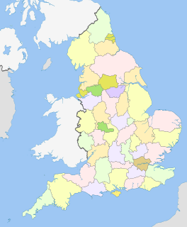
Suffolk is an East Anglian county of historic origin in England. It has borders with Norfolk to the north, Cambridgeshire to the west and Essex to the south. The North Sea lies to the east. The county town is Ipswich; other important towns include Lowestoft, Bury St Edmunds, Newmarket, and Felixstowe, one of the largest container ports in Europe.

Suffolk County is a predominantly suburban county on Long Island and the easternmost county in the U.S. state of New York. As of the 2010 census, the county's population was 1,493,350, estimated to have decreased slightly to 1,481,093 in 2018, making it the fourth-most populous county in New York. Its county seat is Riverhead, though most county offices are in Hauppauge. The county was named after the county of Suffolk in England, from where its earliest European settlers came.

Suffolk County is a county in the Commonwealth of Massachusetts, in the United States. As of 2018, the population was 807,252 making it the fourth-most populous county in Massachusetts. The traditional county seat is Boston, the state capital and the largest city in Massachusetts. The county government was abolished in late 1999, and so Suffolk County today functions only as an administrative subdivision of state government and a set of communities grouped together for some statistical purposes. Suffolk County constitutes the core of the Boston-Cambridge-Newton, MA-NH Metropolitan Statistical Area as well as the greater Boston-Worcester-Providence, MA-RI-NH-CT Combined Statistical Area.

Suffolk University is a private research university in Boston, Massachusetts. With 7,560 students, it is the eighth largest university in metropolitan Boston. It is categorized as a Doctoral Research University by the Carnegie Classification of Institutions of Higher Education. It was founded as a law school in 1906 and named after its location in Suffolk County, Massachusetts. The university's notable alumni include mayors, dozens of U.S. federal and state judges and United States members of Congress.
The counties of England are areas used for different purposes, which include administrative, geographical, cultural and political demarcation. The term 'county' is defined in several manners and can apply to similar or the same areas used by each of these demarcation structures. These different types of county each have a more formal name but are commonly referred to just as 'counties'. The current arrangement is the result of incremental reform.

East Suffolk, along with West Suffolk, was created in 1888 as an administrative county of England. The administrative county was based on the eastern quarter sessions division of Suffolk. East Suffolk County Council's headquarters were at East Suffolk County Hall in Ipswich.
West Suffolk was an administrative county of England created in 1889 from part of the county of Suffolk. It survived until 1974 when it was rejoined with East Suffolk. Its county town was Bury St Edmunds.

St Edmundsbury was a local government district and borough in Suffolk, England. It was named after its main town, Bury St Edmunds. The second town in the district is Haverhill. The population of the district was 111,008 at the 2011 Census.
Suffolk County Community College (SCCC) is a public community college in Selden, New York. It is sponsored by SUNY and Suffolk County, New York. Suffolk County Community College was founded in 1959 and has three campuses: Selden, Brentwood and Riverhead. It also has two satellite centers in Sayville and downtown Riverhead.
This article describes the history of Suffolk, the English county.

Chestnut Hill is a New England village located six miles (9.7 km) west of downtown Boston, Massachusetts, United States. Like all Massachusetts villages, Chestnut Hill is not an incorporated municipal entity. Unlike most Massachusetts villages, it encompasses parts of three separate municipalities, each located in a different county: the town of Brookline in Norfolk County; the city of Boston in Suffolk County, and the city of Newton in Middlesex County. Chestnut Hill's borders are roughly defined by the 02467 ZIP Code. Chestnut Hill is not a topographical designation; the name refers to several small hills that overlook the 135-acre Chestnut Hill Reservoir rather than one particular hill. Chestnut Hill is best known as the home of Boston College, part of the Boston Marathon route, as well as the Collegiate Gothic canvas of landscape architect Frederick Law Olmsted.

This is a list of properties and districts in Massachusetts listed on the National Register of Historic Places. There are over 4,300 listings in the state, representing about 5% of all NRHP listings nationwide and the second-most of any U.S. state, behind only New York. Listings appear in all 14 Massachusetts counties.
The Suffolk County Football Association is the governing body for football in the county of Suffolk, England.
The University of Suffolk is a public university in Suffolk, England. The institution was established in 2007 as University Campus Suffolk (UCS); the current name was adopted in 2016 when it was awarded university status.

New York's 2nd congressional district is a congressional district for the United States House of Representatives along the South Shore of Long Island, New York. It includes southwestern Suffolk County and a small portion of southeastern Nassau County. Peter T. King has been representing the district since 2013. King announced in November 2019 that he will not run for re-election in 2020.

Stanstead is a village and civil parish in Suffolk, England. The name Stanstead comes from the Old English for "Stony place". Located off the B1066, it is around 4 miles (6 km) from Sudbury, and is part of Babergh district. It is about 2 kilometres (1 mi) from Glemsford, 12 miles (19 km) from Hadleigh, and 4 miles (6 km) from Lavenham.

Lound is a village and civil parish in the north of the English county of Suffolk. It is in the East Suffolk district and part of the area known as Lothingland between Lowestoft and Great Yarmouth. Lound lies 4.5 miles (7.2 km) north of Lowestoft, 5 miles (8.0 km) south of Great Yarmouth and 2 miles (3.2 km) west of Hopton on Sea and the North Sea coast. The village lies just west of the main A12 dual carriageway between Great Yarmouth and Lowestoft.
The Eastern Counties Rugby Union (ECRU) is the governing body for the sport of rugby union in the counties of Cambridgeshire, Norfolk and Suffolk in England. Clubs in the old Huntingdonshire and the Soke of Peterborough are affiliated to the East Midlands Rugby Football Union. The union is the constituent body of the Rugby Football Union (RFU) for those counties. The ECRU administers and organises rugby union clubs and competitions in those three counties and administers the Eastern Counties county rugby representative teams.

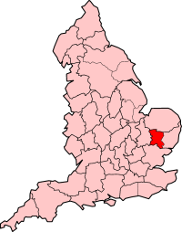
West Suffolk is a local government district in Suffolk, England, which was established on 1 April 2019, following the merger of the existing Forest Heath district with the borough of St Edmundsbury. The two councils had already had a joint Chief Executive since 2011. At the 2011 census, the two districts had a combined population of 170,756.

East Suffolk is a local government district in Suffolk, England, which was established on 1 April 2019, following the merger of the existing Suffolk Coastal and Waveney districts. At the 2011 census, the two districts had a combined population of 239,552.