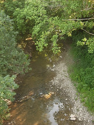
The Mill Creek is a stream in southwest Ohio. It flows 28.4 miles (45.7 km) southwest and south from its headwaters in Liberty Township of Butler County through central Hamilton County and the heart of Cincinnati into the Ohio River just west of downtown. The section of Interstate 75 through Cincinnati is known as the Mill Creek Expressway.
Cincinnati Public Schools is the U.S. state of Ohio's third-largest public school district, by enrollment, after Columbus City Schools and Cleveland Metropolitan School District. Cincinnati Public Schools is the largest Ohio school district rated as 'effective'. Founded in 1829 as the Common Schools of Cincinnati, it is governed by the Cincinnati Board of Education.
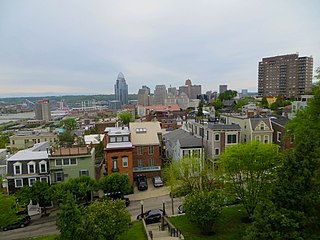
Mount Adams is one of the 52 neighborhoods of Cincinnati, Ohio. Located on a hill immediately east of downtown Cincinnati, it is south of Walnut Hills, southwest of East Walnut Hills, and west of the East End. The population was 1,578 at the 2020 census.

The Betts House, built in 1804, is the oldest surviving building in Cincinnati, and the oldest brick home in Ohio. This survivor of Cincinnati's period of settlement offers exhibits and programs that focus on Cincinnati history, historic preservation, and the built environment. In addition to being a house museum, the Betts House is also the headquarters of The National Society of the Colonial Dames of America in the State of Ohio.

Hyde Park is one of the 52 neighborhoods of Cincinnati, Ohio. Originally established as a retreat for the city's wealthy, the neighborhood is predominately residential, with a central business district known as Hyde Park Square. The population was 14,193 at the 2020 census.
East Walnut Hills is one of the 52 neighborhoods of Cincinnati, Ohio. Established in 1867 and annexed in 1873, it is located in the eastern side of the city. The population was 4,103 at the 2020 census.
Westwood is one of the 52 neighborhoods of Cincinnati, Ohio. Annexed in 1896 and located in the western part of the city, it is the city's largest neighborhood in both area and population. The population was 33,774 at the 2020 census.

Ida Street Viaduct is a registered historic structure in Cincinnati, Ohio, listed in the National Register on November 28, 1980. The reinforced concrete bridge is located in the hilltop neighborhood of Mount Adams.

Carthage is one of the 52 neighborhoods of Cincinnati, Ohio. Established in 1791 or 1792 and annexed in 1911, it is located in the northern part of the city's Mill Creek valley. The neighborhood is predominately residential, and is center of the city's Hispanic community. It shares a border with Elmwood Place, Ohio, which, with adjacent St. Bernard, Ohio, forms an enclave in the middle of Cincinnati. The population was 2,781 at the 2020 census.

College Hill is one of the 52 neighborhoods of Cincinnati, Ohio. Established in 1813 and annexed in 1911, 1915, and 1923, it is located in the northwestern part of the city. It was originally called Pleasant Hill due to its prime location, but was later renamed College Hill because of the two colleges that were established there in the mid-nineteenth century. The neighborhood is not to be confused with North College Hill, which borders College Hill to the north but is not part of Cincinnati. The population was 16,039 at the 2020 census.
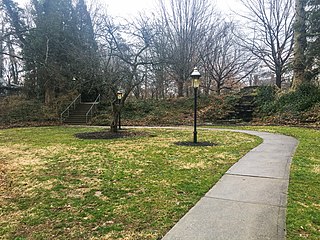
Annwood Park is an urban park in the East Walnut Hills neighborhood of Cincinnati, Ohio, owned and operated by the Cincinnati Park Board. A small park, Annwood was donated to Cincinnati in 1966 and added expanded in 1969. The park is never to be resold and contains no playgrounds or picnic area, as part of the donation agreement. The park is only for walking and sitting, and contains a grotto waterfall and memorial plaque in honor of a local Korean War veteran.

CUF is one of the 52 neighborhoods of Cincinnati, Ohio. Its name is derived from the communities of Clifton Heights, University Heights, and Fairview. These communities surround the University of Cincinnati to the south and west of its main campus, making CUF a predominantly residential, student neighborhood. The population was 20,385 at the 2020 census.

Corryville is one of the 52 neighborhoods of Cincinnati, Ohio. It is located immediately east of the University of Cincinnati, southeast of Clifton, south and west of Avondale, northwest of Walnut Hills, and north of Mount Auburn. The population was 4,373 at the 2020 census.

Villages at Roll Hill is one of the 52 neighborhoods of Cincinnati, Ohio. The neighborhood predominantly consists of Section 8 housing. The population was 1,918 at the 2020 census.

Walnut Hills is one of the 52 neighborhoods of Cincinnati, Ohio. One of the city's oldest hilltop neighborhoods, it is a large diverse area on the near east side of Cincinnati. The population was 6,344 in the 2020 census.

Sedamsville is one of the 52 neighborhoods of Cincinnati, Ohio. Established in 1795 and annexed in 1870, the neighborhood lies along the Ohio River in the western part of the city. The population was 1,256 at the 2020 census.
The Waldvogel Viaduct, also called the Waldvogel Memorial Viaduct, was a bridge on the west side of Cincinnati, Ohio, United States, connecting the Sixth Street Expressway with River Road, Elberon Avenue and Warsaw Avenue. The section of Cincinnati is known as Lower Price Hill.

Downtown Cincinnati is the central business district of Cincinnati, Ohio, United States, as well the economic and symbiotic center of the Cincinnati metropolitan area. Originally the densely populated core of the city, the neighborhood was transformed into a commercial zone in the mid-20th century. The population was 5,835 at the 2020 census.
Rapid Run Park is an urban park in the Price Hill neighborhood of Cincinnati, Ohio, United States.
Pill Hill is an informal name for a neighborhood in uptown Cincinnati, Ohio. It is one of the city's major employment centers, with a large concentration of hospitals and other medical facilities.
