
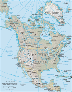
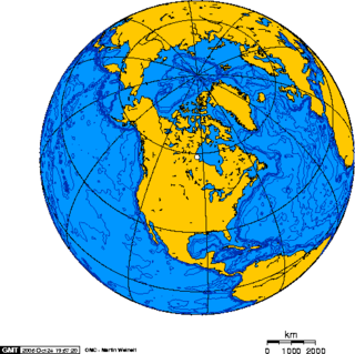
Canada has a vast geography that occupies much of the continent of North America, sharing land borders with the contiguous United States to the south and the U.S. state of Alaska to the northwest. Canada stretches from the Atlantic Ocean in the east to the Pacific Ocean in the west; to the north lies the Arctic Ocean. Greenland is to the northeast and to the southeast Canada shares a maritime boundary with France's overseas collectivity of Saint Pierre and Miquelon, the last vestige of New France. By total area, Canada is the second-largest country in the world, after Russia. By land area alone, however, Canada ranks fourth, the difference being due to it having the world's largest proportion of fresh water lakes. Of Canada's thirteen provinces and territories, only two are landlocked while the other eleven all directly border one of three oceans.

The Rocky Mountains, also known as the Rockies, are a major mountain range located in western North America. The Rocky Mountains stretch 3,000 km (1,900 mi) in straight-line distance from the northernmost part of British Columbia, in western Canada, to New Mexico in the Southwestern United States. The northern terminus is near the Liard River, while the southernmost point is near Albuquerque, adjacent the Sandia–Manzano Mountains. Located within the North American Cordillera, the Rockies are distinct from the Pacific Coast Ranges, Cascade Range, and the Sierra Nevada, which all lie farther to the west.

The term "United States", when used in the geographical sense, is the contiguous United States, the state of Alaska, the island state of Hawaii, the five insular territories of Puerto Rico, Northern Mariana Islands, U.S. Virgin Islands, Guam, and American Samoa, and minor outlying possessions. The United States shares land borders with Canada and Mexico and maritime borders with Russia, Cuba, United Kingdom, Dominican Republic, and the Bahamas in addition to Canada and Mexico. The northern border of the United States with Canada is the world's longest bi-national land border.

The Coast Mountains are a major mountain range in the Pacific Coast Ranges of western North America, extending from southwestern Yukon through the Alaska Panhandle and virtually all of the Coast of British Columbia south to the Fraser River. The mountain range's name derives from its proximity to the sea coast, and it is often referred to as the Coast Range. The range includes volcanic and non-volcanic mountains and the extensive ice fields of the Pacific and Boundary Ranges, and the northern end of the volcanic system known as the Cascade Volcanoes. The Coast Mountains are part of a larger mountain system called the Pacific Coast Ranges or the Pacific Mountain System, which includes the Cascade Range, the Insular Mountains, the Olympic Mountains, the Oregon Coast Range, the California Coast Ranges, the Saint Elias Mountains and the Chugach Mountains. The Coast Mountains are also part of the American Cordillera—a Spanish term for an extensive chain of mountain ranges—that consists of an almost continuous sequence of mountain ranges that form the western backbone of North America, Central America, South America and Antarctica.
The Western United States is the region comprising the westernmost states of the United States. As European settlement in the U.S. expanded westward through the centuries, the meaning of the term the West changed. Before about 1800, the crest of the Appalachian Mountains was seen as the western frontier. The frontier moved westward and eventually the lands west of the Mississippi River were considered the West.

The Steller's jay is a jay native to western North America, closely related to the blue jay found in the rest of the continent, but with a black head and upper body. It is also known as the long-crested jay, mountain jay, and pine jay. It is the only crested jay west of the Rocky Mountains. It is also sometimes colloquially called a "blue jay" in the Pacific Northwest, but is distinct from the blue jay of eastern North America.

ThePacific Coast Ranges, are the series of mountain ranges that stretch along the West Coast of North America from Alaska south to Northern and Central Mexico.

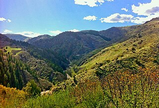
The Canadian Rockies or Canadian Rocky Mountains comprise the Canadian segment of the North American Rocky Mountains. They are the eastern part of the Canadian Cordillera, which is a system of multiple ranges of mountains which runs from the Canadian Prairies to the Pacific Coast. The Canadian Rockies mountain system comprises the southeastern part of this system, lying between the Interior Plains of Alberta and northeastern British Columbia on the east to the Rocky Mountain Trench of BC on the west. The southern end borders Idaho and Montana of the United States. In geographic terms, the boundary is at the Canada–United States border, but in geological terms it might be considered to be at Marias Pass in northern Montana. The northern end is at the Liard River in northern British Columbia.

Mount Fairweather, is the highest mountain in the Canadian province of British Columbia, with an elevation of 4,671 metres (15,325 ft). It is located 20 km (12 mi) east of the Pacific Ocean on the border of Alaska, United States and western British Columbia, Canada. Most of the mountain lies within Glacier Bay National Park and Preserve in the City and Borough of Yakutat, Alaska (USA), though the summit borders Tatshenshini-Alsek Provincial Park, British Columbia (Canada). It is also designated as Boundary Peak 164 or as US/Canada Boundary Point #164.

The American Cordillera is a chain of mountain ranges (cordilleras) that consists of an almost continuous sequence of mountain ranges that form the western "backbone" of North America, South America and Central America. It is also the backbone of the volcanic arc that forms the eastern half of the Pacific Ring of Fire.
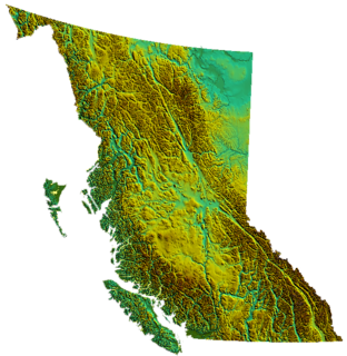
British Columbia is the westernmost province of Canada, bordered by the Pacific Ocean. With an area of 944,735 square kilometres (364,764 sq mi) it is Canada's third-largest province. The province is almost four times the size of United Kingdom and larger than every U.S. state except Alaska. It is bounded on the northwest by the U.S. state of Alaska, directly north by Yukon and the Northwest Territories, on the east by Alberta, and on the south by the U.S. states of Washington, Idaho, and Montana. Formerly part of the British Empire, the southern border of British Columbia was established by the 1846 Oregon Treaty. The province is dominated by mountain ranges, among them the Canadian Rockies but dominantly the Coast Mountains, Cassiar Mountains, and the Columbia Mountains. Most of the population is concentrated on the Pacific coast, notably in the area of Vancouver, located on the southwestern tip of the mainland, which is known as the Lower Mainland. It is the most mountainous province of Canada.
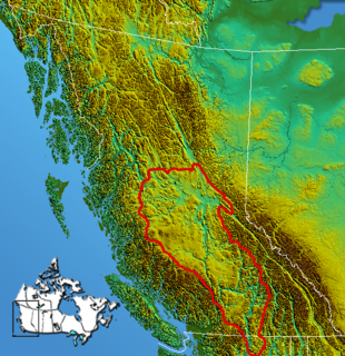
The Interior Plateau comprises a large region of the Interior of British Columbia, and lies between the Cariboo and Monashee Mountains on the east, and the Hazelton Mountains, Coast Mountains and Cascade Range on the west. The continuation of the plateau into the United States is known there as the Columbia Plateau.

The Rainbow Range, formerly known as the Rainbow Mountains, is a mountain range in British Columbia, Canada, located 40 kilometres (25 mi) northwest of Anahim Lake. Located on the western edge of the Chilcotin Plateau, the range adjoins the Coast Mountains Pacific Ranges to the south, and the Kitimat Ranges to the north. In some classification systems it is considered part of the Coast Mountains. It lies north of the Bella Coola and Atnarko Rivers and south and west of the Dean River, which curves around its north flank, and is relatively drier in climate and easier of terrain than more mountainous areas immediately west.

The Massive Range is a mountain range of the Canadian Rockies, located in the southwestern area of the Bow River valley in Banff National Park, Canada.
The North American Cordillera is the North American portion of the American Cordillera which is a mountain chain (cordillera) along the western side of the Americas. The North American Cordillera covers an extensive area of mountain ranges, intermontane basins, and plateaus in western North America, including much of the territory west of the Great Plains. It is also sometimes called the Western Cordillera, the Western Cordillera of North America, or the Pacific Cordillera.
Foothills or piedmont are geographically defined as gradual increases in elevation at the base of a mountain range, higher hill range or an upland area. They are a transition zone between plains and low relief hills and the adjacent topographically higher mountains, hills, and uplands. Frequently foothills consist of alluvial fans, coalesced alluvial fans and dissected plateaus.
North America is the third largest continent, and is also a portion of the second largest supercontinent if North and South America are combined into the Americas and Africa, Europe, and Asia are considered to be part of one supercontinent called Afro-Eurasia.
The Rocky Mountains, commonly known as the Rockies, are a major mountain range in western North America.

The Rocky Mountain Floristic Region, also known as the Rocky Mountain Floristic Province, is a floristic region within the Holarctic Kingdom in western North America delineated by Armen Takhtajan and Robert F. Thorne. The region extends from Kodiak Island in Alaska to the San Francisco Bay Area and Sierra Nevada in California. The Vancouverian Province comprises the coastal part of the region for its entire length, including the Pacific Coast Ranges, and the Rocky Mountain Province includes the Rocky Mountains and associated ranges. There are no endemic plant families in the region but many endemic genera and species.

The North Central Rockies forests is a temperate coniferous forest ecoregion of Canada and the United States. This region gets more rain on average than the South Central Rockies forests and is notable for containing the only inland populations of many species from the Pacific coast.