
The Taupo Volcanic Zone (TVZ) is a volcanic area in the North Island of New Zealand that has been active for the past two million years and is still highly active. Mount Ruapehu marks its south-western end and the zone runs north-eastward through the Taupo and Rotorua areas and offshore into the Bay of Plenty. It is part of the larger Central Volcanic Region that extends further westward through the western Bay of Plenty to the eastern side of the Coromandel Peninsula and has been active for four million years. The Taupo Volcanic Zone is widening east–west at the rate of about 8 mm per year. It is named after Lake Taupo, the flooded caldera of the largest volcano in the zone.

The Rangitikei River is one of New Zealand's longest rivers, 185 kilometres (115 mi) long.
The Rangitaiki River is the longest river in the Bay of Plenty region in New Zealand's North Island. It is 155 kilometres (96 mi) long, and rises inland from northern Hawkes Bay to the east of the Kaingaroa Forest.

Cape Turnagain is a prominent headland on the east coast of New Zealand's North Island, part way between Hawke Bay and Cook Strait, between the mouths of the Porangahau and Akitio Rivers.

The Diocese of Waiapu is one of the thirteen dioceses and hui amorangi of the Anglican Church in Aotearoa, New Zealand and Polynesia. The Diocese covers the area around the East Coast of the North Island of New Zealand, including Tauranga, Taupo, Gisborne, Hastings and Napier. It is named for the Waiapu River.
Tinui is a small village approximately 40 kilometres from Masterton, in the Wairarapa, New Zealand. The name comes from the Māori words ti, cabbage tree, and nui, many.
The Mangawhero River is in the North Island of New Zealand.
The Cam River is a river of New Zealand. It flows north from the Inland Kaikoura Range and is a tributary of the Awatere River.

The Little Opawa River is a river of the south Canterbury Region of New Zealand's South Island. It flows generally east from a ridge 20 kilometres (12 mi) southwest of Fairlie, joining with its southern neighbour, the Ōpaoa River very close to their joint outflow into the Tengawai River, close to the settlement of Albury.
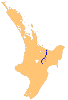
The Mangamaire River is a river of the centre of New Zealand's North Island. One of the headwaters of the Rangitikei River system, it flows generally southwest from its origins southeast of Lake Taupo, forming part of the border of the Kaimanawa Forest Park for much of its length. It meets the young Rangitikei in hill country 40 kilometres (25 mi) east of Mount Ruapehu.
The Mangatewainui River is a river of the Manawatu-Wanganui Region of New Zealand's North Island. An upper tributary of the Manawatu River, it flows generally southeast from its sources in the Ruahine Range northwest of Norsewood, and meets the young Manawatu River 8 kilometres (5 mi) east of Dannevirke.
The Maropea River is a river of the Manawatu-Wanganui Region of New Zealand's North Island. It flows northwest from the Ruahine Range to join the Whakaurekou River 25 kilometres (16 mi) east of Taihape.
The Mataikona River is a river of the Wairarapa of New Zealand's North Island. It flows generally southwest from its sources in rugged hill country 30 kilometres (19 mi) southwest of Pahiatua, flowing to the Pacific Ocean which it reaches 15 kilometres (9 mi) northeast of Castlepoint.
The Old Bed of Waipawa River is a river of the Hawke's Bay region of New Zealand's North Island. It flows roughly parallel with and north of the Waipawa River, which it meets to the east of Waipawa.
The Owahanga River is a river of the Wairarapa, in the Wellington Region of New Zealand's North Island. Its tortuous course winds generally southeast through rough hill country, reaching the sea 30 km (19 mi) southwest of Cape Turnagain.
The Pakowhai River is a river of the Wairarapa, in the Wellington Region of New Zealand's North Island. It flows initially north then east from its sources northeast of Masterton, reaching the Mataikona River 10 kilometres (6 mi) from the coast of the Pacific Ocean.
The Pongaroa River is a river of the southern Hawke's Bay region of New Zealand's North Island. It flows southeast from the Puketoi Range west of Pahiatua, reaching the Owahanga River 15 kilometres from the latter's outflow into the Pacific Ocean.
The Tinui River is a river of the Wellington Region of New Zealand's North Island. It flows initially east from its origins in the northern Wairarapa before turning southwest to flow parallel with the Pacific coast. It reaches the Whareama River at the settlement of Tinui, 30 kilometres (19 mi) east of Masterton.
The Waiotauru River is a river of the Wellington Region of New Zealand's North Island. It flows generally north from two branches, the Southern Waiotauru River and the Eastern Waiotauru River. Both of these branches have their origins in the southwestern Tararua Range, with the Eastern branch having its origin on the slopes of Mount Hector. The Waiotauru meets the Otaki River at Otaki Forks, 15 kilometres (9 mi) southeast of Otaki.
The more northerly of the two rivers called Esk River in New Zealand lies in Hawke's Bay, in the eastern North Island. One of the region's major rivers, it flows south from the slopes of Mount Taraponui in the Maungaharuru Range before turning east to reach Hawke Bay 10 kilometres (6 mi) north of Napier. State Highway 5 follows the lower course of the river for several kilometres close to the settlement of Eskdale. The river is probably named after the Esk River in southern Scotland and north-west England.


