Related Research Articles
The Jordan River is a name given to two minor rivers in the South Island of New Zealand, one in Marlborough, the other in Tasman. Further south, there is also 4 km (2.5 mi) stream in Otago named River Jordan.

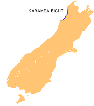
The Karamea Bight is the name given to a large bay in the Tasman Sea formed by a curved stretch of the West Coast of New Zealand's South Island. It stretches for 100 kilometres north from Cape Foulwind to just north of the mouth of the Heaphy River.
Denniston is a small settlement, 15 kilometres east of Westport, on the West Coast of the South Island of New Zealand. It is situated on the Denniston Plateau, 600 metres (2,000 ft) above sea level in the Papahaua Ranges.

The Inangahua River is located in the north-west of New Zealand’s South Island. It is a major tributary of the Buller River, where it joins at the town of Inangahua Junction.

Castle Hill is a location and a high country station in New Zealand's South Island. It is located at an altitude of 700 metres, close to State Highway 73 between Springfield and Arthur's Pass. It is private property and located within the Kura Tawhiti Conservation Area.

The Waimangaroa River is located on the West Coast of New Zealand.
The Papahaua Range is a mountain range on the West Coast of New Zealand's South Island east of the town of Westport. It is a geological continuation of the Paparoa Range that is south of the Buller River and it runs north from the Buller Gorge to the Mōkihinui River. At its north end, it meets the Glasgow Range.
The Allan Hills are a group of hills, mainly ice free and about 12 nautical miles long, lying just north-west of the Coombs Hills near the heads of Mawson Glacier and Mackay Glacier in the Oates Land and Victoria Land regions of Antarctica.
Hook River is a natural watercourse in the southern Canterbury region of New Zealand's South Island. The river flows east from its source to the Wainono Lagoon, a fresh water lake beside the Pacific Ocean. On the way, it passes through the localities of Waiariari and Hook and is crossed by State Highway 1 and the Main South Line railway. Water from the river and an associated aquifer is used for agricultural purposes.
Waimate Creek is a natural watercourse in the southern Canterbury region of New Zealand's South Island. Its original Māori name was Te Waimatemate, which means "slowly moving waters".
Avoca is a locality in the Canterbury region of New Zealand. It is situated along the Midland Railway Line between Craigieburn and Staircase. There are no permanent residents, but it once supported a small number of railway staff.
The Edison River is a river of the Westland District of New Zealand. It arises in the Solution Range near Mount Elliot and flows north-west and north into the Mahitahi River.
The Orikaka River is a river of the West Coast Region of New Zealand's South Island. It flows southwest from the southern end of the Matiri Range before turning south to flow into the Buller River five kilometres to the west of Inangahua.

The Orowaiti River is a river of the West Coast Region of New Zealand's South Island. The smaller of the two rivers which run through the town of Westport, it reaches the Karamea Bight three kilometres to the east of its larger neighbour, the Buller River.
The Penk River is a river of the Marlborough Region of New Zealand's South Island. It flows predominantly south from its origins on the slopes of Mount Horrible to reach the Awatere River 35 kilometres (22 mi) southwest of Seddon.
The Te Wharau or Stony River is a river of the West Coast Region of New Zealand's South Island. It flows generally east from its sources in the Paparoa Range to reach the Inangahua River 15 kilometres north of Reefton.

Lauriston is a lightly populated locality in the Canterbury region of New Zealand's South Island. It is situated on the Canterbury Plains south of the Rakaia River, some 20 kilometres (12 mi) inland from Rakaia. It was named after one of its pioneer settlers with the name of Laurie.

Wallsend is a locality in the West Coast region of New Zealand, located on the south side of the Grey River. It is located opposite Taylorville. The two settlements were connected via a suspension bridge for pedestrians that was known as the Taylorville bridge.

The Blackwater River is located in the Buller District of New Zealand. It flows north-northwest for 19 kilometres (12 mi) from the northern slopes of Mount Copernicus in the Paparoa Range, reaching the Buller River 16 kilometres (9.9 mi) west of Inangahua in the lower Buller Gorge.
References
"Place name detail: Whareatea River". New Zealand Gazetteer. New Zealand Geographic Board . Retrieved 12 July 2009.
41°44′S171°42′E / 41.733°S 171.700°E