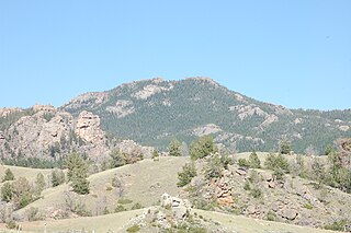
The Laramie Mountains are a range of moderately high peaks on the eastern edge of the Rocky Mountains in the U.S states of Wyoming and Colorado. The range is the northernmost extension of the line of the ranges along the eastern side of the Rockies, and in particular of the higher peaks of the Front Range directly to the south. North of the range, the gap between the Laramie range and the Bighorn Mountains provided the route for historical trails, such as the Oregon Trail, the Mormon Trail, and the Pony Express.

The Laramie River is a tributary of the North Platte River, approximately 280 miles (450 km) long, in the U.S. states of Colorado and Wyoming. The river was named for Jacques La Ramie, a fur trapper who visited the area in the early 19th century. Laramie County, Wyoming, the city of Laramie, and other geographical entities in the region have "Laramie" in their names.

The North Laramie River is a tributary of the Laramie River, 86.4 miles (139.0 km) long, in southeastern Wyoming in the United States.

Chugwater Creek is a tributary of the Laramie River in southeastern Wyoming in the United States. The stream rises northeast of Laramie, in the Laramie Mountains in eastern Albany County and flows 92.6 miles (149 km). It flows northeast, emerges from the mountains and flows past Chugwater, where it turns north-northwest, and flows past Slater. Chugwater Creek joins the Laramie approximately 7 miles (11 km) northeast of Wheatland.
The North Fork Cache la Poudre River is a tributary of the Cache la Poudre River, approximately 59.2 miles (95.3 km) long, in north central Colorado in the United States. It drains a mountainous area of north central Larimer County northwest of Fort Collins on the western side of the Laramie Foothills.
The Libby Creek is a 10.1-mile-long (16.3 km) stream on the eastern slopes of the Snowy Range in southern Wyoming. Libby Creek starts as it flows out of Libby Lake and flows violently down the east side of the Snowies until it empties into the North Fork of the Little Laramie.

Garrett is an unincorporated community in northern Albany County, Wyoming, United States, along the North Laramie River. It lies along local roads north of the city of Laramie, the county seat of Albany County. Its elevation is 6,785 ft (2,068 m), and it is located at 42°6′48″N105°36′36″W. Although Garrett is unincorporated, it once had a post office, with the ZIP code of 82058. The building remains, though is no longer in use. Garrett is also home to River Bridge School, a one-room schoolhouse that is part of Albany County School District #1. Aside from the schoolhouse, the land is privately owned.

Saint Charles Reservoir is the name of three reservoirs in Pueblo County, Colorado. The first one, called just Saint Charles Reservoir, is located in the mountains of southwestern Pueblo County, southwest of Beulah, at an elevation of 8,894 feet. It is located at 38°00′00″N105°02′35″W.

Arlington is a census-designated place (CDP) in southeastern Carbon County, Wyoming, United States. The population was 25 at the 2010 census.

Sherman is a ghost town in Albany County, Wyoming, United States. Sherman is 19 miles (31 km) southeast of Laramie in the Laramie Mountains. It is named for William Tecumseh Sherman. The town was located at the summit of the original grade of the First Transcontinental Railroad and the name Sherman Summit or Sherman Hill Summit was applied to the nearby summits of the modern transportation arteries in the Laramie Mountains.
Wickenburg Mountains is a mountain range located in Maricopa and Yavapai Counties in Arizona. Denver Hill, at an altitude of 4,406 feet or 1,343 meters, is the tallest peak in the range. 34°02′02″N112°33′59″W
This page is based on this
Wikipedia article Text is available under the
CC BY-SA 4.0 license; additional terms may apply.
Images, videos and audio are available under their respective licenses.


