Related Research Articles

Deception Pass is a strait separating Whidbey Island from Fidalgo Island, in the northwest part of the U.S. state of Washington. It connects Skagit Bay, part of Puget Sound, with the Strait of Juan de Fuca. A pair of bridges known collectively as Deception Pass Bridge cross Deception Pass. The bridges were added to the National Register of Historic Places in 1982.

Whidbey Island is the largest of the islands composing Island County, Washington, in the United States, and the largest island in Washington State. Whidbey is about 30 miles (48 km) north of Seattle, and lies between the Olympic Peninsula and the I-5 corridor of western Washington. The island forms the northern boundary of Puget Sound. It is home to Naval Air Station Whidbey Island. The state parks and natural forests are home to numerous old growth trees.

Island County is a county located in the U.S. state of Washington. As of the 2020 census, its population was 86,857. Its county seat is Coupeville, while its largest city is Oak Harbor.

Clinton is a community and census-designated place (CDP) located on southern Whidbey Island in Island County, Washington, United States. The town was named after Clinton, Michigan. As of the 2010 census, the village was 928. However, the post office serves at least 2,500 people.

Freeland is an unincorporated community and census-designated place (CDP) on Whidbey Island in Island County, Washington, United States. At the time of the 2010 census the population was 7,812. The town received its name based on its origins as a socialist commune in the early 1900s: in the eyes of its founders, the land of the town was literally to be free for all people. Some of the first settlers were veterans of a prior experiment in socialism, the nearby Equality Colony.
Bayview is an unincorporated community centered at the intersection of State Route 525 and Bayview Road on Whidbey Island in Island County, Washington, United States.
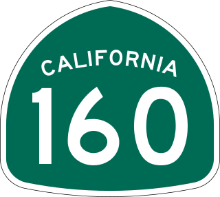
State Route 160 is a state highway in the U.S. state of California consisting of two sections. The longer, southern, section is a scenic highway through the alluvial plain of the Sacramento River, linking SR 4 in Antioch with Sacramento via the Antioch Bridge. The northern section, separated from the southern by Sacramento city streets, is the North Sacramento Freeway, running from the 16th Street Bridge over the American River to Interstate 80 Business towards Roseville.
State Route 525 (SR 525) is a 30.68-mile-long (49.37 km) state highway located in Snohomish and Island counties in the western region of the U.S. state of Washington. SR 525 begins at an interchange with Interstate 5 (I-5) and I-405 in Lynnwood and travels north to SR 99 as a four-lane controlled-access freeway. From Lynnwood, the highway serves Mukilteo and becomes the terminus of SR 526 before taking its ferry route to Clinton on Whidbey Island. SR 525 traverses the island's interior as part of the Whidbey Island Scenic Byway before the designation ends at an intersection with SR 20 south of Coupeville.

State Route 526 (SR 526), also known as the Boeing Freeway, is a state highway in Snohomish County, Washington, United States. The east–west highway travels 4.52 miles (7.27 km) and connects SR 525 in Mukilteo to Interstate 5 (I-5) in southern Everett. The highway serves the Boeing Everett Factory and Paine Field; it also serves as a main route to the city of Mukilteo and the state-run ferry to Whidbey Island.

State Route 20 (SR 20), also known as the North Cascades Highway, is a state highway that traverses the U.S. state of Washington. It is the state's longest highway, traveling 436 miles (702 km) across the northern areas of Washington, from U.S. Route 101 (US 101) at Discovery Bay on the Olympic Peninsula to US 2 near the Idaho state border in Newport. The highway travels across Whidbey Island, North Cascades National Park, the Okanagan Highland, the Kettle River Range, and the Selkirk Mountains. SR 20 connects several major north–south state highways, including Interstate 5 (I-5) in Burlington, US 97 through the Okanogan–Omak area, SR 21 in Republic, and US 395 from Kettle Falls to Colville.

Greenbank is an unincorporated community on Whidbey Island in Island County, Washington, United States.

State Route 112 is a state highway and scenic byway in the U.S. state of Washington. It runs east–west for 61 miles (98 km) along the Strait of Juan de Fuca in Clallam County, connecting the Makah Indian Reservation near Neah Bay to U.S. Route 101 (US 101) near Port Angeles.

Deception Pass Bridge is the common name for two two-lane bridges on Washington State Route 20 connecting Whidbey Island in Island County, to Fidalgo Island in Skagit County, in the U.S. state of Washington. It was a Washington State Highways project, and included project elements built by young workers from the Civilian Conservation Corps. Completion of the bridge was a factor in the decision to build Naval Air Station Whidbey Island and helped Oak Harbor flourish. The bridge is a commonly photographed landmark of the Puget Sound region.
State Route 536 (SR 536) is a 5.38-mile-long (8.66 km) state highway serving Skagit County in the U.S. state of Washington. The highway travels southeast from SR 20 near Fredonia through Mount Vernon to an interchange with Interstate 5 (I-5) on the east side of downtown Mount Vernon. SR 536 was created during the 1964 highway renumbering as a replacement for the Anacortes branch of Primary State Highway 1 (PSH 1). SR 536 was shortened to its current route in 1973 after SR 20 was extended west and a spur route was established to serve Anacortes.

U.S. Route 2 (US 2) is a component of the United States Numbered Highway System that connects the city of Everett in the U.S. state of Washington to the Upper Peninsula of Michigan, with a separate segment that runs from Rouses Point, New York, to Houlton, Maine. Within Washington, the highway travels on a 326-mile-long (525 km) route that connects the western and eastern regions of the state as a part of the state highway system and the National Highway System. US 2 forms parts of two National Scenic Byways, the Stevens Pass Greenway from Monroe to Cashmere and the Coulee Corridor Scenic Byway near Coulee City, and an All-American Road named the International Selkirk Loop within Newport.

Joseph Whidbey State Park is a 112-acre (45 ha) Washington state park in Island County, Washington with 3,100 feet (940 m) of shoreline on the Strait of Juan de Fuca in north Puget Sound. Park activities include picnicking, ADA-accessible hiking, canoeing, crabbing, beachcombing, and birdwatching. A small section of the Pacific Northwest National Scenic Trail crosses through the park.
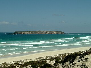
The Whidbey Isles Conservation Park is a protected area in the Australian state of South Australia which consists of seven islands located about 15 kilometres (9.3 mi) west-southwest of Coffin Bay on the lower Eyre Peninsula.

The Cascade Loop Scenic Byway is a 440-mile-long (710 km) National Scenic Byway and Washington State Scenic and Recreational Highway encircling the North Cascades in the U.S. state of Washington. It follows eight different numbered highways:
References
- ↑ "Whidbey Scenic Isle Way". Scenic Byways Program. Washington State Department of Transportation . Retrieved October 16, 2014.