Whitehouse Common

Last updated

Whitehouse Common is an area of Sutton Coldfield, Birmingham, England. It lies north of Falcon Lodge which is separated from it by a main road.
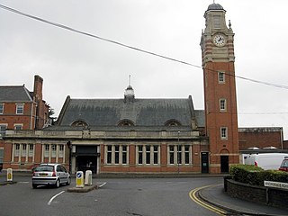
Sutton Coldfield town, suburb of Birmingham, England

Sutton Coldfield, officially the Royal Town of Sutton Coldfield, is a large town and civil parish in Birmingham, England. The town lies about 7 miles northeast of Birmingham City Centre and borders Little Aston, North Warwickshire, Lichfield, Erdington and South Staffordshire. Historically in Warwickshire, it became part of Birmingham and the West Midlands metropolitan county in 1974. In 2015, the town elected a Parish/Town Council for the first time in its recent history.

Birmingham Major city in the English Midlands, 2nd highest population of UK cities

Birmingham is a major city and metropolitan borough in the West Midlands, England. Birmingham is the second-most populous city in the United Kingdom and the most populous city in the English Midlands. It is also the most populous metropolitan district in the United Kingdom, with an estimated 1,137,123 inhabitants, and is considered the social, cultural, financial, and commercial centre of the Midlands. It is situated within the larger West Midlands conurbation, which is the third most populated urban area in the United Kingdom, with a population of 2,897,303 in 2017. The wider Birmingham metropolitan area is the second largest in the United Kingdom with a population of over 3.8 million. It is frequently referred to as both England and the United Kingdom's "second city".

England Country in north-west Europe, part of the United Kingdom

England is a country that is part of the United Kingdom. It shares land borders with Wales to the west and Scotland to the north. The Irish Sea lies west of England and the Celtic Sea to the southwest. England is separated from continental Europe by the North Sea to the east and the English Channel to the south. The country covers five-eighths of the island of Great Britain, which lies in the North Atlantic, and includes over 100 smaller islands, such as the Isles of Scilly and the Isle of Wight.

The area is served by Whitehouse Common Primary School.

Coordinates: 52°34′08″N1°47′53″W / 52.569°N 1.798°W / 52.569; -1.798

Geographic coordinate system Coordinate system

A geographic coordinate system is a coordinate system that enables every location on Earth to be specified by a set of numbers, letters or symbols. The coordinates are often chosen such that one of the numbers represents a vertical position and two or three of the numbers represent a horizontal position; alternatively, a geographic position may be expressed in a combined three-dimensional Cartesian vector. A common choice of coordinates is latitude, longitude and elevation. To specify a location on a plane requires a map projection.


Related Research Articles

Crawford County, Pennsylvania County in the United States

Crawford County is a county located in the U.S. state of Pennsylvania. As of the 2010 census, the population was 88,765. Its county seat is Meadville. The county was created on March 12, 1800, from part of Allegheny County and named for Colonel William Crawford.

Whitehouse, Ohio Village in Ohio, United States

Whitehouse is a village within the Toledo Metropolitan Area in Lucas County, Ohio, United States. The population was 4,149 at the 2010 census.

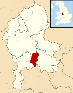
Cannock Chase District Non-metropolitan district in England

Cannock Chase is a local government district in Staffordshire, England. Its council is based in the town of Cannock; other notable towns are Rugeley and Hednesford. The district covers a large part of the Cannock Chase Area of Outstanding Natural Beauty, from which it takes its name.

Novo Sarajevo Municipality in Bosnia and Herzegovina

Novo Sarajevo is a municipality of the city of Sarajevo, Bosnia and Herzegovina.

Murillo, Tolima Municipality and town in Tolima Department, Colombia

Murillo is a town and municipality in the Tolima department of Colombia. The population of the municipality was 4,953 as of the 2005 census, 1,569 who lived within the town of Murillo, the remainder in rural areas of the municipality.

Falcon Lodge

Falcon Lodge is the area of Sutton Coldfield, Birmingham, West Midlands, England, covered in predominantly council houses forming the Falcon Lodge Estate. It is located between Whitehouse Common and Reddicap Heath. To the west of the estate lies Rectory Park. It forms part of the edge of the Sutton Coldfield conurbation and the English countryside.

Vajska Place in Vojvodina, Serbia

Vajska is a village in Serbia. It is situated in the Bač municipality, in the South Bačka District, Vojvodina province. Two neighbouring settlements, Labudnjača and Živa, are also officially regarded as parts of Vajska although they are physically separated from it. The nameLabudnjača is derived from the Serbian word "labud".

Monroe Township, Putnam County, Indiana Township in Indiana, United States

Monroe Township is one of thirteen townships in Putnam County, Indiana. As of the 2010 census, its population was 1,569 and it contained 672 housing units.

Brawdy village in Pembrokeshire, Wales

Brawdy is a village and community in Pembrokeshire, Wales.

Drift, Kentucky Unincorporated community in Kentucky, United States

Drift, Kentucky is an unincorporated community and coal town in Floyd County, Kentucky, United States. As of the census of 2000, there were 569 people residing in the ZIP Code Tabulation Area (ZCTA) for Drift's ZIP code (41619).

569th Strategic Missile Squadron

The 569th Strategic Missile Squadron is an inactive United States Air Force unit. It was last assigned to the 9th Strategic Aerospace Wing, stationed at Mountain Home AFB, Idaho

Belleville Air Force Station

Belleville Air Force Station is a closed United States Air Force General Surveillance Radar station. It is located 2 miles (3.2 km) southeast of Belleville, Illinois. It was closed in 1968.

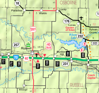
Homer, Kansas Unincorporated community in Kansas, United States

Homer is an unincorporated area in Russell County, Kansas, United States. It lies on the border between Grant and Russell Townships. There is no community or settlement at Homer.

Cofton Common

Cofton Common is a small area of Birmingham, England, located near Longbridge on the border with Worcestershire.

Elton is a hamlet and civil parish in the far north of Herefordshire. It is situated on the Wigmore to Ludlow road.

Monjarás is a corregimiento in Calobre District, Veraguas Province, Panama with a population of 585 as of 2010. Its population as of 1990 was 580; its population as of 2000 was 569.

Bassenhally Pit

Bassenhally Pit is an 8.6 hectare biological Site of Special Scientific Interest north-east of Whittlesey in Cambridgeshire]].

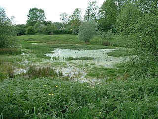
The Boardwalks

The Boardwalks is a 7.8 hectare Local Nature Reserve in Peterborough in Cambridgeshire. It is owned and managed by Peterborough City Council.

East Walton and Adcocks Common

East Walton and Adcock's Common is a 62.4-hectare (154-acre) biological and geological Site of Special Scientific Interest south-east of King's Lynn in Norfolk. It is a Geological Conservation Review site and part of Norfolk Valley Fens Special Area of Conservation