Related Research Articles

Corson County is a county in the U.S. state of South Dakota. As of the 2020 census, the population was 3,902. Its county seat is McIntosh. The county was named for Dighton Corson, a native of Maine, who came to the Black Hills in 1876, and in 1877 began practicing law at Deadwood.

Winona County is a county in the U.S. state of Minnesota. As of the 2020 census, its population was 49,671. Its county seat is Winona. Winona County comprises the Winona, MN Micropolitan Statistical Area.

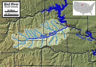
The Bad River is a tributary of the Missouri River, approximately 161 miles (259 km) long, in central South Dakota in the United States. The river is formed at Philip, South Dakota, by the confluence of its North and South forks. The North Fork Bad River rises in eastern Pennington County and flows 51 miles (82 km) east-southeast to Philip, while the South Fork Bad River rises at the confluence of Whitewater Creek and Big Buffalo Creek in Jackson County, within the Buffalo Gap National Grassland, and flows 36 miles (58 km) northeast to Philip. The main stem of the Bad River flows east-northeast from Philip, passing Midland and Capa. It joins the Missouri at Fort Pierre. The Bad drainage basin is about 3,000 square miles (7,800 km2) and is located south of the Cheyenne River in the Pierre Hills and Southern Plateaus.
Rutherford Creek is a tributary of the Green River, British Columbia, Canada, entering that river a few miles above Nairn Falls Provincial Park, near the village of Pemberton. The creek's headwaters are on the eastern side of the Pemberton Icefield, from where it flows southeast for the first half of its course, then generally east for the remainder. It is approximately 24 km (15 mi) in length. The mouth is at 50° 16' 3" N, 122° 57' 41" W.
Nancy Hanks Creek is a stream of the Buffalo Gap National Grassland in Jackson County, South Dakota, not far from Kadoka. It has an elevation of 2,103 feet (641 m), and flows into the White River.
Potato Creek is an unincorporated community in Jackson County, in the U.S. state of South Dakota.
Bear-in-the-Lodge Creek is a stream in the U.S. state of South Dakota.
Beverly Creek is a stream in the U.S. state of South Dakota.
Big Buffalo Creek is a stream in Jackson County in the U.S. state of South Dakota.
Black Pipe Creek is a stream in the U.S. state of South Dakota.
Brady Creek is a stream in the U.S. state of South Dakota.
Brave Bull Creek is a stream in the U.S. state of South Dakota.
Craven Creek is a stream in the U.S. state of South Dakota.
Eagle Nest Creek is a stream in the U.S. state of South Dakota.
Franklin Creek is a stream in the U.S. state of South Dakota.
Hump Creek is a stream in the U.S. state of South Dakota.
Lost Dog Creek is a stream in the U.S. state of South Dakota.
Red Stone Creek is a stream in Jackson County in the U.S. state of South Dakota.
Stink Creek is a stream in the U.S. states of North Dakota and South Dakota.
Jakes Creek is a stream in northeastern Dallas County in the U.S. state of Missouri. It is a tributary of the Niangua River.
References
- ↑ U.S. Geological Survey Geographic Names Information System: Whitewater Creek (South Dakota)
- ↑ Federal Writers' Project (1940). South Dakota place-names, v.3. University of South Dakota. p. 69.
43°54′20″N101°51′00″W / 43.90556°N 101.85000°W