
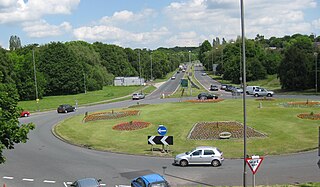
Whitkirk is a suburb of east Leeds, England. It is situated between Cross Gates to the north, Austhorpe to the east, Killingbeck to the west, Colton to the south-east and Halton to the south-west. The Temple Newsam estate lies directly south of the area.

John Smeaton was a British civil engineer responsible for the design of bridges, canals, harbours and lighthouses. He was also a capable mechanical engineer and an eminent physicist. Smeaton was the first self-proclaimed "civil engineer", and is often regarded as the "father of civil engineering". He pioneered the use of hydraulic lime in concrete, using pebbles and powdered brick as aggregate. Smeaton was associated with the Lunar Society.

Temple Newsam is a Tudor-Jacobean house in Leeds, West Yorkshire, England, with grounds landscaped by Capability Brown.

Austhorpe is a civil parish and residential suburb of east Leeds, West Yorkshire, England. It is 5 miles (8.0 km) to the east of city centre and close to the A6120 dual carriageway and the M1 motorway.

Seacroft is an outer-city suburb/township consisting mainly of council estate housing covering an extensive area of east Leeds, West Yorkshire, England. It lies in the LS14 Leeds postcode area, around 4 miles (6.4 km) east of Leeds city centre.

Halton is a district of east Leeds, West Yorkshire, England, situated between Cross Gates to the north, Halton Moor to the west, Colton to the east and Whitkirk to the South. Temple Newsam lies directly south of the estate.
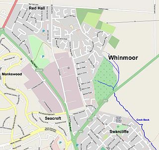
Whinmoor is a residential area of east Leeds, West Yorkshire, England.

Barwick-in-Elmet is a village in West Yorkshire, 7 miles (11 km) east of Leeds city centre. It is one of only three places in the area to be explicitly associated with the ancient Romano-British kingdom of Elmet, the others being Scholes-in-Elmet and Sherburn-in-Elmet.
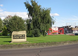
Cross Gates is a suburb in east Leeds, West Yorkshire, England.
Colton is a district of east Leeds, West Yorkshire, England, situated between Cross Gates to the north, Halton and Halton Moor to the west, Whitkirk to the north-west and Austhorpe to the north-east. Temple Newsam lies directly south of the estate.
John Brian Bolus was an English cricketer who played in seven Test matches from 1963 to 1964. Cricket commentator Colin Bateman stated, "Bolus was essentially an accumulator, dependably totting up 25,000 runs over 20 summers".
The West Yorkshire Association Football League is a football competition based in Yorkshire, England. It was previously known as the Leeds League until the name change in 1939. Although it is named the West Yorkshire League, clubs from the Harrogate and York areas of North Yorkshire also play in the competition.

Manston is a suburb and former village to the east of Cross Gates, Leeds, England, situated 4 miles (6 km) east of Leeds city centre.

Killingbeck is a district of east Leeds, West Yorkshire, England that is situated between Seacroft to the north, Cross Gates and Whitkirk to the east, Gipton to the west, Halton Moor to the south, Halton to the south-east and Osmondthorpe to the south-west.

Temple Moor High School is a coeducational secondary school and sixth form located in Leeds, West Yorkshire, England. In recent years, it has received 'Science College' status. In 2017 an Ofsted inspection gave the school a Good rating.
Osmondthorpe a district of east Leeds in West Yorkshire, England is considered part of the Halton Moor district.
The Leeds Outer Ring Road is a main road that runs around most of the perimeter of the city of Leeds, West Yorkshire, England. The ring road is approximately 29 miles and consists of single and dual carriageways. The road is not a loop and so is not a true ring road, although it is designated as such.
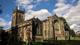
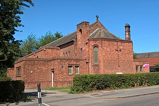
St Mary's Church in Whitkirk, Leeds, West Yorkshire, England is an active Anglican parish church in the archdeaconry of Leeds and the Diocese of Leeds.