
Lechlade is a town at the edge of the Cotswolds in Gloucestershire, England, 55 miles (89 km) south of Birmingham and 68 miles (109 km) west of London. It is the highest point at which the River Thames is navigable, although there is a right of navigation that continues south-west into Cricklade, in the neighbouring county of Wiltshire. The town is named after the River Leach that joins the Thames near the Trout Inn and St. John's Bridge.

Churchdown is a large village in Gloucestershire, England, situated between Gloucester and Cheltenham in the south of the Tewkesbury Borough.
The Gloucestershire Wildlife Trust is the Gloucestershire local partner in a conservation network of 46 Wildlife Trusts. The Wildlife Trusts are local charities with the specific aim of protecting the United Kingdom's natural heritage. The Gloucestershire Wildlife Trust is managed by a board of trustees elected from its membership who provide overall direction for the development of the trust and there are advisory committees. The work of the trust is carried out through staff and volunteers.

Toddington is a large village and civil parish in the county of Bedfordshire, England. It is situated 5 miles north-north-west of Luton, 4 miles (6 km) north of Dunstable, 6 miles (10 km) south-west of Woburn, and 35 miles north-north-west of London on the B5120 and B579. It is 0.5 miles from Junction 12 of the M1 motorway and lends its name to the nearby motorway service station. The hamlet of Fancott also forms part of the Toddington civil parish.

Hartlip is a village and civil parish in the borough of Swale, Kent, England.

Whittington is a village and civil parish in north west Shropshire, England, lying east and north-east of Oswestry. The parish had a population of 2,592 at the 2011 census. The village of Whittington is in the centre of the parish, and three smaller villages, Park Hall to its west, Hindford to the north-east and Babbinswood to the south, are also within the parish.
Kinver is a large village in the District of South Staffordshire in Staffordshire, England. It is in the far south-west of the county, at the end of the narrow finger of land surrounded by the counties of Shropshire, Worcestershire and the West Midlands. The nearest towns are Stourbridge, West Midlands, Kidderminster in Worcestershire and Bridgnorth, Shropshire. The Staffordshire and Worcestershire Canal passes through, running close to the course of the meandering River Stour. According to the 2011 census Kinver ward had a population of 7,225.
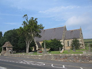
Wick is a village in South Gloucestershire, England. It is the main settlement in the civil parish of Wick and Abson. The population of this civil parish taken at the 2011 census was 1,989.
Alfrick is a village and civil parish in the Malvern Hills district of Worcestershire, England, about seven miles west of Worcester.
Dowdeswell is a civil parish in the ward of Chedworth, Cotswold, in the ceremonial county of Gloucestershire, England. It is separated into Upper and Lower Dowdeswell, the former being south of the latter. The population of the civil parish at the 2011 census was 134.

Eastington is a village and civil parish in Gloucestershire, England. It lies 4 miles west of Stroud and 9 miles south of Gloucester at the entrance to the Stroud Valley. It is west of the town of Stonehouse and south of Junction 13 of the M5 motorway and the A38 and A419 roads. Since the M5 and its access roads were opened, the main road no longer runs through the village.

Whipsnade is a small village and civil parish in Bedfordshire, England. It lies on the eastward tail spurs of the Chiltern Hills, about 2+1⁄2 miles (4.0 km) south-south-west of Dunstable on the top of the Dunstable Downs, which drop away steeply to the south of the village.

Hertford Heath is a village and civil parish near the county town of Hertford in Hertfordshire, England. The population at the 2011 Census was 2,672.

Willsbridge is a village in the unitary authority of South Gloucestershire, England, located on the outskirts of Bristol. Willsbridge Castle, situated on a prominent hillside site, was built around 1730, with crenellations added in the nineteenth century.

Woodcroft is a small village in the Forest of Dean district of Gloucestershire, England. It is located on the eastern bank of the River Wye, opposite Piercefield House, two miles north of the Welsh town of Chepstow. The village is immediately north of Tutshill, within the parish of Tidenham. The population in 2011 was 284.

Barton Hills are situated southeast of the village of Barton-le-Clay in the English county of Bedfordshire. They are part of the Chilterns and hiking routes are marked on maps at the entrance to the hills. From the foot of the hillside, a spring marks the start of a chalk stream river. During the summer, Dartmoor ponies roam the hills.

Cliburn is a village and civil parish in the Westmorland and Furness Unitary Authority of Cumbria, England. The civil parish includes the hamlet of Town Head. In 2001 the population was 204, increasing to 274 at the 2011 Census.

Thorington is a village and civil parish in the East Suffolk district of the English county of Suffolk. It is located around 3 miles (4.8 km) south-east of the town of Halesworth, immediately south of the village of Wenhaston. The A12 main road runs through the parish to the east of the village. In 2001 the parish had a population of 76. Thorington Hall was demolished in 1949, but The Round House, a listed gamekeeper's lodge for the Thorington Estate, survives. From 1974 to 2019 it was in Suffolk Coastal district. It was in the hundred of Blything.

Lancaut is a deserted village and former civil parish, now in the parish of Tidenham, in the Forest of Dean district, in Gloucestershire, England, located alongside the River Wye, around two miles north of Chepstow. It occupies a narrow-necked promontory formed by a curve of the river, which acts as the border between England and Wales. Little remains of the village today, except for the roofless church of St. James.

The Westgate area of Gloucester is centred on Westgate Street, one of the four main streets of Gloucester and one of the oldest parts of the city. The population of the Westgate ward in Gloucester was 6,687 at the time of the 2011 Census.
