The Cotswold Water Park is the United Kingdom's largest marl lake system, straddling the Wiltshire–Gloucestershire border, northwest of Cricklade and south of Cirencester. The lakes were created in the second half of the 20th century by extraction of glacial Jurassic limestone gravel, which had eroded from the Cotswold Hills, and these filled naturally after working began to cease in the early 1970s.

Strawberry Banks is a 5.06-hectare (12.5-acre) biological Site of Special Scientific Interest in Gloucestershire, notified in 1993.

Barnsley Warren is a 61.3-hectare (151-acre) biological Site of Special Scientific Interest in Gloucestershire, notified in 1954 and renotified in 1984. The site is also a Nature Conservation Review site. It lies in a steep-sided dry valley, east of the A429, northeast of Cirencester in the Cotswolds. The site is listed in the 'Cotswold District' Local Plan 2001-2011 as a Key Wildlife Site (KWS).
Dowdeswell Reservoir and former water treatment works lie below the parish of Dowdeswell in Gloucestershire. They were originally built by Cheltenham Corporation to supply the town of Cheltenham with drinking water and subsequently became part of the Severn Trent network.

Brassey is a 2.1-hectare (5.2-acre) biological Site of Special Scientific Interest in Gloucestershire, notified in 1954 and renotified in 1983. It is situated on the north side of the Windrush Valley, midway between Naunton and Upper Slaughter. The reserve comprises sloping, unimproved limestone pasture. There is a fast-flowing stream. This site is one of the few freshwater marshes in Gloucestershire. The stream joins the River Windrush.

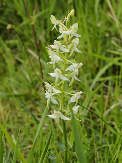
Daneway Banks is a 17-hectare (42-acre) biological Site of Special Scientific Interest in Gloucestershire, notified in 1954 and renotified in 1983. It lies half a mile west of Sapperton and is part of a group of wildlife sites in the Frome Valley that includes Siccaridge Wood and Sapperton Canal reserves. The site is in the Cotswold Area of Outstanding Natural Beauty.

Wotton Hill is a hill on the edge of the Cotswold Hills in Gloucestershire, England, 0.5 miles (0.80 km) north of Wotton-under-Edge. The Cotswold Way passes over the hill.

Salmonsbury Meadows is an 18-hectare (44-acre) biological and geological Site of Special Scientific Interest in Gloucestershire, notified in 1985. The site is listed in the 'Cotswold District' Local Plan 2001-2011 as a Key Wildlife Site (KWS).

Bull Cross, The Frith and Juniper Hill is a 42.33-hectare (104.6-acre) biological and geological Site of Special Scientific Interest in Gloucestershire, notified in 1954. The site is listed in the ‘Stroud District’ Local Plan, adopted November 2005, Appendix 6 as an SSSI and Regionally Important Geological Site (RIGS).

Lineover Wood is a 20.3-hectare (50-acre) biological Site of Special Scientific Interest in Gloucestershire, notified in 1986.
Shorn Cliff And Caswell Woods is a 69.2-hectare (171-acre) biological Site of Special Scientific Interest in Gloucestershire, notified in 1986. The site is listed in the 'Forest of Dean Local Plan Review' as a Key Wildlife Site (KWS).

Lippets Grove is a 5-hectare (12-acre) nature reserve in Gloucestershire. The site was leased from the Forestry Commission in 1987 and is managed by the Gloucestershire Wildlife Trust. The site is listed in the 'Forest of Dean Local Plan Review' as a Key Wildlife Site (KWS).
East Wood and is a 0.82-hectare (2.0-acre) nature reserve in Gloucestershire, England. The west site is 0.45-hectare (1.1-acre). The east site is 0.37-hectare (0.91-acre). It is part of a larger area of woodland called East Wood, which is adjacent to Oakhill Wood and Woolaston Wood (east). The site was leased from the Forestry Commission in 1986 and is managed by the Gloucestershire Wildlife Trust. The site is listed in the 'Forest of Dean Local Plan Review' as a Key Wildlife Site (KWS).

Chedworth Nature Reserve is a 6-hectare (15-acre) nature reserve in Gloucestershire. The site is listed in the 'Cotswold District' Local Plan 2001-2011 as a Key Wildlife Site (KWS).
Cutsdean Quarry is a 0.83-hectare (2.1-acre) nature reserve in Gloucestershire. The site is listed in the 'Cotswold District' Local Plan 2001-2011 as a Key Wildlife Site (KWS).
Five Acre Grove is a 5-hectare (12-acre) nature reserve in Gloucestershire. The site is listed in the 'Cotswold District' Local Plan 2001-2011 as a Key Wildlife Site (KWS).

Sapperton Valley is a 3.7-hectare (9.1-acre) nature reserve near Chalford in the Stroud district of Gloucestershire, England. The site is managed by the Gloucestershire Wildlife Trust under leasing arrangements with the Bathurst Estate, in place since 1964.