
Mińsk Mazowiecki(listen) "Masovian Minsk" is a town in central Poland with 40,211 inhabitants (2015). It is situated in the Masovian Voivodeship, previously in Siedlce Voivodeship (1975–1998). It is the capital of Mińsk County.

Wołomin(listen) is the main town of Wołomin County situated in the Masovian Voivodship. Wołomin is situated approximately 20 km (12 mi) east of Warsaw, the capital of Poland, near the railway to Białystok. It has approximately 36,000 inhabitants and covers an area of 14 km2 (5 sq mi).

Pułtusk is a town in Poland by the river Narew, 70 kilometres north of Warsaw. It is located in the Masovian Voivodship and has a population of about 19,000.

Ulica Nowy Świat is one of the main historic thoroughfares of Warsaw.
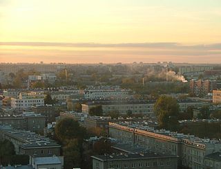
Grochów is a district of Warsaw, officially part of the borough of Praga-Południe although not connected at all to historical "Praga" district. It is one of the most notable residential areas of right-bank Warsaw. There are a large number of blocks of flats, as well as many pre-WWI houses. Grochów is nicknamed "the lungs of Warsaw", owing to its many green spaces. Despite plans made by the former Communist authorities, Grochów had not transformed into strictly industrial district, even though it had been such in the 19th century.

Jerusalem Avenue is one of the principal streets of the city of Warsaw in Poland. It runs through the City Centre along the East-West axis, linking the western borough of Wola with the bridge on the Vistula River and the borough of Praga on the other side of the river.
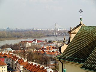
Powiśle is a neighbourhood in Warsaw's borough of Śródmieście. It is located between the Vistula river and its escarpment. Historically it is composed of three neighbourhoods: the Powiśle proper, Mariensztat to the north and Solec to the south.

Marszałkowska is one of the main thoroughfares of Warsaw's city center. It links Bank Square in its north sector with Plac Unii Lubelskiej in the south.

Wesoła is one of the districts of Warsaw, and has been since October 27, 2002. Wesoła is located in the south-eastern part of city.

Stara Prochownia also known as the Bridge Gate is a historic building in Warsaw New Town. It is located on ulica Boleść, just below the New Town and the Barbican, on the Vistula River escarpment.

Krakowskie Przedmieście is one of the best known and most prestigious streets of Poland's capital Warsaw, surrounded by historic palaces, churches and manor-houses. Krakowskie Przedmieście Royal Avenue constitutes the northernmost part of Warsaw's Royal Route, and links the Old Town and Royal Castle with some of the most notable institutions in Warsaw, including – proceeding southward – the Presidential Palace, Warsaw University, and the Polish Academy of Sciences headquartered in the Staszic Palace. The immediate southward extension of Krakowskie Przedmieście along the Royal Route is ulica Nowy Świat.

Konstancin-Jeziorna is a town in Piaseczno County, Masovian Voivodeship, Poland, with 17,566 inhabitants. It is located about 20 km (12 mi) south of downtown Warsaw and is a part of the metropolitan area of that city.

The Church of the Holy Cross is a Roman Catholic house of worship in Warsaw, Poland. Located on Krakowskie Przedmieście opposite the main Warsaw University campus, it is one of the most notable Baroque churches in Poland's capital.

Jeruzal is a village in the administrative district of Gmina Mrozy, within Mińsk County, Masovian Voivodeship, in east-central Poland. It lies approximately 12 kilometres (7 mi) south of Mrozy, 24 km (15 mi) south-east of Mińsk Mazowiecki, and 61 km (38 mi) east of Warsaw.
The Warsaw New Town is a neighbourhood dating from the 15th century in Warsaw, Poland. It lies just north of the Old Town and is connected to it by ulica Freta, which begins at the Warsaw Barbican. Like the Old Town, the New Town was almost completely destroyed by the Germans during World War II and rebuilt after the war.

Wolska is the main artery of Warsaw's borough of Wola. Initially Wola district was but a western suburb of Warsaw and a road leading to it was dubbed "droga wolska" - Wola road. In 1725 parts of that road closest to the Warsaw Old Town, located along the Saxon Axis, were officially renamed to "Aleja Wolska" - Wola Avenue. In modern times it starts at a crossing of Chłodna and Towarowa Streets, and runs as a continuation of Solidarity Avenue through the neighbourhoods of Młynów, Czyste and Ulrychów, all the way to Połczyńska Street.

Artur Zawisza Square is a public square in Warsaw's borough of Ochota. It is named after Artur Zawisza, a 19th-century Polish revolutionary who was executed on the spot by Russians in 1833.

Jana Rosoła street is one of the three main thoroughfares of Warsaw's borough of Ursynów. Named after Jan Rosół, participant of the January Uprising, it links Wąwozowa Street in the southernmost neighbourhood of Kabaty with the Dolina Służewiecka, that is Warsaw's section of National road 2, itself part of European route E30. The street was planned in the 1970s as one of principal arteries of the planned residential area of Ursynów, where most of road traffic would be channelled. Most other streets in the borough serve for local traffic only, or connect the three principal arteries. The street itself started to be built in 1975, two years later the first plattenbau blocks of flats were completed in Ursynów.


