Related Research Articles

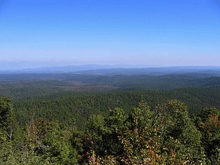
The Ouachita National Forest is a National Forest that lies in the western portion of Arkansas and portions of eastern Oklahoma.

The Great Allegheny Passage (GAP) is a rail trail system in Maryland and Pennsylvania—the central trail of a network of long-distance hiker-biker trails throughout the Allegheny region of the Appalachian Mountains, connecting Washington, D.C. to Pittsburgh, Pennsylvania. It consists of several smaller trails including the Allegheny Highlands Trail of Maryland, the Allegheny Highlands Trail of Pennsylvania and the Youghiogheny River Trail.

Kisatchie National Forest, the only National forest in Louisiana, United States, is located in the forested piney hills and hardwood bottoms of seven central and northern parishes. It is part of the Cenozoic uplands and has large areas of longleaf pine forests. It is one of the largest pieces of natural landscape in Louisiana, with some 604,000 acres (2,440 km2) of public land, more than half of which is vital longleaf pine and flatwoods vegetation. These support many rare plant and animal species. There are also rare habitats, such as hillside seepage bogs and calcareous prairies. The forest also contains and provides a buffer for the Kisatchie Hills Wilderness, a nationally designated wilderness area that contributes to protecting biodiversity of the coastal plain region of the United States.

The George Washington and Jefferson National Forests are U.S. National Forests that combine to form one of the largest areas of public land in the Eastern United States. They cover 1.8 million acres (7,300 km2) of land in the Appalachian Mountains of Virginia, West Virginia, and Kentucky. Approximately 1 million acres (4,000 km2) of the forest are remote and undeveloped and 139,461 acres (564 km2) have been designated as wilderness areas, which eliminates future development.

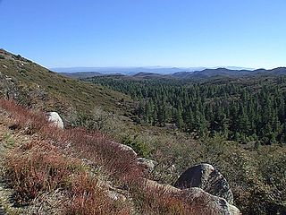
Cleveland National Forest encompasses 460,000 acres, mostly of chaparral, with a few riparian areas. A warm dry mediterranean climate prevails over the Forest. It is the southernmost National forest of California. It is administered by the United States Forest Service, a government agency within the United States Department of Agriculture. It is divided into the Descanso, Palomar and Trabuco Ranger Districts and is located in the counties of San Diego, Riverside, and Orange.

Sproul State Forest is a Pennsylvania state forest in Pennsylvania Bureau of Forestry District #10. The main offices are located in Renovo, Pennsylvania in Clinton County in the United States.

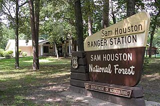
The Sam Houston National Forest, one of four National Forests in Texas, is located 50 miles north of Houston. The forest is administered together with the other three United States National Forests and two National Grasslands located entirely in Texas, from common offices in Lufkin, Texas. The units include Angelina, Davy Crockett, Sabine, and Sam Houston National Forests, plus Caddo National Grassland and Lyndon B. Johnson National Grassland. There are local ranger district offices located in New Waverly.

Kittatinny Valley State Park is located near Andover, New Jersey. Features include Glacial lakes, limestone outcroppings, former railroads, and a small airport. Lake Aeroflex and Gardner's Pond form part of the headwaters of the Pequest River and are excellent for fishing and boating. The park is home to a variety of wildlife such as whitetail deer, wild turkeys, a variety of songbirds, beavers, muskrats, and squirrels. The park is operated and maintained by the New Jersey Division of Parks and Forestry.

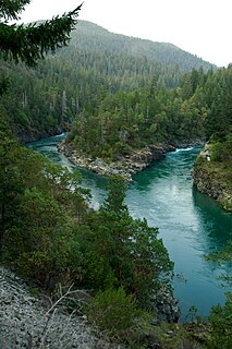
Smith River National Recreation Area is located northwestern California, United States. The Smith River National Recreation Area is in Six Rivers National Forest and is managed by the U.S. Forest Service, an agency of the U.S. Department of Agriculture. Created by Congress in 1990, Smith River National Recreation Area forms a northern border to Redwood National and State Parks.

Mount Rogers National Recreation Area is a United States National Recreation Area (NRA) located in southwestern Virginia near the border with Tennessee and North Carolina. The centerpiece of the recreation area is the Lewis Fork Wilderness containing Mount Rogers, the highest point in the state of Virginia with a summit elevation of 5,729 feet. The recreation area is under the jurisdiction of the George Washington and Jefferson National Forests. The recreation area was established by an act of the United States Congress on May 31, 1966.

Caroline Coroneos Dormon, also known as Carrie Dormon, was an American botanist, horticulturist, ornithologist, historian, archeologist, preservationist, naturalist, conservationist, and author from Louisiana.

The San Gabriel Wilderness is a wilderness area created in 1968 of more than 36,118 acres (150 km2) within the Angeles National Forest and San Gabriel Mountains National Monument.

The Wild Oak Trail is a 27.0-mile (43.5 km) National Recreation Trail located in the Ridge-and-Valley Appalachians in Central Virginia, United States. It is part of George Washington National Forest. The trail is a loop, and begins at the headwaters of the North River, and traverses up to several ridge tops. Due to the trail's difficulty and length, it sees little traffic.

Waterloo State Recreation Area is the third-largest park in Michigan, encompassing over 21,000 acres (85 km2) of forest, lakes and wetlands. Located in northeast Jackson County and parts of Washtenaw County, the park is the largest in the Lower Peninsula of Michigan and features 4 campgrounds, 11 lakes, a nature center, and over 50 miles (80 km) of trails - some for horses, bicycles, hiking and cross-country skiing. Waterloo SRA includes the Black Spruce Bog Natural Area, a National Natural Landmark and borders the 11,000-acre (45 km2) Pinckney Recreation Area on the east and the 950-acre (3.8 km2) Phyllis Haehnle Memorial Audubon Sanctuary to the west. The land preserved by the park is not all contiguous and numerous private landholdings and roads run through the park area. The area is characterized by moraines, kettle lakes, swamps and bogs left by retreating glaciers after the last ice age. The park was created by the federal government during the Great Depression and is long-term leased to the state.

The Mokelumne Wilderness is a 105,165-acre federally designated wilderness area located 70 miles (110 km) east of Sacramento, California. It is within the boundaries of three national forests: Stanislaus, Eldorado and Toiyabe. First protected under the Wilderness Act of 1964, the Mokelumne’s borders were expanded under the California Wilderness Act of 1984 with the addition of 55,000 acres. The wilderness takes its name from the Mokelumne River, which was named after a Mi-wok Indian village located on the riverbank in California's Central Valley.

Wild Rivers Recreation Area is located in north central New Mexico within the Rio Grande del Norte National Monument. Two rivers that run through the park, the Rio Grande and Red River are National Wild and Scenic Rivers. NM 378 that traverses the recreation area is designated a New Mexico Scenic Byway. Recreational opportunities include whitewater rafting, hiking, biking, fishing and camping.

Mill Creek, a wildland in the George Washington and Jefferson National Forests of western Virginia, has been recognized by the Wilderness Society as a special place worthy of protection from logging and road construction. The Wilderness Society has designated the area as a “Mountain Treasure”.

Kisatchie Hills Wilderness is a 8,701-acre (3,521 ha) designated wilderness area in the U.S. state of Louisiana. Contained within Kisatchie National Forest, the wilderness is managed by the U.S. Forest Service. In addition to a variety of wildlife, the area features terrain that is unusually rugged for Louisiana. Undeveloped except for its trail system, the area may be accessed only by foot or on horseback.
References
- ↑ "Wild Azalea Trail". AllTrails.com. Retrieved 2020-05-29.
- ↑ "Wild Azalea Trail|Kisatchie National Forest". fs.usda.gov. Retrieved 2020-05-29.
- ↑ "Wild Azalea Trail". Louisiana Travel. 2014-07-15. Retrieved 2020-05-29.
- ↑ "Wild Azalea Trail - Kisatchie National Forest". Pack and Paddle. Retrieved 2020-05-29.
- ↑ "Wild Azalea Trail - Where the Wild Things Roam". wildazaleatrail. Retrieved 2020-05-29.