National Wildlife RefugeSystem (NWRS) is a system of protected areas of the United States managed by the United States Fish and Wildlife Service (FWS), an agency within the Department of the Interior. The National Wildlife Refuge System is the system of public lands and waters set aside to conserve America's fish, wildlife, and plants. Since President Theodore Roosevelt designated Florida's Pelican Island National Wildlife Refuge as the first wildlife refuge in 1903, the system has grown to over 568 national wildlife refuges and 38 wetland management districts encompassing about 856,000,000 acres (3,464,109 km2).
In all modern states, a portion of land is held by central or local governments. This is called public land, state land, or Crown land. The system of tenure of public land, and the terminology used, varies between countries. The following examples illustrate some of the range.
Land trusts are nonprofit organizations which own and manage land, and sometimes waters. There are three common types of land trust, distinguished from one another by the ways in which they are legally structured and by the purposes for which they are organized and operated:

The Adirondack Park is a part of New York's Forest Preserve in northeastern New York, United States. The park was established in 1892 for “the free use of all the people for their health and pleasure”, and for watershed protection. The park's boundary roughly corresponds with the Adirondack Mountains. Unlike most state parks, about 52 percent of the land is privately owned inholdings. State lands within the park are known as Forest Preserve. Land use on public and private lands in the park is regulated by the Adirondack Park Agency. This area contains 102 towns and villages, as well as numerous farms, businesses and an active timber-harvesting industry. The year-round population is 132,000, with 200,000 seasonal residents. The inclusion of human communities makes the park one of the great experiments in conservation in the industrialized world. The Forest Preserve was designated a National Historic Landmark in 1963.
The protected areas of Michigan come in an array of different types and levels of protection. Michigan has five units of the National Park Service system. There are 14 federal wilderness areas; the majority of these are also tribal-designated wildernesses. It has one of the largest state forest systems as well having four national forests. The state maintains a large state park system and there are also regional parks, and county, township and city parks. Still other parks on land and in the Great Lakes are maintained by other governmental bodies. Private protected areas also exist in the state, mainly lands owned by land conservancies.

The Upper Missouri River Breaks National Monument is a national monument in the western United States, protecting the Missouri Breaks of north central Montana. Managed by the Bureau of Land Management (BLM), it is a series of badland areas characterized by rock outcroppings, steep bluffs, and grassy plains; a topography referred to as "The Breaks" by locals.
The American Battlefield Trust is a charitable organization whose primary focus is in the preservation of battlefields of the Revolutionary War, the American Civil War, and the War of 1812 through acquisition of battlefield land. The American Battlefield Trust was formerly known as the Civil War Trust. On May 8, 2018, the organization announced the creation of the American Battlefield Trust as the umbrella organization for two divisions, the Civil War Trust and the Revolutionary War Trust, which was formerly known as "Campaign 1776."

The Long Island Central Pine Barrens is a large area of publicly protected pine barrens in Suffolk County, New York, on Long Island, covering more than 100,000 acres (405 km2).

The National Wilderness Preservation System (NWPS) of the United States protects federally managed wilderness areas designated for preservation in their natural condition. Activity on formally designated wilderness areas is coordinated by the National Wilderness Preservation System. Wilderness areas are managed by four federal land management agencies: the National Park Service, the U.S. Forest Service, the U.S. Fish and Wildlife Service, and the Bureau of Land Management.

The Ashdown Gorge Wilderness is located in eastern Iron County, Utah, United States, within the arid Colorado Plateau region.

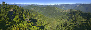
The Trinity Alps Wilderness is a 525,627-acre (212,714 ha) designated wilderness located in northern California, roughly between Eureka and Redding. It is jointly administered by Shasta-Trinity, Klamath, and Six Rivers National Forests. About 4,623 acres (1,871 ha) are administered by the Bureau of Land Management. The wilderness is located in the Salmon and Scott Mountains, subranges of the Klamath Mountains region. The high, granitic and ultramafic peaks of the eastern half of the wilderness area are known as the Trinity Alps. Granite peaks at the core of the area are known as the White Trinities, reddish ultramafic peaks in the southeast are known as the Red Trinities, and the forested mountains in the western half of the wilderness are known as the Green Trinities.

The Wild Sky Wilderness is a 106,577-acre (431 km2) wilderness area in the western Cascade Range of Washington state. The wilderness is within the Mount Baker-Snoqualmie National Forest north of the U.S. Highway 2 towns of Index and Skykomish. The wilderness flanks, but does not include, the North Fork Skykomish River and the Beckler River. The Henry M. Jackson Wilderness is adjacent to the east and northeast. The highest point in Wild Sky Wilderness is 6,244 foot Gunn Peak.
An inholding is privately owned land inside the boundary of a national park, national forest, state park, or similar publicly owned, protected area. In-holdings result from private ownership of lands predating the designation of the park or forest area, or the expansion of the park area to encompass the privately owned property. In the United States, the main causes of inholdings is that all of the Federal land-management agencies were formed over a century after the government sold and issued land grants to private citizens to fund the administration of the United States. When the park system was formed, many of these now-called "inholdings" had been in private ownership for generations and not available for sale when the park was formed. Over the last several decades, conservation groups have lobbied the United States Congress to acquire private residences especially within designated wilderness areas, either by direct purchase or via land exchange which trades the inholding for other federal lands located outside of national parks or wilderness areas.

According to the California Protected Areas Database (CPAD), in the state of California, United States, there are over 14,000 inventoried protected areas administered by public agencies and non-profits. In addition, there are private conservation areas and other easements. They include almost one-third of California's scenic coastline, including coastal wetlands, estuaries, beaches, and dune systems. The California State Parks system alone has 270 units and covers 1.3 million acres (5,300 km2), with over 280 miles (450 km) of coastline, 625 miles (1,006 km) of lake and river frontage, nearly 18,000 campsites, and 3,000 miles (5,000 km) of hiking, biking, and equestrian trails.
Hells Canyon Wilderness is a 9,951 acre wilderness area in the U.S. state of Arizona. It is located approximately 25 miles (40 km) northwest of Phoenix in Maricopa and southeast Yavapai counties.
The California Desert Protection Act of 2010 was legislation proposed by U.S. Senator Dianne Feinstein. The stated aim of the legislation was "to provide for conservation, enhanced recreation opportunities, and development of renewable energy in the California Desert Conservation Area."
The Wildlands Conservancy (TWC) is a nonprofit organization whose mission is to preserve land for public recreation. It operates 23 preserves in California and Oregon. The preserve system comprises 210,686 acres including mountains, valleys, deserts, rivers and oceanfront lands. TWC buys land, restores land, builds public visitor facilities and provides outdoor education programs for children. All usage is free of charge. There are over 1 million visitors annually.

The Big Sur Land Trust is a private 501(c)(3) non-profit located in Monterey, California, that has played an instrumental role in preserving land in California's Big Sur and Central Coast regions. The trust was the first to conceive of and use the "conservation buyer" method in 1989 by partnering with government and developers to offer tax benefits as an inducement to sell land at below-market rates. Since 1978, with the support of donors, funders and partners, it has conserved over 40,000 acres through conservation easements, acquisition and transfer of land to state, county and city agencies. It has placed conservation easements on 7,000 acres and has retained ownership of over 4,000 acres.

The policies protecting land used in Big Sur are some of the most restrictive local-use standards in California, and are widely regarded as one of the most restrictive development protections anywhere. The program protects viewsheds from the highway and many vantage points, and severely restricts the density of development. About 60% of the coastal region is owned by governmental or private agencies which do not allow any development. The majority of the interior region is part of the Los Padres National Forest, Ventana Wilderness, Silver Peak Wilderness or Fort Hunter Liggett. The area is protected by the Big Sur Local Coastal Plan, which preserves it as "open space, a small residential community, and agricultural ranching." Its intention is "preserving the environment and visual access to it, the policies of the local coastal plan are to minimize, or limit, all destination activities."

The Sabinoso Wilderness is a 29,855 acres (120.82 km2) area in San Miguel County, New Mexico. The US Bureau of Land Management owns and administers the wilderness area. The semi-arid wilderness includes few natural resources but has a diverse geology, as well as a range of plant and animal species.


