Chatsworth is a township municipality in Grey County, in southwestern Ontario, Canada. The township is located at the headwaters of the Styx River, the Saugeen River, the Sauble River, the Bighead River, the Spey River, and the old Sydenham River.
West Grey is a municipality in the northern area of Southwestern Ontario, Canada, in Grey County spanning across the River Styx, the Rocky Saugeen River, the Beatty Saugeen River, and the South Saugeen River.

The Township of Woolwich is a rural township in Southwestern Ontario. The municipality is located in the northeastern part of Waterloo Region and is made up of 10 small communities, with Elmira, Ontario the largest and St. Jacobs, Ontario the second largest. The population at the time of the 2021 Census was 26,999, up from the 2016 population of 25,006. Waterloo Region is still home to the largest population of Old Order Mennonites in Canada, particularly in the areas around St Jacobs and Elmira. They are often seen on the local roads using their traditional horse and buggy transportation; many also use horses to pull the implements in their farm fields.
South Bruce Peninsula is a town at the base of the Bruce Peninsula of Ontario, Canada, in Bruce County between Lake Huron and Georgian Bay. It was formed on January 1, 1999, when the town of Wiarton, the village of Hepworth, and the townships of Albemarle and Amabel were amalgamated. The new municipality was created to provide necessary political representation, administrative support, and necessary municipal services on behalf of the residents.

The Saugeen River is located in southern Ontario, Canada. The river begins in the Osprey Wetland Conservation Lands and flows generally north-west about 160 kilometres (99 mi) before exiting into Lake Huron. The river is navigable for some distance, and was once an important barge route. Today the river is best known for its fishing and as a canoe route.

Bruce County is a county in Southwestern Ontario, Canada. It has eight lower-tier municipalities with a total 2016 population of 66,491. It is named for James Bruce, 8th Earl of Elgin and 12th Earl of Kincardine, the sixth Governor General of the Province of Canada. The Bruce name is also linked to the Bruce Trail and the Bruce Peninsula.

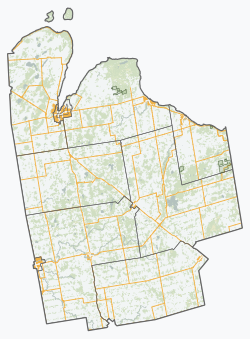
Grey County is a county in the province of Ontario. The county is located in the Southwestern Ontario region, and is a part of the Georgian Triangle. At the time of the 2021 Canadian census the population of the county was 100,905. Owen Sound is the county seat and the largest city in Grey County.
Middlesex Centre is a township in Middlesex County, in southwestern Ontario, Canada, north and west of London. The Corporation of the Township of Middlesex Centre formed on January 1, 1998, with the amalgamation of the former Townships of Delaware, Lobo, and London. It is part of the London census metropolitan area.
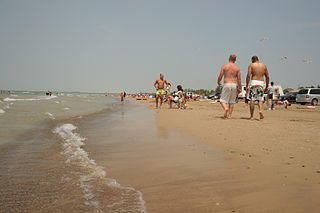
Sauble Beach is a beach community and unincorporated area in the town of South Bruce Peninsula, Bruce County, in the northern area of southwestern Ontario, Canada. It is on the Bruce Peninsula, along the eastern shore of Lake Huron, on the north edge of the Saugeen First Nation. The beach takes its name from that given by early French explorers to the sandy Sauble River, originally "La Rivière Au Sable" also indicating that the river emptied into Lake Huron at a sandy beach. The river was labelled with the French name on maps until 1881, when it became the Sauble River; in early years, a sawmill was built on the river, and later, a hydro electric plant.

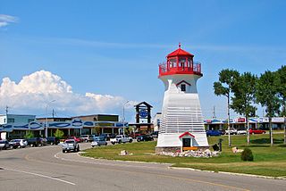
Southampton is a community on the shores of Lake Huron in Bruce County, Ontario, Canada. It is close to Port Elgin and is located at the mouth of the Saugeen River in the Saugeen Ojibway Nation Territory. The size of the town is 6.44 square kilometres. The permanent population in 2016 was 3,678, but the summer population is higher since cottagers and campers spend vacation time in the area.
Terrace Bay is a township in Thunder Bay District in northern Ontario, Canada, located on the north shore of Lake Superior east of Thunder Bay along Highway 17. The name originates from a series of lake terraces formed as the water level in Lake Superior lowered following the latest ice age.
Saugeen First Nation is an Ojibway First Nation band located along the Saugeen River and Bruce Peninsula in Ontario, Canada. The band states that their legal name is the "Chippewas of Saugeen". Organized in the mid-1970s, Saugeen First Nation is the primary "political successor apparent" to the Chippewas of Saugeen Ojibway Territory; the other First Nation that is a part of Chippewas of Saugeen Ojibway Territory is Cape Croker. The Ojibway are of the Algonquian languages family. The First Nation consist of four reserves: Chief's Point 28, Saugeen 29, Saugeen Hunting Grounds 60A, and Saugeen and Cape Croker Fishing Islands 1.
Saugeen Shores is a town in Bruce County, Ontario, Canada, formed in 1998. In addition to the two main population centres of Southampton and Port Elgin, the town includes a portion of the village of Burgoyne and the North Bruce area, straddling the municipal eastern and southern boundary respectively. In 2016, the permanent population of Saugeen Shores was 13,715, in a land area of 171.05 square kilometres (66.04 sq mi).

Port Elgin is a community in the town of Saugeen Shores, Ontario, Canada. Its location is in the traditional territory of the Saugeen Ojibway Nation. Originally named Normanton the town was renamed Port Elgin when it was incorporated in 1874, after James Bruce, 8th Earl of Elgin, a former Governor General of the Province of Canada.
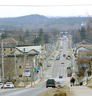
Durham is a community in the municipality of West Grey, Grey County, Ontario, Canada. Durham is located near the base of the Bruce Peninsula.

Priceville is a village in the southwest corner of the Municipality of Grey Highlands, Grey County, Ontario, Canada. It is on the Saugeen River on Grey Road 4, east of Durham and southwest of Flesherton.

Ayton is a community in the municipality of West Grey, Grey County, Ontario, Canada.
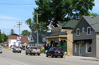
The village of Dornoch is located less than 11 kilometers north of the town of Durham on Highway 6 in Grey County, Ontario, Canada. It is part of the municipality of West Grey.
Chatsworth is a community in Grey County, Ontario, Canada, part of the Township of Chatsworth. It is located south of Owen Sound and north of Durham where Highways 6 and 10 merge. The village neighbours Williamsford, Dornoch, and Desboro.
Negro Creek is the name of a road, a river, and the historic site of an early Black settlement. It is situated along Highway 6 south of Williamsford, in Grey County, Ontario.