Related Research Articles

Westchester County is a county located in the southeastern portion of the U.S. state of New York, bordering the Long Island Sound to its east and the Hudson River on its west. The county is the seventh most populous county in the State of New York and the most populous north of New York City. According to the 2020 United States Census, the county had a population of 1,004,456, its highest decennial count ever and an increase of 55,344 (5.8%) from the 949,113 counted in 2010. Westchester covers an area of 450 square miles (1,200 km2), consisting of six cities, 19 towns, and 23 villages. Established in 1683, Westchester was named after the city of Chester, England. The county seat is the city of White Plains, while the most populous municipality in the county is the city of Yonkers, with 211,569 residents per the 2020 census. The county is part of the Hudson Valley region of the state.

Elmsford is a village in Westchester County, New York, United States. It is part of the New York metropolitan area. Roughly one square mile, the village is fully contained within the borders of the town of Greenburgh. As of the 2010 census, the population of Elmsford was 4,664.

Greenburgh is a town in western Westchester County, New York. The population was 95,397 at the time of the 2020 census. The town consists of 6 villages and an unincorporated area.

Greenville, commonly known as Edgemont, is a census-designated place (CDP) in the town of Greenburgh in Westchester County, New York, United States. The population was 9,394 at the 2020 census. Most of its residents refer to the area as Edgemont, which is also the name of its school district.

Rye Brook is a village in Westchester County, New York, United States, within the town of Rye. The population was 9,347 at the 2010 census.

Thornwood is a hamlet, census-designated place (CDP), and postal designation in the town of Mount Pleasant in Westchester County, New York. The population was 3,759 at the 2010 census.

Tuckahoe is a village in Westchester County, New York, United States. One-and-a-half miles long and three-quarters of a mile wide, with the Bronx River serving as its western boundary, the Village of Tuckahoe is approximately sixteen miles north of midtown Manhattan in Southern Westchester County. As of the 2010 census, the village's population was 6,486.

Pelham is a suburban town in Westchester County, approximately 10 miles northeast of Midtown Manhattan. As of the 2020 census, it had a population of 13,078, an increase from the 2010 census. Historically, Pelham was composed of five villages and became known as "the Pelhams". Pelham currently contains two independently incorporated villages: the Villages of Pelham and Pelham Manor.
The North Bronx is the northern section of the Bronx, one of the five boroughs of New York City. It is bordered by Westchester County to the north, the South Bronx to the south, the Hudson River to the west and the Long Island Sound to the east. The western part is more urbanized and hilly than its eastern counterpart, just like the rest of the borough. Despite being recognized as different from the South Bronx, the actual borders of the North Bronx is undefined. One commonly set border is Fordham Road/Pelham Parkway, the upper limit for widespread poverty and arson during the 1970s and 1980s.

The Sprain Brook Parkway is a 12.65-mile (20.36 km) controlled-access parkway in Westchester County, New York, United States. It begins at the Bronx River Parkway in the city of Yonkers, and ends at the former site of the Hawthorne Circle, where it merges into the Taconic State Parkway. The parkway serves an alternate to the Bronx River Parkway, boasting an interchange connection through western Westchester with Interstate 287. New York's Department of Transportation (NYSDOT) refers to it internally as New York State Route 987F (NY 987F), an unsigned reference route.
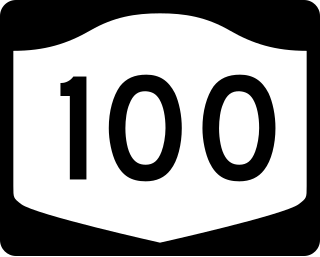
New York State Route 100 (NY 100) is a major north–south state highway in Westchester County, New York, in the United States. It begins parallel to Interstate 87 (I-87) at a junction with the Cross County Parkway in the city of Yonkers and runs through most of the length of the county up to U.S. Route 202 (US 202) in the town of Somers. NY 100 was designated as part of the 1930 renumbering of state highways in New York. Prior to becoming a state road, various sections of NY 100 were part of several important early roads in the county.
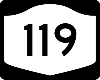
New York State Route 119 (NY 119) is an east–west state highway in Westchester County, New York, in the United States. The road starts in Tarrytown at an intersection with U.S. Route 9 (US 9) and comes to an end at a junction with NY 22 in White Plains. The road is a major thoroughfare in the county and provides access to the New York State Thruway, Saw Mill River Parkway, Sprain Brook Parkway and Bronx River Parkway, four of the major roads in the county. NY 119 closely parallels Interstate 287 (I-287) and connects to the highway multiple times. The route was assigned in the 1930 renumbering of state highways in New York and once had a spur route, NY 119A. That highway is now part of NY 120.

The East Bronx is the part of the New York City borough of the Bronx which lies east of the Bronx River; this roughly corresponds to the eastern half of the borough. Neighborhoods include: Baychester, Castle Hill, City Island, Co-op City, Country Club, Eastchester, Edenwald, Edgewater Park, Harding Park, Morris Park, Parkchester, Pelham Bay, Pelham Parkway, Soundview, Throggs Neck, Van Nest, Wakefield, Westchester Square, and Williamsbridge.

The New York, Westchester and Boston Railway Company, was an electric commuter railroad in the Bronx and Westchester County, New York from 1912 to 1937. It ran from the southernmost part of the South Bronx, near the Harlem River, to Mount Vernon with branches north to White Plains and east to Port Chester. From 1906, construction and operation was under the control of the New York, New Haven & Hartford Railroad (NH) until its bankruptcy in 1935.
Wykagyl is a suburban community in New Rochelle, Westchester County, New York, United States. It is conterminous with ZIP code 10804, encompassing much of the city's 'North End'. According to Forbes, in 2010 Wykagyl's 10804 ZIP code, with a median home price of $806,264, ranked 333rd on its list of the 500 most expensive ZIP codes in the U.S. The Washington Post ranks Wykagyl among the nation's 650 Super Zips, or those with the highest percentile rankings for median household income and the share of adults with college degrees or higher.

The 2006 Westchester County tornado was the strongest and largest tornado in Westchester County, New York since the 1904 Chappaqua tornado. It touched down there on Wednesday, July 12, 2006, and traveled 13 miles (21 km) into southwestern Connecticut during a 33-minute span through two states. The tornado touched down at 3:30 p.m. EDT (19:30 UTC) on the shore of the Hudson River before becoming a waterspout and traveling 3 mi (5 km) across the river. Coming ashore, the tornado entered Westchester County and struck the town of Sleepy Hollow at F1 intensity. After passing through the town, it intensified into an F2 tornado and grew to almost a one-quarter mile (400 m) in diameter. The tornado continued through the county, damaging numerous structures, until it crossed into Connecticut at 4:01 p.m. EDT (20:01 UTC). Not long after entering the state, it dissipated in the town of Greenwich at 4:03 p.m. EDT (20:03 UTC). When the tornado entered Westchester County, it was the eighth known tornado to either touch down or enter the county since 1950.
Westchester Square is a residential neighborhood geographically located in the eastern section of the New York City borough of the Bronx. Its boundaries, starting from the north and moving clockwise are: East Tremont Avenue and Silver Street, Blondell Avenue and Westchester Creek to the east, Waterbury Avenue to the south and Castle Hill Avenue to the west. The main roadways through Westchester Square are East Tremont Avenue, Westchester Avenue and Williamsbridge Road.
Sutton Manor is a distinctive early 20th century suburban residential district in the city of New Rochelle in Westchester County, New York. The neighborhood is located off the northern shore of Long Island Sound on Echo Bay. It was developed as an upper middle class enclave for families with heads of households employed in New York City and served as a model for the ideal suburban setting; harmonious architecture and exclusive amenities. The development appears to have been modeled on neighboring Larchmont Manor in the Town of Mamaroneck, yet on a smaller scale. That subdivision was conceived originally as an exclusive and convenient seasonal playground for New York’s wealthy upper classes, with its 6-acre waterfront park.

Albee Square is a public plaza in Downtown Brooklyn, New York City. The plaza is located at the intersection of Fulton Street, DeKalb Avenue, and Albee Square West. It is named after Edward Franklin Albee II who was the owner of several area theaters during the 1800s. Albee Square was a theater until 1977 when it was replaced by the Albee Square Mall, which was subsequently demolished for new development in 2004. The Dime Savings Bank Building, part of The Brooklyn Tower, is located on the northeast corner of Albee Square.
References
- ↑ "Winchester Villages". GDC Homes. Ginsburg Development Companies, LLC. Retrieved 2008-07-13.
- ↑ Singer, Penny (1996-09-15). "What 'Affordable' Can Mean in Westchester's Housing Market". New York Times. Retrieved 2008-07-13.
40°58′9.5″N73°50′56″W / 40.969306°N 73.84889°W
| | This article about a location in Westchester County, New York is a stub. You can help Wikipedia by expanding it. |