Davenport is a town in Delaware County, New York, United States. The population was 2,965 at the 2010 census. The town is in the northeast part of the county.

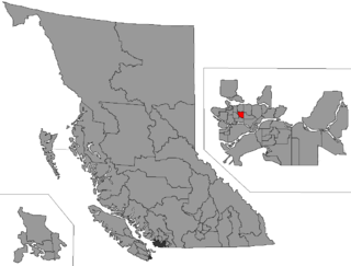
Vancouver-Kingsway is a provincial electoral district for the Legislative Assembly of British Columbia, Canada.

Kavanagh is a hamlet in Alberta, Canada within Leduc County. It is located on Highway 2A between Millet and Leduc, approximately 30 kilometres (19 mi) south of Edmonton.
Arborfield No. 456, Saskatchewan is a rural municipality in north eastern Saskatchewan. Arborfield No. 456 RM was formed December 13, 1909. To the east is now Hudson Bay No. 394, however previously it was Rural municipality No. 455. The Rural municipality provide essential services such as fire, police and health protection as well as road and school services to 1,416 km² or rural population not covered by urban civic governments.

The York Bluecoat School in York, England, was founded in 1705 as a charity school for forty poor boys.

Busby is a small hamlet in central Alberta, Canada within Westlock County. It is located on Highway 651, approximately 52 kilometres (32 mi) northwest of Edmonton and 16 kilometres (9.9 mi) west of Highway 2.

Iron Springs is a hamlet in southern Alberta, Canada within the Lethbridge County. It is located on Highway 25, approximately 28 kilometres (17 mi) northeast of Lethbridge. It was founded in 1925 when the railroad arrived. The community was named after a spring of the same name near the original town site.

Jean Cote, or Jean Côté, is a hamlet in northern Alberta, Canada within the Municipal District of Smoky River No. 130. It is located approximately 11 kilometres (6.8 mi) west of Highway 2 and 123 kilometres (76 mi) northeast of Grande Prairie.

Lodgepole is a hamlet in central Alberta, Canada within Brazeau County. It is located approximately 31 kilometres (19 mi) west of Highway 22 and 131 kilometres (81 mi) southwest of Edmonton.

Mearns is a hamlet in central Alberta, Canada within Sturgeon County. It is located approximately 11 kilometres (6.8 mi) west of Highway 2 and 31 kilometres (19 mi) northwest of Edmonton's city limits.

Parkland is a hamlet in southern Alberta, Canada within the Municipal District of Willow Creek No. 26. It is located on Highway 2, approximately 86 kilometres (53 mi) northwest of Lethbridge.

St. Edouard is a hamlet in northern Alberta, Canada within the County of St. Paul No. 19. It is located 2 kilometres (1.2 mi) south of Highway 28, approximately 82 kilometres (51 mi) southwest of Cold Lake.

Sunnybrook is a hamlet in central Alberta, Canada within Leduc County. It is located on Highway 39, approximately 43 kilometres (27 mi) west of Leduc.

Sunnynook is a hamlet in southern Alberta, Canada within Special Area No. 2. It is located approximately 10 kilometres (6.2 mi) east of Highway 36 and 86 kilometres (53 mi) northeast of Brooks. The hamlet formerly housed the Berry Creek Community School Division office and area post office until amalgamation of the school division into Prairie Land Regional Division.

Telfordville is a hamlet in central Alberta, Canada within Leduc County. It is located just off Highway 622, approximately 41 kilometres (25 mi) west of Leduc.

Vimy is a hamlet in Westlock County in Central Alberta, Canada. It is located 1.4 kilometres (0.87 mi) east of Highway 2, approximately 59 kilometres (37 mi) north of Edmonton.
Willow Creek No. 458 is a rural municipality in the Canadian province of Saskatchewan, located in the Census Division 14. The seat of the municipality is located in the Hamlet of Brooksby.
Hazel Dell No. 335 is a rural municipality in the Canadian province of Saskatchewan, located in the Census Division 9. The seat of the municipality is located in the Hamlet of Hazel Dell.

Newcombe No. 260 is a rural municipality in west-central Saskatchewan, Canada encompassing 1,075.60 square kilometers in area. The rural municipality is at the intersection of Highway 21 and Highway 44. The Lemsford Ferry is located within the rural municipality. The rural municipality maintains its office in Glidden, Saskatchewan. The rural municipality in conjunction with the provincial government is in charge of maintenance of highways in its area. The rural municipality was established in 1911 and is named after Allan Simpson Newcombe who played a leadership role in establishing the Boston Colony of immigrants from Massachusetts. Glidden is named after Charles Glidden who sold the town site to the Canadian Pacific Railway.
Pleasant Valley No. 288 is a rural municipality in the Canadian province of Saskatchewan. The municipality is located in the Census Division 12 which is a part of SARM Division 6. The seat of the municipality is located in the Town of Rosetown.


