Related Research Articles

Oxfordshire is a county in South East England. The ceremonial county borders Warwickshire to the north-west, Northamptonshire to the north-east, Buckinghamshire to the east, Berkshire to the south, Wiltshire to the south-west and Gloucestershire to the west.

Bucklebury is a village and civil parish in West Berkshire, England. The village is about 5 miles (8 km) north-east of Newbury and between 1 and 3 miles north of the A4 road. The parish has a population of 2,116, but the village is much smaller. Bucklebury Common, with an area of over 1 square kilometre (0.39 sq mi), is one of the largest commons in the ceremonial and historic county of Berkshire.
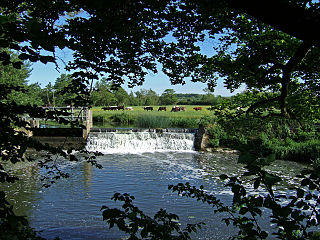
Yeovilton is a village and civil parish in Somerset, England, situated 1 mile (1.6 km) east of Ilchester, 5 miles (8.0 km) north of Yeovil, in the South Somerset district. The village has a population of 1,226.
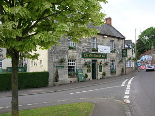
Aller is a village and parish in Somerset, England, situated 5 miles (8.0 km) west of Somerton on the A372 road towards Bridgwater in the South Somerset district. The village has a population of 410. The parish includes the hamlet of Beer and the deserted medieval village of Oath on the opposite bank of the River Parrett.

Stawley is a village and civil parish in Somerset, England, situated 10 miles (16.1 km) west of Taunton in the Somerset West and Taunton district. The parish has a population of 279 and includes the village of Kittisford and the hamlets of Appley, Greenham and Tracebridge.

Baunton is a village and civil parish in the Cotswold district of Gloucestershire, England, located about two miles north of Cirencester on the River Churn.

Heanton Punchardon is a village, civil parish and former manor, anciently part of Braunton Hundred. It is situated directly east-southeast of the village of Braunton, in North Devon. The parish lies on the north bank of the estuary of the River Taw and it is surrounded, clockwise from the north, by the parishes of Braunton, Marwood, Ashford and across the estuary, Fremington. The population was 418 in 1801 and 404 in 1901. Its largest localities are Wrafton and Chivenor. The surrounding area is also an electoral ward with a total population at the 2011 census of 2,673.

Seavington St Michael is a village and civil parish in Somerset, England. It is situated next to the village of Seavington St Mary, about 3 miles (4.8 km) east of Ilminster, within the South Somerset district. It lies in a hollow within a larger area of low-lying hills and valleys running broadly east-west. A part of the South Petherton Hundred, originally the area included seven settlements which have gradually merged or vanished, but were the origin of the Seavington—part of the village name.

Stoke St Michael is a village and civil parish on the Mendip Hills 4 miles (6.4 km) north east of Shepton Mallet, and 8 miles (12.9 km) west of Frome, in the Mendip district of Somerset, England.
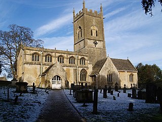
Withington is a Cotswold village and civil parish in Gloucestershire, England, about 6 1⁄2 miles (10 km) southeast of Cheltenham and 8 miles (13 km) north of Cirencester. The River Coln runs through the village. The parish includes the hamlets of Hilcot, Foxcote and Cassey Compton. The parish population taken at the 2011 census was 532.

Braishfield is a village and civil parish north of Romsey in Hampshire, England. The name is thought to be derived from the Old English bræsc + feld, meaning 'open land with small branches or brushwood'. The hamlet of Pucknall lies due east of the village.

Miserden is a village and civil parish in Stroud District, Gloucestershire, England, 4 miles north east of Stroud. The parish includes Whiteway Colony and the hamlets of Sudgrove and The Camp. In the 2001 census the parish had a population of 420, increasing to 449 at the 2011 census.

Ixworth is a village and civil parish in the West Suffolk district of the English county of Suffolk. It is 6 miles (9.7 km) north-east of Bury St Edmunds on the A143 road to Diss and 9 miles (14 km) south-east of Thetford. The parish has a population of 2,177, increasing to 2,365 at the 2011 Census. The south end of High Street and town may also be historically listed as Ixworth St Mary.

Great Wolford is a village and civil parish in the Stratford-on-Avon district of Warwickshire, England. With the neighbouring parish of Little Wolford it is part of 'The Wolfords'.
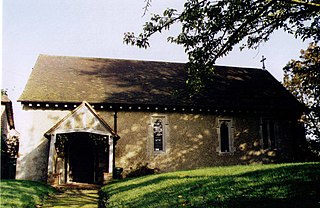
West Worldham is a small village in the East Hampshire district of Hampshire, England. It is 2.1 miles (3.4 km) southeast of Alton. Hartley Mauditt and East Worldham are nearby, which along with West Worldham form the Parish of Worldham. West Worldham contains some eighteen houses with a population of about 50; about half the population of 1851, when it was 98. Of note is the Manor Farm and cottage and the late 12th century St Nicholas Church, both Grade II listed buildings.
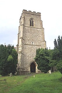
Clopton is a village and civil parish in Suffolk. It is located between Ipswich and Debenham two kilometres north of Grundisburgh on the River Lark. The village is no larger than a series of houses either side of the B1078, surrounded by farm land. The village itself has no clear centre; houses and other buildings are concentrated around the four manors of Kingshall, Brendhall, Rousehall and Wascolies, all of which are mentioned in the Domesday Book.

Burnett is a small village within the civil parish of Compton Dando, approximately 500 metres (1,600 ft) from the River Chew in the Chew Valley within the Unitary Authority of Bath and North East Somerset in Somerset, England. The nearest town is Keynsham, which lies approximately 3 miles (4.8 km) north of the village. The parish had an acreage of 608 acres (246 ha). It is within the Bristol/Bath Green Belt.
Shareshill is a village and civil parish in the South Staffordshire district, in the county of Staffordshire, England. The population as measured in the 2011 census was 759. The parish church is dedicated to St Mary and St Luke, Shareshill.

Tong or Tong Village is a village in the City of Bradford metropolitan district, West Yorkshire, England. It is a historic village, and is sometimes thought to be a smaller version of the larger area of Tong, which is a local election ward.

Old St Mellons is a village and community on the eastern edge of Cardiff, Wales. It is separated from what is now the modern St Mellons suburb by the B4487 main road to Newport. Lying to the east of the Rhymney River it forms part of the historic county of Monmouthshire.
References
- ↑ David, Ross. "Winson, St Michael's Church". Britain Express. Retrieved 9 December 2019.
- ↑ "Winson Manor". British Listed Buildings. British Listed Buildings. Retrieved 9 December 2019.
- ↑ "Field (wheelwright)". The Museum of English Rural Life. Retrieved 9 December 2019.