
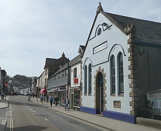
Wadhurst is a market town in East Sussex, England. It is the centre of the civil parish of Wadhurst, which also includes the hamlets of Cousley Wood and Tidebrook. Wadhurst is twinned with Aubers in France.

Mary Baker was an English impostor. Posing as the fictional Princess Caraboo, Baker pretended to come from a far-off island kingdom and fooled a British town for some months.

Budleigh Salterton is a seaside town on the coast in East Devon, England, 15 miles (24 km) south-east of Exeter. It lies within the East Devon Area of Outstanding Natural Beauty, and forms much of the electoral ward of Budleigh, whose ward population at the 2021 census was 7,671.
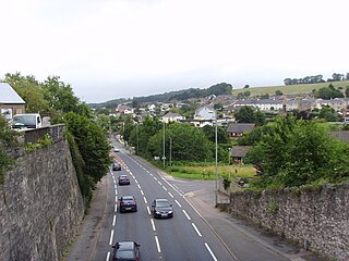
Okehampton is a town and civil parish in West Devon in the English county of Devon. At the 2021 census, the parish had a population of 7,313, which was slightly more than the 7,104 recorded at the 2011 census. The Okehampton built-up area had a population of 9,112 at the 2021 census, up from 7,647 in 2011.

Nailsworth is a town and civil parish in the Stroud District in Gloucestershire, England, lying in one of the Stroud Valleys in the Cotswolds, on the A46 road, 4 miles (6.4 km) south of Stroud and about 25 miles (40 km) north-east of Bristol and Bath. The parish had a population of 5,794 at the 2011 census.

Almondsbury is a large village and civil parish in South Gloucestershire, England. It is situated on the A38 road in the Avon Green Belt 7 miles (11 km) north of Bristol city centre. It is adjacent to junction 16 of the M5 motorway and Almondsbury Interchange, where the M4 and M5 cross. It is part of the Bristol Built-up Area.

Hatherleigh is a small market town in the West Devon district, in the county of Devon, England. In 2011 the parish had a population of 1306.

Bedminster, colloquially known as Bemmy, is a district of Bristol, England, on the south side of the city. It is also the name of a council ward which includes the central part of the district.

Bovey Tracey is a town and civil parish in Devon, England. It is located on the edge of Dartmoor, which gives rise to the slogan used on the town's boundary signs: The Gateway to the Moor. It is often known locally as Bovey. About 10 miles (16 km) south-west of Exeter, it lies on the A382 road, about halfway between Newton Abbot and Moretonhampstead. The village is at the centre of the electoral ward of Bovey. At the 2021 census, it had a population of 7,996, which was slightly more than the 7,168 recorded at the 2011 census.

St Marychurch is an area of Torquay, in the Torbay district, in the ceremonial county of Devon, England. It is one of the oldest settlements in South Devon. Its name derives from the church of St Mary, which was founded in Anglo-Saxon times. The ward population taken at the 2011 census was 11,262.

Abbotskerswell is a village and civil parish in the English county of Devon. The village is in the north part of the parish and is located two miles (3 km) south of the town of Newton Abbot, 7 miles (11 km) from the seaside resort of Torquay and 32 miles (51 km) from the city of Plymouth. The A381 road between Newton Abbot and Totnes runs down the western side of the parish and the main railway line between these two towns forms part of its eastern boundary.
Woodbury is a village and civil parish in East Devon in the English county of Devon, 7 miles (11 km) south east of the city of Exeter. At the 2011 Census the village had a population of 1,605, and the parish had a population of 3,466. It lies on the east bank of the Exe Estuary, has borders – clockwise from the estuary – with the district of Exeter and then the parishes of Clyst St George, Clyst St Mary, Farringdon, Colaton Raleigh, Bicton and Lympstone. Woodbury is part of the electoral ward of Woodbury and Lympstone whose population at the 2011 Census was 5,260.

Willand is a village and civil parish in Mid Devon, England. It is about 19 km (12 mi) north of Exeter and 2.4 km (1.5 mi) north of Cullompton. In 1991 the population was 3750 although recently this has grown considerably. The National Grid reference for the centre of the area is ST037110. Willand is a major part of Lower Culm electoral ward. The ward population at the 2011 Census was 5,808. The parish is surrounded, clockwise from the north, by the parishes of Halberton, Uffculme and Cullompton.
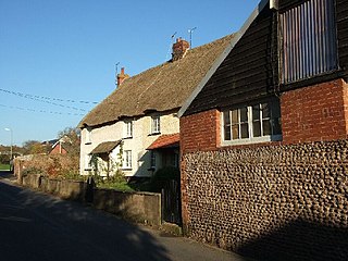
Buckland Brewer is a village and civil parish in the Torridge district of Devon, England, 4.7 miles south of Bideford. Historically the parish formed part of Shebbear Hundred. According to the 2001 census it had a population of 777, increasing to 794 at the 2011 census The village is part of Waldon electoral ward. The population for this at the same census was 1,679.
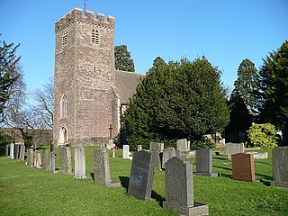
Kingskerswell is a village and civil parish within Teignbridge local government district in the south of Devon, England. The village grew up where an ancient track took the narrowest point across a marshy valley and it is of ancient foundation, being mentioned in the Domesday Book. It has a church dating back to the 14th century and the ruins of a manor house of similar date. The coming of the railway in the 1840s had a large effect on the village, starting its conversion into a commuter town. The village is a major part of the electoral ward called Kerswell-with-Combe. This ward had a population of 5,679 at the 2011 census.

Tedburn St Mary is a village and civil parish in the Teignbridge district of Devon, England, approximately 8 miles west of Exeter. According to the 2021 census, it had a population of 1,550, which was slightly more than the 1,472 recorded at the 2011 census. The village is the principal population centre of the electoral ward called Teignbridge North. The population of the ward at the 2011 census is 2,715.
Marshfield is a village and community of Newport, Wales. It sits approximately 5 miles southwest of Newport, and 7 miles northeast of Cardiff. The area is governed by Newport City Council. The community includes Castleton. Its population in 2011 was 3,054.
Nash is a village and community to the south of the city of Newport, South Wales, in the Lliswerry ward.
Meshaw is a village and civil parish in the North Devon district of Devon, England. Its nearest town is South Molton, which lies approximately 5.9 miles (9.5 km) north-west from the village. The village lies just off the B3137 road. Meshaw also lies on the same B3137 road as Witheridge which is approximately 4.7 miles south-east of the village. In 2001 the population of the civil parish of Meshaw was 151.

Cheldon is a village and former civil parish, 17 miles (27 km) north-west of Exeter, now in the parish of Chulmleigh, in the North Devon district, in the county of Devon, England. In 1961, the parish had a population of 32.
