
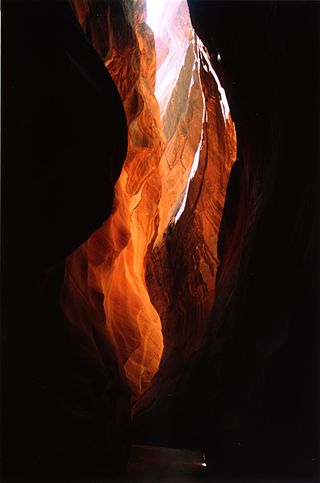
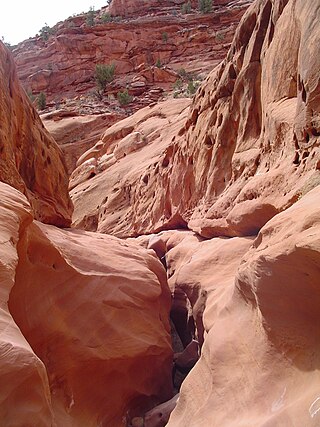
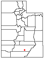
Wolverine Canyon is a canyon near the town of Boulder, Utah. [1] It is small, only 3 miles in length until it meets with Horse Canyon and Little Death Hollow, and then leads down to the Escalante River.
Wolverine Canyon is a canyon near the town of Boulder, Utah. [1] It is small, only 3 miles in length until it meets with Horse Canyon and Little Death Hollow, and then leads down to the Escalante River.

Bethel Township is a township in Fulton County, Pennsylvania, United States. The population was 1,551 at the 2020 census.
Buckskin Gulch is a gulch and canyon located in southern Kane County, Utah, near the Arizona border in the Paria Canyon-Vermilion Cliffs Wilderness. With a length of over 16 miles (26 km), it is one of the main tributaries of the Paria River, a tributary of the Colorado River.

Saskatoon Fairview is a provincial electoral district for the Legislative Assembly of Saskatchewan, Canada. The district includes the neighbourhoods of Kensington, Parkridge, Pacific Heights, Blairmore S. C., Confederation Park and part of Massey Place. Contrary to the name, the neighbourhood of Fairhaven is not part of the riding.

Gold Canyon is a census-designated place (CDP) and unincorporated community in Pinal County, Arizona, United States. The community is sometimes incorrectly called Gold Camp.
Paloma is an unincorporated community in Calaveras County, California. It lies at an elevation of 1362 feet and is located at 38°15′34″N120°45′48″W. The community is in ZIP code 95252 and area code 209.
Cottonwood Canyon Road is a scenic 46-mile (74 km) or 47-mile (76 km) dirt road that traverses Cottonwood Canyon in Kane County, Utah. The drive begins in Cannonville, just off Utah State Route 12, continues southward through Grand Staircase–Escalante National Monument, and eventually connects to U.S. Route 89.

Reidville is a village located north east of Deer Lake. A post office was established in 1967 and the first Postmisstress was Dorothy Barrett.
Death Hollow, Death Canyon or Little Death Hollow is a slot canyon in the Grand Staircase–Escalante National Monument in central Garfield County, Utah, United States.

Horse Canyon is a small canyon near the towns of Boulder and Escalante in the Grand Staircase–Escalante National Monument in central Garfield County, Utah, United States

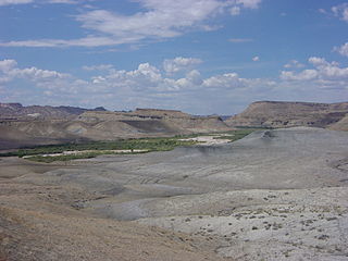
The Canyons of the Escalante is a collective name for the erosional landforms created by the Escalante River and its tributaries—the Escalante River Basin. Located in southern Utah in the western United States, these sandstone features include high vertical canyon walls, numerous slot canyons, waterpockets, domes, hoodoos, natural arches and bridges. This area—extending over 1,500 square miles (3,885 km2) and rising in elevation from 3,600 ft (1,097 m) to over 11,000 ft (3,353 m)—is one of the three main sections of the Grand Staircase–Escalante National Monument, and also a part of the Glen Canyon National Recreation Area, with Capitol Reef National Park being adjacent to the east.
Harris Wash is a long tributary of the Escalante River located in Garfield County in southern Utah, in the western United States. Over 40 miles (64 km) long with a drainage of 270 square miles (700 km2), it exhibits many of the geologic features found in the Canyons of the Escalante, including high vertical canyon walls and narrow slot canyons. A popular recreational destination and a historic transportation route, it is located within the Grand Staircase–Escalante National Monument.

The Embassy of Brazil in Moscow is the diplomatic mission of Brazil to the Russian Federation and to the Republic of Uzbekistan. Since 28 October 1963 the Embassy and the Residence of the Brazilian Ambassador are located at 54 Bolshaya Nikitskaya Street in the Presnensky District of Moscow.
The Row is an unincorporated community in Charles City County, Virginia, United States.
Rochdale Village is student housing cooperative apartment complex in Berkeley, California. The property is owned by UC Berkeley and leased by the Berkeley Student Cooperative (BSC). It was built during the late 1960s and early 1970s, with money loaned by the Department of Housing and Urban Development to the BSC. With approximately 260 residents, it is the largest housing co-op in Berkeley and one of the largest student housing cooperatives in the world. It lies at an elevation of 236 feet.
Opegoi is a former Karok settlement in Humboldt County, California. It was located on the Klamath River opposite the mouth of Red Cap Creek, at an elevation of 341 feet.
WINI is a radio station broadcasting an oldies format. Licensed to Murphysboro, Illinois, the station is owned by Southern Illinois Radio Group, and carries Westwood One's Good Time Oldies network.
Mollie's Nipple or Molly's Nipple is the name given to as many as seven peaks, at least one butte, at least one well, and some other geological features in Utah. Some sources claim there are eleven geological features in Utah that bear this name. At least some of those names are attributed to John Kitchen – a pioneer of an early exploration of Utah, who named them to commemorate a nipple of his wife Molly.

Lone Rock is a solitary rock in Wahweap Bay in Lake Powell in Glen Canyon Recreation Area less than 10 miles (16 km) from Glen Canyon Dam. It is located within Kane County, Utah, United States.
Qualey is an unincorporated community in Washington County, in the U.S. state of Ohio.

Kite Hill is a city park and natural area in the Castro district of San Francisco, California. At an elevation of 350 feet, the 2.87 acre park is named for its gusty winds. The natural area includes a panoramic view of San Francisco.
37°45′30″N111°15′34″W / 37.75833°N 111.25944°W
| | This article about a location in Utah is a stub. You can help Wikipedia by expanding it. |