
Berlin is the capital and largest city of Germany by both area and population. Its 3.7 million inhabitants make it the European Union's most populous city, according to population within city limits. One of Germany's sixteen constituent states, Berlin is surrounded by the State of Brandenburg and contiguous with Potsdam, Brandenburg's capital. Berlin's urban area, which has a population of around 4.5 million, is the second most populous urban area in Germany after the Ruhr. The Berlin-Brandenburg capital region has over six million inhabitants and is Germany's third-largest metropolitan region after the Rhine-Ruhr and Rhine-Main regions.

Brandenburg is a state in the northeast of Germany. With an area of 29,478 square kilometres (11,382 sq mi) and a population of 2.5 million residents, it is the fifth-largest German state by area and the tenth-most populous. Potsdam is the state capital and largest city, while other major towns include Cottbus, Brandenburg an der Havel and Frankfurt (Oder).

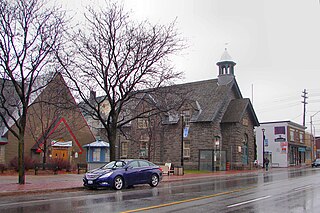
Kreuzberg is a district of Berlin, Germany. It is part of the Friedrichshain-Kreuzberg borough located south of Mitte. During the Cold War era, it was one of the poorest areas of West Berlin, but since German reunification in 1990 it has become more gentrified and known for its arts scene.

Mitte is the first and most central borough of Berlin. The borough consists of six sub-entities: Mitte proper, Gesundbrunnen, Hansaviertel, Moabit, Tiergarten and Wedding.

Friedrichshain-Kreuzberg is the second borough of Berlin, formed in 2001 by merging the former East Berlin borough of Friedrichshain and the former West Berlin borough of Kreuzberg. The historic Oberbaum Bridge, formerly a Berlin border crossing for pedestrians, links both districts across the river Spree as the new borough's landmark.

Neukölln is one of the twelve boroughs of Berlin. It is located in the southeastern part from the city centre towards Berlin Schönefeld Airport. It was part of the former American sector under the Four-Power occupation of the city. It features many Gründerzeit buildings and is characterized by having one of the highest percentage of immigrants in Berlin. In recent years an influx of students and creative types has led to gentrification.
Westboro is an area in the west end of Ottawa, Ontario, Canada. Located along the Ottawa River, Island Park Drive defines Westboro's eastern border, while the Ottawa River defines its northern border. Under this definition, the population of the area is 22,725.

Prenzlauer Berg is a locality of Berlin, forming the southerly and most urban district of the borough of Pankow. From its founding in 1920 until 2001, Prenzlauer Berg was a district of Berlin in its own right. However, that year it was incorporated into the greater district of Pankow.

Moabit is an inner city locality in the borough of Mitte, Berlin, Germany. As of 2016, around 77,000 people lived in Moabit. First inhabited in 1685 and incorporated into Berlin in 1861, the former industrial and working-class neighbourhood is fully surrounded by three watercourses which define its present-day border. Between 1945 and 1990, Moabit was part of the British sector of West Berlin that directly bordered East Berlin.

Friedrichshain is a quarter (Ortsteil) of the borough of Friedrichshain-Kreuzberg in Berlin, Germany. From its creation in 1920 until 2001, it was a freestanding city borough. Formerly part of East Berlin, it is adjacent to Mitte, Prenzlauer Berg, Kreuzberg and Lichtenberg.

Downtown Calgary is a dense urban district in central Calgary, Alberta. It contains the second largest concentration of head offices in Canada, despite only being the country's fourth largest city in terms of population. The downtown is divided into several residential, commercial, corporate, and mixed-use neighbourhoods, including the Financial District (CBD), Eau Claire, Chinatown, East Village, Beltline, and the West End.

Fürstenwalde/Spree is the most populous town in the Oder-Spree District of Brandenburg, Germany.
The Oberbaum Bridge is a double-deck bridge crossing Berlin's River Spree, considered one of the city's landmarks. It links Friedrichshain and Kreuzberg, former boroughs that were divided by the Berlin Wall, and has become an important symbol of Berlin’s unity.

Kiez is a German word that refers to a city neighbourhood, a relatively small community within a larger town. The word is mainly used in Berlin and northern Germany. Similar quarters are called Veedel in Cologne and Grätzl in Vienna.

Friedrichstadt was an independent suburb of Berlin, and is now a historical neighbourhood of the city itself. The neighbourhood is named after the Prussian king Frederick I.

Erlton is an inner city residential neighbourhood in the southwest quadrant of Calgary, Alberta. It is bounded by the Elbow River to the north and west, by Spiller Road to the east and by Mission Road to the south. Macleod Trail bisects the neighbourhood from north to south. The neighbourhood is represented by the Erlton Community Association.
Berlin has developed a highly complex transportation infrastructure providing very diverse modes of urban mobility. 979 bridges cross 197 kilometers of innercity waterways, 5,334 kilometres (3,314 mi) of roads run through Berlin, of which 73 kilometres (45 mi) are motorways. Long-distance rail lines connect Berlin with all of the major cities of Germany and with many cities in neighboring European countries. Regional rail lines provide access to the surrounding regions of Brandenburg and to the Baltic Sea.

Neukölln, until 1920 an independent city, is an inner-city district of Berlin in the homonymous borough (Bezirk) of Neukölln, including the historic village of Alt-Rixdorf and numerous Gründerzeit apartment blocks. With 166,714 inhabitants (2018) the Ortsteil is the most densely populated of Berlin. It was originally characterized by mostly working-class inhabitants and later a relatively high percentage of immigrants, especially of Turkish and Russian descent, but since the turn of the millennium an influx of students, creatives, and western immigrants has led to gentrification.

Mediaspree is one of the largest property investment projects in Berlin. It aims to establish telecommunication and media companies along a section of the banks of the river Spree as well as to implement an urban renewal of the surrounding area. So far, for the most part, unused or temporarily occupied real estate is to be converted into office buildings, lofts, hotels, and other new structures.

Luisenstadt is a former quarter (Stadtteil) of central Berlin, now divided between the present localities of Mitte and Kreuzberg. It gave its name to the Luisenstadt Canal and the Luisenstädtische Kirche.
