Wren's Egg

Last updated

The Wren's Egg
Wren's Egg and Nest, bronze age cists, Blairbuy Farm.jpg
Coordinates 54°44′46″N4°32′52″W / 54.746058°N 4.5478679°W / 54.746058; -4.5478679 Coordinates: 54°44′46″N4°32′52″W / 54.746058°N 4.5478679°W / 54.746058; -4.5478679
Designated31 December 1921
Reference no. SM90316
Dumfries and Galloway UK location map.svg
Red pog.svg
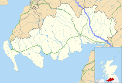
Location of The Wren's Egg in Dumfries and Galloway

The Wren's Egg (grid reference NX 3610 4199 ) is the name given to a set of late Neolithic or Bronze Age stone monuments in the parish of Glasserton, Wigtownshire, Dumfries and Galloway. The site comprises two pairs of standing stones to the north and south of a large glacial erratic, the Wren's Egg itself. [1] [2] It was one of the first monuments taken into state care after the Ancient Monuments Act passed in 1882. [3]

Historic Environment Scotland | Àrainneachd Eachdraidheil Alba notes the site's significance as follows:

Standing stones are a widespread class of monument across Scotland with notable concentrations in the Western and Northern Isles, Caithness, Aberdeenshire, Perthshire and Dumfries and Galloway. However, pairs of stones which appear to have been constructed as an intervisible and discrete group are less common. These standing stones survive within an area that has a concentration of contemporary or near-contemporary sites and as such they have the potential to contribute to our understanding of the development of the landscape. [1]

The pair of stones to the north are in their original settings. They stand oriented east-west, roughly 1.5m apart and 18m from the Wren's Egg. The southern pair are sited 405m from the northern stones, also in an east-west alignment and roughly 1m apart. The standing stones are no taller than 0.6m. [1] The Wren's Egg is not in its original position; it appears a farmer tried and failed to move it from the field. [3]

It was previously thought that the Wren's Egg lay at the centre of two concentric stone circles, but excavations in 1975 showed that this was not the case. [1] In 2012 three cists dating to the Bronze Age were discovered 155m to the northeast of the Wren's Egg. One of these cists contained skeletal remains. [1] [4]

The Wren's Egg and standing stones were scheduled in 1887 by Augustus Pitt Rivers while visiting Sir Herbert Maxwell. In 1890 the monument was one of the first to be taken into state care, after Maxwell offered it into guardianship. [1] [3] It is notable, and 'puzzling', that Pitt Rivers chose to schedule the Wren's Egg and not the nearby Torhouse Stone Circle. [3]
Further reading

Related Research Articles

Chambered cairn Burial monument (Usually Neolithic)

A chambered cairn is a burial monument, usually constructed during the Neolithic, consisting of a sizeable chamber around and over which a cairn of stones was constructed. Some chambered cairns are also passage-graves. They are found throughout Britain and Ireland, with the largest number in Scotland.

Kilmartin Glen British Neolithic monument site

Kilmartin Glen is an area in Argyll north of Knapdale. It has the most important concentration of Neolithic and Bronze Age remains in mainland Scotland. The glen is located between Oban and Lochgilphead, surrounding the village of Kilmartin. In the village, Kilmartin Museum explains the stories of this ancient landscape and the people who dwelt there. There are more than 800 ancient monuments within a six-mile (ten-kilometre) radius of the village, with 150 monuments being prehistoric. Monuments include standing stones, a henge monument, numerous cists, and a "linear cemetery" comprising five burial cairns. Several of these, as well as many natural rocks, are decorated with cup and ring marks.

Innerwick Human settlement in Scotland

Innerwick is a coastal civil parish and small village, which lies in the east of East Lothian, five miles from Dunbar and approximately 32 miles from Edinburgh.

Glasserton is a civil parish in Dumfries and Galloway, south-west Scotland. It is on the Machars peninsula, in the traditional county of Wigtownshire. The parish is about 8 miles (13 km) in length, varying in breadth from 1 to 3 miles, and contains 13,477 acres (54.54 km2).

Rendall

Rendall is a parish on Mainland, Orkney, Scotland. It is in the north west of the island and lies east of the parishes of Birsay and Evie and north east of Harray. The island of Gairsay is also in the parish.

Stoneykirk is an area and a village in the heart of the Rhins of Galloway, Wigtownshire, in the administrative council area of Dumfries and Galloway, Scotland nearly ten miles in length and three and a half miles in breadth, bounded on the east by the bay of Luce, and on the west by the Irish Channel, 5 miles (8.0 km) south of Stranraer.

Crossmichael Human settlement in Scotland

Crossmichael is a small village on the east side of Loch Ken in the historical county of Kirkcudbrightshire, about 4 miles (6.4 km) north of Castle Douglas in Scotland.

Cargenbridge Human settlement in Scotland

Cargenbridge is a village located in Dumfries and Galloway, United Kingdom southwest of Dumfries. It is in Troqueer parish, in the historic county of Kirkcudbrightshire.

Drumtroddan standing stones

The Drumtroddan standing stones are a small Neolithic or Bronze Age stone alignment in the parish of Mochrum, Wigtownshire, Dumfries and Galloway. The monument comprises three stones, only one of which is now standing, aligned northeast-southwest. The two end stones are 3m in length; the middle stone is roughly 2.7m long. The stones were likely set up in the 3rd or 2nd millennium BCE but sites of this type are difficult to date. Short stone row alignments are considered to be relatively late constructions; however, the height of the stones in this monument may indicate that it dates from an earlier period.

Pict's Knowe is a henge monument in the parish of Troqueer, Dumfries and Galloway. It is one of a small group of henge monuments around Dumfries which includes Broadlea henge near Annan. Pict's Knowe is located 4 km SW of Dumfries on a small sandy bank in the peat covered valley of the Crooks Pow stream.

Curriestanes cursus is a large neolithic ditched enclosure on the outskirts of Dumfries, in the parish of Troqueer, Dumfries and Galloway. It is visible only from aerial photography. It is, along with Pict's Knowe, one of two scheduled monuments in Troqueer parish.

Broadlea henge is a Neolithic or Bronze Age monument in the parish of Middlebie, Dumfries and Galloway. It is one of very few henge monuments in southern Scotland. The only other well preserved site is the considerably smaller Pict's Knowe near Dumfries. While Pict's Knowe is a single entrance, Class I henge, Broadlea has two entrances, making it a Class II henge. It measures 50m by 45m inside its ditch, which is as wide as 10m. The banks have been flattened over time but still rise in parts to around four feet high.

Droughdool Mote

Droughdool Mote is a Neolithic round mound in the parish of Old Luce, Wigtownshire, Dumfries and Galloway. The mound is oval in plan, measuring 60m by 50m at its base and rises to 10m in height. It is located 400m south of the late neolithic palisaded enclosure at Dunragit. It has been suggested that the mound may have been used as a viewing platform for activities at Dunragit complex of monuments. The most well known parallel the site has is Silbury Hill in Wiltshire, but is closer in size to the less well known sites at Conquer Barrow, Willy Howe and Wold Newton. The mound was originally built with stepped sides on top of a sand dune. Excavation between 1999-2002 revealed a round cairn at the top of the mound, similar to the nearby Mid Gleniron A.

Cat Stones of Scotland

The Cat Stones of Scotland are natural prominent rock features or standing stones around Scotland that are often linked to battles or burials. The English term cat applied to such stones derives from the Gaelic cath. Clach a'Chait would be the Gaelic for "Stone of the Cat".

Mid Gleniron

Mid Gleniron is a prehistoric site in Dumfries and Galloway used in the Neolithic and Bronze Age. The site is a scheduled ancient monument that comprises a group of six burial cairns. Two of the cairns, Mid Gleniron I and Mid Gleniron II are chambered cairns of the Clyde tradition. These are of historic importance because of their multi-stage construction which provides evidence for the development of Clyde cairns at the beginning of the Neolithic period.

Nith Bridge cross

The Nith Bridge cross is a sculptured Anglo-Saxon cross, near the village of Thornhill, Dumfries and Galloway. It is the best preserved monument of its type in the region, after the Ruthwell Cross, although the arms are missing. It is a Scheduled monument. The cross is made of red sandstone and carved with animal and plant interlace designs in low relief. It is 6 feet 6 inches tall.

High Banks cup and ring markings

The High Banks cup and ring markings are a series of Neolithic or Bronze Age carvings on an outcrop of rock near High Banks farm, 3 km SE of Kirkcudbright, Dumfries and Galloway. They are one of the best collections of cup and ring markings in Galloway.

Cairnderry chambered cairn

Cairnderry chambered cairn is a chambered cairn in Dumfries and Galloway. It is a Bargrennan cairn, a type of Neolithic or early Bronze Age monument only found in south west Scotland.

Loanhead of Daviot stone circle Recumbent stone circle in Aberdeenshire

Loanhead of Daviot stone circle is a recumbent stone circle in Aberdeenshire in lowland northeast Scotland. The circle consists of the recumbent stone with its flankers and a complete set of eight orthostats about 21 metres (69 ft) in diameter surrounding a low kerbed ring cairn which has an open court. However, the present appearance has in part been produced by substantial restoration after archaeological excavation in 1934, and in 1989 by the removal of the stones covering the central court.

References

  1. 1 2 3 4 5 6 "The Wren's Egg, two standing stones 18m ENE and two standing stones 406m SSE of (SM90316)". portal.historicenvironment.scot. Archived from the original on 13 November 2018. Retrieved 10 November 2019.
  2. Geoffrey, Stell (1996). Dumfries and Galloway. Exploring Scotland's Heritage (2nd ed.). Edinburgh: The Stationery Office. p. 169. ISBN   0114952949.
  3. 1 2 3 4 "Wren's Egg - Statement of Significance | Historic Environment Scotland". www.historicenvironment.scot. Archived from the original on 2 August 2019. Retrieved 10 November 2019.
  4. "'The Wren's Egg' | Canmore". canmore.org.uk. Archived from the original on 6 March 2017. Retrieved 10 November 2019.