Related Research Articles

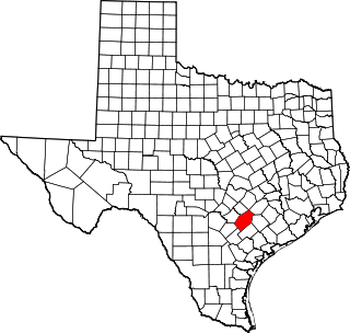
Gonzales County is a county in the U.S. state of Texas, adjacent to Greater Austin-San Antonio. As of the 2020 census, its population was 19,653. The county is named for its county seat, the city of Gonzales. The county was created in 1836 and organized the following year. As of August 2020, under strict budgetary limitations, the County of Gonzales government-body is unique in that it claims to have no commercial paper, regarding it as "the absence of any county debt."

Caldwell County is a county located in the U.S. state of Texas. As of the 2020 census, its population was 45,883. Its county seat is Lockhart. The county was founded in 1848 and named after Mathew Caldwell, a ranger captain who fought in the Battle of Plum Creek against the Comanches and against Santa Anna's armies during the Texas Revolution. Caldwell was also a signer of the Texas Declaration of Independence.

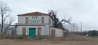
Oak Forest was a settlement in Gonzales County, Texas, United States, five miles west of Gonzales. Oak Forest was situated along modern U.S. Highway 90 Alternate and CR 143, adjacent to the Guadalupe River and due south of the modern Palmetto State Park. Formerly the location of a mill and later re-purposed as a power dam, it failed in 1935 during a flood and was later rebuilt. There is still an operating hydroelectric dam and a small reservoir called MA Wade Dam near the site. According to the Handbook of Texas, the community had an estimated population 25 in 2000.
West Point is an unincorporated community in western Fayette County, Texas, United States.
Cego is an unincorporated community in western Falls County, Texas, United States. Cego is located on Farm to Market Road 1950. As of 2000, the population was 42.

Heidenheimer is an unincorporated community in Bell County, Texas, United States. According to the Handbook of Texas, the community had an estimated population of 144 in 2000. The community is part of the Killeen–Temple–Fort Hood Metropolitan Statistical Area.
South Bend is an unincorporated community in Young County, Texas, United States. According to the Handbook of Texas, the community had an estimated population of 140 in 2000.
Cost is an unincorporated community in Gonzales County, Texas, United States. According to the Handbook of Texas, the community had an estimated population 62 in 2000.
Sweet Home is an unincorporated community in Lavaca County, Texas, United States. According to the Handbook of Texas, the community had an estimated population of 360 in 2000.
Francitas is an unincorporated community in Jackson County, Texas, United States. According to the Handbook of Texas, the community had an estimated population of 760 in 2000.
Harwood is a ghost town in Gonzales County, Texas, United States. According to the Handbook of Texas, the community had an estimated population of 112 in 2000.
Flomot is an unincorporated community in Motley County, Texas, United States. According to the Handbook of Texas, the community had an estimated population of 181 in 2000.
Panola is an unincorporated community in Panola County, Texas, United States. According to the Handbook of Texas, the community had an estimated population of 296 in 2000.
Judson is an unincorporated community in Gregg County, Texas, United States. According to the Handbook of Texas, the community had an estimated population of 650 in 2000. It is part of the Longview, Texas Metropolitan Statistical Area.
Pandora is an unincorporated community in Wilson County, Texas, United States. According to the Handbook of Texas, the community had an estimated population of 125 in 2000. Pandora is part of the San Antonio Metropolitan Statistical Area.

Gillett is an unincorporated community in Karnes County, Texas, United States. According to the Handbook of Texas, the community had an estimated population of 120 in 2000.
Ottine is an unincorporated community in Gonzales County, Texas, United States. According to the Handbook of Texas, the community had an estimated population of 90 in 2000. It is home to Palmetto State Park, which can accommodate approximately 500 daily campers.
Bebe is an unincorporated community in Gonzales County, Texas, United States.
Hobson is an unincorporated community in Karnes County, Texas, United States. According to the Handbook of Texas, the community had an estimated population of 135 in 2000. The ZIP Code for Hobson is 78117.

The Westmoreland Historic District is a neighborhood in Neartown Houston, Texas. It is west of Spur 527, between Westheimer Road and West Alabama Street.
References
- 1 2 U.S. Geological Survey Geographic Names Information System: Wrightsboro, Texas
- ↑ "Wrightsboro, Texas". The Handbook of Texas online. Retrieved August 29, 2009.
- ↑ "Wrightsboro, Texas". Texas Escapes Online Magazine. Retrieved August 29, 2009.
- ↑ USPS – Cities by ZIP Code

