Wrightsville Dam

Last updated
Wrightsville dam
Official name Wrightsville Dam
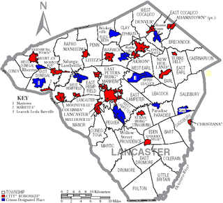
Location Lancaster / York counties, Pennsylvania, USA
Construction began 1840
Opening date 1840
Operator(s) defunct
Dam and spillways
Impounds Susquehanna River
Height 10 feet
Length ~5,000 feet

The Wrightsville Dam was a 19th-century dam on the lower Susquehanna River between Wrightsville and Columbia, Pennsylvania.

Susquehanna River river in the northeastern United States

The Susquehanna River is a major river located in the northeastern and mid-Atlantic United States. At 464 miles (747 km) long, it is the longest river on the East Coast of the United States that drains into the Atlantic Ocean. With its watershed, it is the 16th-largest river in the United States, and the longest river in the early 21st-century continental United States without commercial boat traffic.

Wrightsville, Pennsylvania Borough in Pennsylvania, United States

Wrightsville is a borough in York County, Pennsylvania, United States. The population was 2,320 at the 2010 census. Wrightsville borough has a police department, historic society, and a volunteer fire company.

Columbia, Pennsylvania Place in Pennsylvania, United States

Columbia, formerly Wright's Ferry, is a borough (town) in Lancaster County, Pennsylvania, 28 miles (45 km) southeast of Harrisburg on the east (left) bank of the Susquehanna River, across from Wrightsville and York County and just south of U.S. Route 30. The settlement was founded in 1726 by Colonial English Quakers from Chester County led by entrepreneur and evangelist John Wright. Establishment of the eponymous Wright's Ferry, the first commercial Susquehanna crossing in the region, inflamed territorial conflict with neighboring Maryland but brought growth and prosperity to the small town, which was just a few votes shy of becoming the new United States' capital. Though besieged for a short while by Civil War destruction, Columbia remained a lively center of transport and industry throughout the 19th century, once serving as a terminus of the Pennsylvania Canal. Later, however, the Great Depression and 20th-century changes in economy and technology sent the borough into decline. It is notable today as the site of one of the world's few museums devoted entirely to horology.

The low-head dam was constructed in 1840 to impound the waters of the Susquehanna to provide a slackwater pool to allow the safe passage of canal boats from the Pennsylvania Canal on the Columbia (Lancaster County) side across the mile-wide rocky river to the Susquehanna and Tidewater Canal on the Wrightsville (York County) side. [1]

Pennsylvania Canal former canal network in Pennsylvania

Pennsylvania Canal(or sometimes Pennsylvania Canal system) refers generally to a complex system of transportation infrastructure improvements including canals, dams, locks, tow paths, aqueducts, and viaducts. The Canal and Works were constructed and assembled over several decades beginning in 1824, the year of the first enabling act and budget items. It should be understood the first use of any railway in North America was the year 1826, so the newspapers and the Pennsylvania Assembly of 1824 applied the term then to the proposed Right of ways mainly for the canals of the Main Line of Public Works to be built across the southern part of Pennsylvania.

Lancaster County, Pennsylvania county in Pennsylvania, United States

Lancaster County, sometimes nicknamed the Garden Spot of America or Pennsylvania Dutch Country, is a county located in the south central part of the Commonwealth of Pennsylvania. As of the 2010 census, the population was 519,445. Its county seat is Lancaster.

Susquehanna and Tidewater Canal

The Susquehanna and Tidewater Canal between Wrightsville, Pennsylvania, and Havre de Grace, Maryland, at the head of Chesapeake Bay, provided an interstate shipping alternative to 19th-century arks, rafts, and boats plying the difficult waters of the lower Susquehanna River. Built between 1836 and 1840, it ran 43 miles (69 km) along the west bank of the river and rendered obsolete an older, shorter canal along the east bank. Of its total length, 30 miles (48 km) were in Pennsylvania and 13 miles (21 km) in Maryland. Though rivalry between Philadelphia, Pennsylvania, and Baltimore, Maryland, delayed its construction, the finished canal brought increased shipments of coal and other raw materials to both cities from Pennsylvania's interior. Competition from railroads was a large factor in the canal's decline after 1855. Canal remnants, including a lock keeper's house, have been preserved in Maryland, and locks 12 and 15 have been preserved in Pennsylvania. A copy of a detailed survey blueprint of the entire canal system including structures and property ownership details was donated by the Safe Harbor Water Power Corporation to Millersville University. The survey consists of 67 pages, 98 x 30 cm. and is undated but the assumption is the original was created while the canal was in use.

See also

Related Research Articles

Main Line of Public Works canal and transportation system in Pennsylvania

The Main Line of Public Works was a package of legislation supporting a vision passed in 1826 — a collection of various long proposed canal and road projects that became a canal system and later added railroads designed to cross the breadth of Pennsylvania with the visionary goal of providing the best commercial means of transportation between Philadelphia and Pittsburgh. Built between 1826 and 1834 by the Commonwealth of Pennsylvania, it established the Pennsylvania Canal System, the Allegheny Portage Railroad, and the Pennsylvania Canal System administrated under a new Commission.

Northern Central Railway

The Northern Central Railway (NCRY) was a Class I Railroad connecting Baltimore, Maryland with Sunbury, Pennsylvania, along the Susquehanna River. Completed in 1858, the line came under the control of the Pennsylvania Railroad (PRR) in 1861, when the PRR acquired a controlling interest in the Northern Central's stock to compete with the rival Baltimore and Ohio Railroad (B&O). For eleven decades the Northern Central operated as a subsidiary of the PRR until much of its Maryland trackage was washed out by Hurricane Agnes in 1972; after which most of its operations ceased as the Penn Central declined to repair sections. It is now a fallen flag railway, having come under the control of the later Penn Central, Conrail, and then broken apart and disestablished. The southern part in Pennsylvania is now the York County Heritage Rail Trail which connects to a similar hike/bike trail in Northern Maryland down to Baltimore, named the Torrey C. Brown Rail Trail. Only the trackage around Baltimore remains in rail service.

National Register of Historic Places listings in Pennsylvania Wikimedia list article

This is a list of properties and districts listed on the National Register of Historic Places in Pennsylvania. As of 2015, there are over 3,000 listed sites in Pennsylvania. Sixty-six of the 67 counties in Pennsylvania have listings on the National Register; Cameron County is the only county without any sites listed.

Columbia–Wrightsville Bridge

The Columbia–Wrightsville Bridge, officially the Veterans Memorial Bridge, spans the Susquehanna River between Columbia and Wrightsville, Pennsylvania, and carries Pennsylvania Route 462 and BicyclePA Route S. Built originally as the Lancaster-York Intercounty Bridge, construction began in 1929, and the bridge opened September 30, 1930. On November 11, 1980, it was officially dedicated as Veterans Memorial Bridge, though it is still referenced locally as the Columbia–Wrightsville Bridge.

The Department of the Susquehanna was a military department created by the United States War Department during the Gettysburg Campaign of the American Civil War. Its goal was to protect the state capital and the southern portions of the commonwealth of Pennsylvania, and to deny the Confederate army passage across the vital Susquehanna River.

Wrights Ferry Bridge bridge in United States of America

The Wright's Ferry Bridge carries U.S. Route 30 (US 30) over the Susquehanna River between Columbia and Wrightsville, Pennsylvania. The "Wright's Ferry" its name commemorates was the first ferry across the Susquehanna River. The bridge is considered the fifth Columbia–Wrightsville Bridge; it complements the fourth one, which still carries Lincoln Highway traffic.

Pennsylvania Railroad Bridge (Columbia, Pennsylvania) bridge in United States of America

The Pennsylvania Railroad Bridge once carried the York Branch of the Pennsylvania Railroad across the Susquehanna River between Columbia and Wrightsville, Pennsylvania and is therefore considered a Columbia-Wrightsville Bridge. It and its predecessors were a vital commercial and passenger linkage between Philadelphia and Baltimore for over 100 years.

The Long Level was a section on the old Erie Canal, extending from Frankfort, New York 70 miles (110 km) westward to Syracuse, New York. The flat topography of this area meant that this section of the canal required no lockage. Initial construction on the Erie Canal was begun on this section at Rome, New York on July 4, 1817.

Mason-Dixon Trail

The Mason-Dixon Trail is a 195.9-mile (315.3 km), blue-blazed footpath that connects the Appalachian Trail with the Brandywine Trail, passing through Gifford Pinchot State Park and White Clay Creek Preserve in Pennsylvania and White Clay Creek State Park in Delaware. About 30 per cent of the "trail" is a route marked along public roads; the remainder is actual trail.

Transportation in Lancaster County, Pennsylvania

Transportation in Lancaster County, Pennsylvania has a long and variegated history. An early-settled part of the United States, and lying on the route between Philadelphia and Harrisburg, it has been the site of early experiments in canals, railroads, and highways. Before all these, at least ten Native American paths crossed parts of the county, many connecting with the Susquehannock village of Conestoga.

Pennsylvania Route 624 highway in Pennsylvania

Pennsylvania Route 624 is a north–south state route located in southern central Pennsylvania. Its southern terminus is at PA 24 in Red Lion. The northern terminus is at PA 462 in Wrightsville near the Columbia-Wrightsville Bridge that carries PA 462 across the Susquehanna River. PA 624 is a two-lane undivided road that runs through rural areas in eastern York County. The route heads northeast from Red Lion and passes through Windsor before it comes to an intersection with PA 124 and PA 425 in Craley. PA 624 continues northeast before it turns north and follows the western bank of the Susquehanna River to Wrightsville. PA 224 was originally designated in 1928 to run from Red Lion north to U.S. Route 30 in Wrightsville. The route was extended south to PA 24/PA 74 in Red Lion by 1930. In the 1930s, PA 224 was renumbered to PA 624 to avoid confusion with US 224. The south end of PA 624 was moved to its current location in the 1960s following a rerouting of PA 24.

Wrights Ferry

Wright's Ferry was a Pennsylvania Colony settlement established by John Wright in 1726, that grew up around the site of an important Inn and Pub anchoring the eastern end of a popular animal powered ferry (1730–1901) and now a historic part of Columbia, Pennsylvania. The complex was important in settling the lands west of the cranky Susquehanna, for without resorting to water craft, the ferry was the first means of crossing the wide watercourse of the relatively shallow Susquehanna River for settlers with a cargo in the southern part of Pennsylvania—which is very wide from Middletown, Dauphin County southerly past Wright's Ferry and grows steadily wider as it nears its mouth at the Chesapeake Bay, and whose banks are steep enough to prevent easy cargo handling from small boats.

Codorus Navigation

The Codorus Navigation Company, based in York in south-central Pennsylvania, was formed in 1829 to make a navigable waterway along Codorus Creek from York, Pennsylvania to the Susquehanna River, a distance of 11 miles (18 km). Plans called for 3 miles (4.8 km) of canal, 8 miles (12.9 km) of slack-water pools, 10 dams, and 13 locks with an average lift of about 7 feet (2.1 m).

References

  1. McClure, James, Where exactly is the Susquehanna River's Holtwood Dam?, York Town Square blog, York Daily Record, Retrieved 2008-10-14.