
The Arapaho are a Native American people historically living on the plains of Colorado and Wyoming. They were close allies of the Cheyenne tribe and loosely aligned with the Lakota and Dakota.

The Lakota are a Native American people. Also known as the Teton Sioux, they are one of the three prominent subcultures of the Sioux people. Their current lands are in North and South Dakota. They speak Lakȟótiyapi—the Lakota language, the westernmost of three closely related languages that belong to the Siouan language family.
The Sioux or Oceti Sakowin are groups of Native American tribes and First Nations peoples in North America. The modern Sioux consist of two major divisions based on language divisions: the Dakota and Lakota; collectively they are known as the Očhéthi Šakówiŋ. The term "Sioux" is an exonym created from a French transcription of the Ojibwe term "Nadouessioux", and can refer to any ethnic group within the Great Sioux Nation or to any of the nation's many language dialects.
The Indian Territory and the Indian Territories are terms that generally described an evolving land area set aside by the United States Government for the relocation of Native Americans who held aboriginal title to their land as a sovereign independent state. In general, the tribes ceded land they occupied in exchange for land grants in 1803. The concept of an Indian Territory was an outcome of the US federal government's 18th- and 19th-century policy of Indian removal. After the American Civil War (1861–1865), the policy of the US government was one of assimilation.
The American frontier, also known as the Old West or the Wild West, encompasses the geography, history, folklore, and culture associated with the forward wave of American expansion in mainland North America that began with European colonial settlements in the early 17th century and ended with the admission of the last few western territories as states in 1912. This era of massive migration and settlement was particularly encouraged by President Thomas Jefferson following the Louisiana Purchase, giving rise to the expansionist attitude known as "Manifest Destiny" and the historians' "Frontier Thesis". The legends, historical events and folklore of the American frontier have embedded themselves into United States culture so much so that the Old West, and the Western genre of media specifically, has become one of the defining periods of American national identity.

The American Indian Wars, also known as the American Frontier Wars, and the Indian Wars, were fought by European governments and colonists in North America, and later by the United States and Canadian governments and American and Canadian settlers, against various American Indian and First Nation tribes. These conflicts occurred in North America from the time of the earliest colonial settlements in the 17th century until the early 20th century. The various wars resulted from a wide variety of factors. The European powers and their colonies also enlisted allied Indian tribes to help them conduct warfare against each other's colonial settlements. After the American Revolution, many conflicts were local to specific states or regions and frequently involved disputes over land use; some entailed cycles of violent reprisal.

Red Cloud's War was an armed conflict between an alliance of the Lakota, Northern Cheyenne, and Northern Arapaho peoples against the United States that took place in the Wyoming and Montana territories from 1866 to 1868. The war was fought over control of the western Powder River Country in present north-central Wyoming.

The Treaty of Fort Laramie is an agreement between the United States and the Oglala, Miniconjou, and Brulé bands of Lakota people, Yanktonai Dakota and Arapaho Nation, following the failure of the first Fort Laramie treaty, signed in 1851.

The Sioux Wars were a series of conflicts between the United States and various subgroups of the Sioux people which occurred in the later half of the 19th century. The earliest conflict came in 1854 when a fight broke out at Fort Laramie in Wyoming, when Sioux warriors killed 31 American soldiers in the Grattan Massacre, and the final came in 1890 during the Ghost Dance War.

Patrick Edward Connor was an American soldier who served as a Union general during the American Civil War. He is most notorious for his massacres against Native Americans during the Indian Wars in the American Old West.

The Bozeman Trail was an overland route in the western United States, connecting the gold rush territory of southern Montana to the Oregon Trail in eastern Wyoming. Its most important period was from 1863–68. Despite the fact that "the major part of the route in Wyoming used by all Bozeman Trail travelers in 1864 was pioneered by Allen Hurlbut", it was named after John Bozeman. Many miles of the Bozeman Trail in present Montana followed the tracks of Bridger Trail, opened by Jim Bridger in 1864.
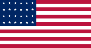
This timeline of United States government military operations, based in part on reports by the Congressional Research Service, shows the years and places in which U.S. military units participated in armed conflicts or occupation of foreign territories. Items in bold are wars most often considered to be major conflicts by historians and the general public.

The Standing Rock Reservation lies across the border between North and South Dakota in the United States, and is inhabited by ethnic "Hunkpapa and Sihasapa bands of Lakota Oyate and the Ihunktuwona and Pabaksa bands of the Dakota Oyate," as well as the Hunkpatina Dakota. The Ihanktonwana Dakota are the Upper Yanktonai, part of the collective of Wiciyena. The sixth-largest Native American reservation in land area in the US, Standing Rock includes all of Sioux County, North Dakota, and all of Corson County, South Dakota, plus slivers of northern Dewey and Ziebach counties in South Dakota, along their northern county lines at Highway 20.

Fort Gibson is a historic military site next to the modern city of Fort Gibson, in Muskogee County Oklahoma. It guarded the American frontier in Indian Territory from 1824 to 1888. When it was constructed, the fort was farther west than any other military post in the United States. It formed part of the north–south chain of forts that was intended to maintain peace on the frontier of the American West and to protect the southwestern border of the Louisiana Purchase. The fort succeeded in its peacekeeping mission for more than 50 years, as no massacres or battles occurred there.

Fort Fetterman was constructed in 1867 by the United States Army on the Great Plains frontier in Dakota Territory, approximately 11 miles northwest of present-day Douglas, Wyoming. Located high on the bluffs south of the North Platte River, it served as a major base for the start of several United States military expeditions against warring Native American tribes. The fort is listed on the National Register of Historic Places.

The history of Idaho in the American Civil War is atypical, as the territory was far from the battlefields.

During the American Civil War, most of what is now the U.S. state of Oklahoma was designated as the Indian Territory. It served as an unorganized region that had been set aside specifically for Native American tribes and was occupied mostly by tribes which had been removed from their ancestral lands in the Southeastern United States following the Indian Removal Act of 1830. As part of the Trans-Mississippi Theater, the Indian Territory was the scene of numerous skirmishes and seven officially recognized battles involving both Native American units allied with the Confederate States of America and Native Americans loyal to the United States government, as well as other Union and Confederate troops.
Fort Cobb was a United States Army post established in what is now Caddo County, Oklahoma in 1859 to protect relocated Native Americans from raids by the Comanche, Kiowa, and Cheyenne. The fort was abandoned by Maj. William H. Emory at the beginning of the Civil War, but then occupied by Confederate forces from 1861–1862. The post was eventually reoccupied by US forces starting in 1868. After establishing Fort Sill the US Army abandoned Fort Cobb. Today there is little left of the former military post.

Black Beaver or Se-ket-tu-may-qua was a trapper and interpreter who worked for the American Fur Company. He served as a scout and guide as he was fluent in English, as well as several European and Native American languages. He is credited with establishing the California and Chisholm trails.

Pawnee Scouts were employed by the United States Army in the latter half of the 19th century. Like other groups of Indian scouts, Pawnee men were recruited in large numbers to aid in the ongoing conflicts between settlers and the Native Americans in the United States. Because the Pawnee people were at war with the Sioux and Cheyenne and had been under constant pressure and aggression by those tribes, some of them were more than willing to serve with the army for pay. A number of Pawnee served between 1864 and 1871. They were armed with rifles, revolvers and were issued scout uniforms.
