Related Research Articles
Multiple-image Network Graphics (MNG) is a graphics file format, published in 2001, for animated images. Its specification is publicly documented and there are free software reference implementations available.

In computer graphics and digital photography, a raster graphic is a mechanism that represents a two-dimensional image as a rectangular matrix or grid of square pixels, viewable via a computer display, paper, or other display medium. A raster is technically characterized by the width and height of the image in pixels and by the number of bits per pixel. Raster images are stored in image files with varying dissemination, production, generation, and acquisition formats.
Scalable Vector Graphics (SVG) is an XML-based vector image format for two-dimensional graphics with support for interactivity and animation. The SVG specification is an open standard developed by the World Wide Web Consortium (W3C) since 1999.

A website is a collection of web pages and related content that is identified by a common domain name and published on at least one web server. Notable examples are wikipedia.org, google.com, and amazon.com.
Web design encompasses many different skills and disciplines in the production and maintenance of websites. The different areas of web design include web graphic design; user interface design ; authoring, including standardised code and proprietary software; user experience design ; and search engine optimization. Often many individuals will work in teams covering different aspects of the design process, although some designers will cover them all. The term "web design" is normally used to describe the design process relating to the front-end design of a website including writing markup. Web design partially overlaps web engineering in the broader scope of web development. Web designers are expected to have an awareness of usability and if their role involves creating markup then they are also expected to be up to date with web accessibility guidelines.
Graphics are visual images or designs on some surface, such as a wall, canvas, screen, paper, or stone, to inform, illustrate, or entertain. In contemporary usage, it includes a pictorial representation of data, as in design and manufacture, in typesetting and the graphic arts, and in educational and recreational software. Images that are generated by a computer are called computer graphics.
A digital image is an image composed of picture elements, also known as pixels, each with finite, discrete quantities of numeric representation for its intensity or gray level that is an output from its two-dimensional functions fed as input by its spatial coordinates denoted with x, y on the x-axis and y-axis, respectively. Depending on whether the image resolution is fixed, it may be of vector or raster type. By itself, the term "digital image" usually refers to raster images or bitmapped images.
An image server is web server software which specializes in delivering images. However, not all image servers support HTTP or can be used on web sites.
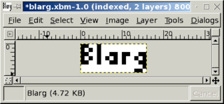
In computer graphics, the X Window System used X BitMap (XBM), a plain text binary image format, for storing cursor and icon bitmaps used in the X GUI. The XBM format is superseded by XPM, which first appeared for X11 in 1989.
Image file formats are standardized means of organizing and storing digital images. An image file format may store data in an uncompressed format, a compressed format, or a vector format. Image files are composed of digital data in one of these formats so that the data can be rasterized for use on a computer display or printer. Rasterization converts the image data into a grid of pixels. Each pixel has a number of bits to designate its color. Rasterizing an image file for a specific device takes into account the number of bits per pixel that the device is designed to handle.
Open XML Paper Specification is an open specification for a page description language and a fixed-document format. Microsoft developed it as the XML Paper Specification (XPS). In June 2009, Ecma International adopted it as international standard ECMA-388.
Cartesian Perceptual Compression is a proprietary image file format. It was designed for high compression of black-and-white raster Document Imaging for archival scans.

gvSIG is a geographic information system (GIS), that is, a desktop application designed for capturing, storing, handling, analyzing and deploying any kind of referenced geographic information in order to solve complex management and planning problems. gvSIG is known for having a user-friendly interface, being able to access the most common formats, both vector and raster ones. It features a wide range of tools for working with geographic-like information.
SQL Server Reporting Services (SSRS) is a server-based report generating software system from Microsoft. It is part of a suite of Microsoft SQL Server services, including SSAS and SSIS.
Kosmo is a desktop geographic information system (GIS) with advanced functions. It is the first of a series of developments that are being made available to the community.

The Geospatial Data Abstraction Library (GDAL) is a computer software library for reading and writing raster and vector geospatial data formats, and is released under the permissive X/MIT style free software license by the Open Source Geospatial Foundation. As a library, it presents a single abstract data model to the calling application for all supported formats. It may also be built with a variety of useful command line interface utilities for data translation and processing. Projections and transformations are supported by the PROJ library.

A Web mapping or an online mapping is the process of using the maps delivered by geographic information systems (GIS) on the Internet, more specifically in the World Wide Web (WWW). A web map or an online map is both served and consumed, thus web mapping is more than just web cartography, it is a service by which consumers may choose what the map will show. Web GIS emphasizes geodata processing aspects more involved with design aspects such as data acquisition and server software architecture such as data storage and algorithms, than it does the end-user reports themselves.
Distributed GIS refers to GI Systems that do not have all of the system components in the same physical location. This could be the processing, the database, the rendering or the user interface. It represents a special case of distributed computing, with examples of distributed systems including web-based GIS and Mobile GIS. Distribution of resources provides corporate and enterprise-based models for GIS. Distributed GIS permits a shared services model, including data fusion based on Open Geospatial Consortium (OGC) web services. Distributed GIS technology enables modern online mapping systems, Location-based services (LBS), web-based GIS and numerous map-enabled applications. Other applications include transportation, logistics, utilities, farm / agricultural information systems, real-time environmental information systems and the analysis of the movement of people. In terms of data, the concept has been extended to include volunteered geographical information. Distributed processing allows improvements to the performance of spatial analysis through the use of techniques such as parallel processing.

The First International Conference on the World-Wide Web was the first-ever conference about the World Wide Web, and the first meeting of what became the International World Wide Web Conference. It was held on May 25 to 27, 1994 in Geneva, Switzerland. The conference had 380 participants, who were accepted out of 800 applicants. It has been referred to as the "Woodstock of the Web".
JPEG XL is a royalty-free raster-graphics file format that supports both lossy and lossless compression. It is designed to outperform existing raster formats and thus to become their universal replacement.
References
- ↑ Putz, Steve. "Interactive Information Services Using World-Wide Web Hypertext". Archived from the original on June 28, 2011.
{{cite web}}: CS1 maint: unfit URL (link)