The Endau River is a river that flows through the Malaysian state of Johor and empties to the South China Sea. The river is the namesake of Endau Rompin National Park which is located to the northeast of Johor.

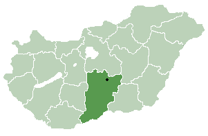
Móricgát is a village in Bács-Kiskun county, in the Southern Great Plain region of southern Hungary.
Suess Glacier is a glacier between Canada Glacier and Lacroix Glacier, flowing south into Taylor Valley in Victoria Land, Antarctica. It was charted and named by the British Antarctic Expedition under Scott, 1910–13, for Professor Eduard Suess, noted Austrian geologist and paleontologist.
Los Navalucillos is a municipality located in the province of Toledo, Castile-La Mancha, Spain. According to the 2006 census (INE), the municipality has a population of 2636 inhabitants.
Ngükang is a village in the Tibet Autonomous Region of China.

Mese is a town in the Kayah State of eastern part of Burma.

Makowa is a village in the administrative district of Gmina Fredropol, within Przemyśl County, Subcarpathian Voivodeship, in south-eastern Poland, close to the border with Ukraine. It lies approximately 10 kilometres (6 mi) south-west of Fredropol, 19 km (12 mi) south-west of Przemyśl, and 66 km (41 mi) south-east of the regional capital Rzeszów.

Zajeziorze is a village in the administrative district of Gmina Samborzec, within Sandomierz County, Świętokrzyskie Voivodeship, in south-central Poland. It lies approximately 2 kilometres (1 mi) south of Samborzec, 9 km (6 mi) south-west of Sandomierz, and 79 km (49 mi) east of the regional capital Kielce.

Cegły is a village in the administrative district of Gmina Ostrów Wielkopolski, within Ostrów Wielkopolski County, Greater Poland Voivodeship, in west-central Poland. It lies approximately 5 kilometres (3 mi) west of Ostrów Wielkopolski and 96 km (60 mi) south-east of the regional capital Poznań.

Rudzienice is a village in the administrative district of Gmina Iława, within Iława County, Warmian-Masurian Voivodeship, in northern Poland. It lies approximately 8 kilometres (5 mi) north-east of Iława and 58 km (36 mi) west of the regional capital Olsztyn.

Suliszewice is a village in the administrative district of Gmina Łobez, within Łobez County, West Pomeranian Voivodeship, in north-western Poland. It lies approximately 4 kilometres (2 mi) east of Łobez and 76 km (47 mi) east of the regional capital Szczecin.
Menzel Kamel is a town and commune in the Monastir Governorate, Tunisia.
Golobradovo is a village in Stambolovo Municipality, in Haskovo Province, in southern Bulgaria.

Meskiana is a town and commune in Oum El Bouaghi Province, Algeria. According to the 1998 census it has a population of 25,849. It was the birthplace of novelist Yamina Méchakra.
Mäense is a village in Lääneranna Parish, Pärnu County, in western Estonia, covering 6.537 km². It is located along the Highway 190 which links the village to National Road 10, and is 1 kilometre away from Massu, the nearest village, and about 110 km in straight-line distance and 128 km in road distance away from Tallinn, the capital of Estonia. It had a population of 20 in the 2000 census and a population of 12 in the 2011 Census. The population is 50% male and 50% female, and there are no children under the age of 18, with 25% over 65. All inhabitants of the village identify as ethnic Estonians. The village is surrounded by farmland and woodland.
Ridase is a village in Lääneranna Parish, Pärnu County, in western Estonia.
The Cragsman Peaks are peaks on the west side of Marshall Bay, extending from Cape Vik northwest to Coldblow Col on the south coast of Coronation Island, in the South Orkney Islands. They were surveyed by the Falkland Islands Dependencies Survey in 1956–58 and so named by the UK Antarctic Place-Names Committee because the peaks provide a "climbers' paradise."
Renard Glacier is a glacier flowing into the southernmost part of Charlotte Bay, on the west coast of Graham Land. Charted by the Belgian Antarctic Expedition under Gerlache, 1897-99. Named by the United Kingdom Antarctic Place-Names Committee (UK-APC) in 1960 for Charles Renard (1847–1905), who, with A.C. Krebs, constructed and flew the first dirigible airship capable of steady flight under control, in 1884.
Adohoun is an arrondissement in the Mono department of Benin. It is an administrative division under the jurisdiction of the commune of Athiémè. According to the population census conducted by the Institut National de la Statistique Benin on February 15, 2002, the arrondissement had a total population of 10,622.
Slyudyanka is the name of several inhabited localities in Russia:


