Yarloop Workshops

Last updated

Yarloop Workshops
Yarloop wkshop gnangarra 08.jpg
Inside the main workshop, major features of the image are a self-propelled steam tractor, a steam locomotive, and wheel lathe
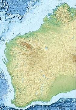
Australia Western Australia relief location map.png
Red pog.svg
Location of Yarloop Workshops
Yarloop Workshops
Location Yarloop, Western Australia, Western Australia
Coordinates 32°58′S115°54′E / 32.96°S 115.9°E / -32.96; 115.9
Defunct
Designated12 May 2000
Reference no. 1203

The Yarloop Workshops was a railway and timber mill machinery workshop, situated in the town of Yarloop, Western Australia.

Contents

The workshops operated from 1901 to 1978. Originally built by Charles and Edwin Millar [1] on the site of the first timber mill in the area, the operations expanded to become the support facility for Millars Karri and Jarrah Forests Limited's 26 timber mills and the rail network that connected them. The workshops hand-crafted most of the parts necessary to maintain the equipment rather than experience delays in obtaining parts from the United Kingdom. After suffering extensive damage from Cyclone Alby in 1978, Millars moved their operation to a site just outside the town on the South Western Highway. The site then changed ownership several times until it was bought by Bunnings in 1983. [2]
History

In 1895 the Millar brothers built a timber mill (?) on the site and as production increased the need to maintain equipment meant that the place was expanded to incorporate the various machinery workshops until 1901 when the site's sole function was for the maintenance of Millars equipment. During both World War I and World War II the workshops were converted to manufacture armaments. In the 1930s the timber industry in the region peaked with Millars operating 26 sawmills and an extensive private railway system to support them. The workshops became the centre of the operations employing over 100 people. The workshops included a foundry making the parts as necessary; as part of this is the largest collection of wooden patterns were made and are still retained on site in the workshops. [3] [4]

2016 fire

On 7 January 2016 the workshop, along with most of the townsite, was destroyed by the 2016 Waroona bushfire. [4] [5]

Rebuilding

Rebuilding of the Yarloop Workshops in January 2023 Rebuilding of Yarloop Workshop, January 2023 10.jpg
Rebuilding of the Yarloop Workshops in January 2023

In January 2022, it was announced that the workshops would be rebuilt, with the first stage focusing on rebuilding the steam workshops. [6]

Related Research Articles

<span class="mw-page-title-main">Darling Scarp</span> Scarp east of Perth, Western Australia

The Darling Scarp, also referred to as the Darling Range or Darling Ranges, is a low escarpment running north–south to the east of the Swan Coastal Plain and Perth, Western Australia. The escarpment extends generally north of Bindoon, to the south of Pemberton. The adjacent Darling Plateau goes easterly to include Mount Bakewell near York and Mount Saddleback near Boddington. It was named after the Governor of New South Wales, Lieutenant-General Ralph Darling.

The Peel region is one of the nine regions of Western Australia. It is located on the west coast of Western Australia, about 75 km (47 mi) south of the state capital, Perth. It consists of the City of Mandurah, and the Shires of Boddington, Murray, Serpentine-Jarrahdale and Waroona.

<span class="mw-page-title-main">Waroona, Western Australia</span> Town in Western Australia

Waroona is a town located in the Peel region of Western Australia along the South Western Highway, between Pinjarra and Harvey. The town is the seat of the Shire of Waroona. At the 2016 census, Waroona had a population of 2,934.

<span class="mw-page-title-main">Yarloop, Western Australia</span> Town in Western Australia

Yarloop is a town in the South West of Western Australia along the South Western Highway, between Waroona and Harvey. At the 2016 census, Yarloop had a population of 395. On 7 January 2016 a bushfire destroyed most of the town.

<span class="mw-page-title-main">Cookernup, Western Australia</span> Town in Western Australia

Cookernup is a town in the South West of Western Australia near the South Western Highway, between Waroona and Harvey.

<span class="mw-page-title-main">Harvey, Western Australia</span> Town in Western Australia

Harvey is a town located in the South West of Western Australia along the South Western Highway, 140 kilometres (87 mi) south of Perth, between Pinjarra and Bunbury. It has a population of 2,750. Harvey Town is known for its dairy industry and oranges.

<span class="mw-page-title-main">Department of Fire and Emergency Services</span>

The Department of Fire and Emergency Services (DFES) is a government department that is responsible for fire and emergency services in Western Australia. The department came into being in 2012 as a result of the Perth Hills Bush Fire review.DFES is responsible for the management, training and funding of career and volunteer Services including:

<span class="mw-page-title-main">South Western Highway</span> Highway in Western Australia

South Western Highway is a highway in the South West region of Western Australia connecting Perth's southeast with Walpole. It is a part of the Highway 1 network for most of its length. It is about 406 kilometres (252 mi) long.

<span class="mw-page-title-main">Jarrahdale, Western Australia</span> Suburb of Perth, Western Australia

Jarrahdale is a small historic town located 45 km south-east of Perth, Western Australia in the Darling Range. The name is derived from its situation in a jarrah forest. Established in the late 1800s as the state's first major timber milling operation, it played a key role in the development of Western Australia through the exportation of jarrah around the world. At the 2016 census, Jarrahdale had a population of 1,192. Since 2001, the historic precinct has been managed by the state's National Trust organisation alongside private residential and tourism-oriented developments.

<span class="mw-page-title-main">Nanga Brook, Western Australia</span> Town in Western Australia

Nanga Brook is a former town located in the Peel region of Western Australia in the Lane Poole Reserve between Dwellingup and Waroona.

<span class="mw-page-title-main">Shire of Waroona</span> Local government area in Western Australia

The Shire of Waroona is a local government area in the Peel region of Western Australia between Mandurah and Harvey and about 110 kilometres (68 mi) south of Perth, the state capital. The Shire covers an area of about 835 km² (322 mi²) and its seat of government is the town of Waroona.

<span class="mw-page-title-main">Timber railway lines of Western Australia</span> Railway lines utilised by timber industry in Western Australia

The network of railway lines in Western Australia associated with the timber and firewood industries is as old as the mainline railway system of the former Western Australian Government Railways system.

Millars' Karri and Jarrah Company (1902) Limited, commonly known as Millars, was a Western Australian focused timber and timber railway company.

The Department of Parks and Wildlife (DPaW) was the department of the Government of Western Australia responsible for managing lands described in the Conservation and Land Management Act 1984 and implementing the state's conservation and environment legislation and regulations. The minister responsible for the department was the Minister for the Environment.

<span class="mw-page-title-main">2015–16 Australian bushfire season</span>

The most destructive bushfire season in terms of property loss since the 2008–09 Australian bushfire season, occurred in the summer of 2015–16, with the loss of 408 houses and at least 500 non-residential buildings as a result of wild fires between 1 June 2015 and 31 May 2016. The season also suffered the most human fatalities since the 2008–09 Australian bushfire season; 6 died in Western Australia, 2 in South Australia and 1 in New South Wales. 8 deaths were as a direct result of fire, and a volunteer firefighter died due to unrelated health complications while on duty.

<span class="mw-page-title-main">Jonathan Somers</span> Machinery manufacturer, former mayor of Toodyay

Jonathan Somers (1862-1928) was a machinery manufacturer and mayor of Toodyay. He arrived in Toodyay as a blacksmith from Newcastle, New South Wales, and over time built up a major industry manufacturing vehicles and machinery using local timbers. Examples of his work won recognition at the 1899 Western Australian International Mining and Industrial Exhibition, also known as the Coolgardie Exhibition, and in 1900 he won first prize for a wagon at the Glasgow International Exhibition. His contribution to public life led to him becoming the Mayor of Newcastle in 1908. It was largely due to his influence as mayor that the town of Newcastle was renamed Toodyay in 1910.

Mornington, also known as Mornington Mills, is the site of former timber saw mills and a community on the Darling Range in Western Australia. It was part of the operations of Millars Karri and Jarrah Forests Limited. At the 2021 census, the area had a population of 42.

<span class="mw-page-title-main">Marrinup, Western Australia</span> Ghost town in Western Australia

Marrinup is a ghost town in the Peel region of Western Australia between Dwellingup and Pinjarra. Its local government area is the Shire of Murray. The town was destroyed in the 1961 bushfires and the townsite is now used as a campground. The ruins of the townsite are heritage listed. Little remains of the town other than an old bridge over Marrinup Creek and some wooden railway sleepers.

The 2016 Waroona-Yarloop bushfire started in the east in the forests of the Darling Scarp before reaching the Swan Coastal Plain and continued westwards until it reached the Indian Ocean. It started as a lightning strike that caused two fires in the Lane Poole Reserve state forest near Dwellingup, Western Australia on 5 January 2016 and then burnt close to Waroona and then through the historical town of Yarloop, destroying it, before continuing southwards towards the outskirts of the town of Harvey and westwards to Preston Beach. Around 70,000 ha of land was burnt, two people died and at least 166 buildings were destroyed in Yarloop alone with only ninety buildings surviving. In total 181 buildings and structures were lost with the total cost of fighting the fire and the cost of the damage and the loss resulting estimated at $155 million.

<span class="mw-page-title-main">Whittaker, Western Australia</span> Locality in the Shire of Murray

Whittaker is a rural locality of the Shire of Murray in the Peel Region of Western Australia. North Dandalup Dam and its reservoir are located within the locality in its north-western corner.

References

  1. "Yarloop". Harvey History Online. 14 April 1990. Retrieved 8 January 2016.
  2. "History". Yarloop Workshops. Yarloop Workshops Inc. Retrieved 7 December 2008.
  3. "REGISTER OF HERITAGE PLACES - ASSESSMENT DOCUMENTATION" (PDF). Heritage Council of Western Australia. Retrieved 7 December 2008.
  4. 1 2 "WA fires: historic Yarloop timber workshops destroyed by Waroona blaze". WA Today. 8 January 2016. Retrieved 8 January 2016.
  5. Tyler, Debra (photographer); Smith, Tamara (photographer); Vitale, Brad (photographer); Jackson, John (photographer) (2008), Waroona and Yarloop before and after the bushfire of 6th January 2016 , retrieved 3 February 2021
  6. "Redevelopment begins at Yarloop Workshops". Bunbury Mail. 26 January 2022. Retrieved 24 January 2023.

32°57′33″S115°54′01″E / 32.9593°S 115.9004°E / -32.9593; 115.9004