
Jujuy is a province of Argentina, located in the extreme northwest of the country, at the borders with Chile and Bolivia. The only neighboring Argentine province is Salta to the east and south.
The Scaife Mountains is a group of mountains rising west of Prehn Peninsula and between the Ketchum and Ueda glaciers, in Palmer Land, at the base of Antarctic Peninsula.

Argentine Antarctica is an area on Antarctica claimed by Argentina as part of its national territory. It consists of the Antarctic Peninsula and a triangular section extending to the South Pole, delimited by the 25° West and 74° West meridians and the 60° South parallel. This region overlaps with British and Chilean claims in Antarctica. None of these claims have widespread international recognition.
La Quiaca is a small city in the north of the province of Jujuy, Argentina, on the southern bank of the La Quiaca River, opposite the town of Villazón, Bolivia. It lies at the end of National Route 9, 289 km (180 mi) from San Salvador de Jujuy, and at an altitude of 3,442 m (11,293 ft) above mean sea level.
Santa Ana (Tucumán) is a settlement in Tucumán Province in northern Argentina.
Carro Quemado is a village and rural locality (municipality) in La Pampa Province in Argentina.
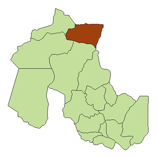
Puesto Viejo is a town and municipality in Jujuy Province in Argentina.
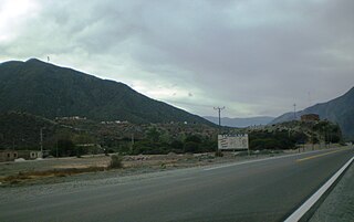
Tumbaya is a town and municipality in Jujuy Province in Argentina.
San José is a rural municipality and village in Jujuy Province in Argentina.
Yavi Chico is a rural municipality and village in Jujuy Province in Argentina.
Shaqui is a municipality and village in La Rioja Province in northwestern Argentina.
La Dorada is a village and municipality in Catamarca Province in northwestern Argentina.

Las Juntas (Ambato) is a village and municipality in Catamarca Province in northwestern Argentina.
Manantiales (Argentina) is a village and municipality in Catamarca Province in northwestern Argentina.

Barrio Bancario is a municipality in Catamarca Province in northwestern Argentina. It is located within the Greater San Fernando del Valle de Catamarca area.
Sumalao is a municipality in Catamarca Province in northwestern Argentina. It is located within the Greater San Fernando del Valle de Catamarca area.
Los Altos (Catamarca) is a town and municipality in Catamarca Province in northwestern Argentina.

Conway Island lies in Crates Bay to the west of Lens Peak and facing Bregare Point, off the northeast coast of Stresher Peninsula, Graham Land. It was photographed by Hunting Aerosurveys Ltd in 1956–57, and mapped from these photos by the Falkland Islands Dependencies Survey. It was named by the UK Antarctic Place-Names Committee in 1959 for Martin Conway, 1st Baron Conway of Allington, an English mountaineer and a pioneer of polar skiing during his crossing of Vestspitsbergen in 1896.

Melville Glacier is a glacier, 12 nautical miles (22 km) long, between Mapple Glacier and Pequod Glacier on the east coast of Graham Land, Antarctica. It flows eastwards between Stevrek Ridge and Parlichev Ridge in the Aristotle Mountains, to enter Domlyan Bay in the Weddell Sea. It was surveyed by the Falkland Islands Dependencies Survey in 1947 and 1955, and was named by the UK Antarctic Place-Names Committee after Herman Melville, the author of the 1851 novel Moby-Dick. Several other features in the area, such as Mount Ahab, are named after characters in the story.
