New South Wales is a state on the east coast of Australia. It borders three other states, Queensland to the north, Victoria to the south, and South Australia to the west. Its coast borders the Coral and Tasman Seas to the east. The Australian Capital Territory is an enclave within the state. New South Wales' state capital is Sydney, which is also Australia's most populous city. In June 2020, the population of New South Wales was over 8.1 million, making it Australia's most populous state. Just under two-thirds of the state's population, 5.3 million, live in the Greater Sydney area. The demonym for inhabitants of New South Wales is New South Welshmen.

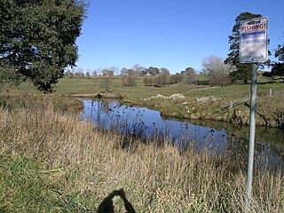
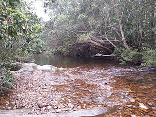
Peel River, a watercourse that is part of the Namoi catchment within the Murray–Darling basin, is located in the North West Slopes and Plains district of New South Wales, Australia.

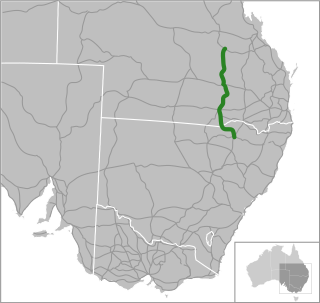
The Castlereagh Highway is a 790-kilometre (490 mi) state highway located in New South Wales and Queensland, Australia. The highway's northern terminus is at a junction with the Carnarvon Highway, south of St George, Queensland. Its southern terminus is at a junction with the Great Western Highway at Marrangaroo, 10 kilometres (6.2 mi) north-west of Lithgow. From north to south the highway traverses South West Queensland and the North West Slopes, Orana, and Central West regions of New South Wales.

The Carnarvon Highway is a state highway of Queensland, Australia, linking Moree south of the NSW/QLD border, via the town of St George, eventually to the township of Rolleston. Formerly, north of Roma it was known as the Carnarvon Developmental Road. National Route 46 runs from Mungindi to the Castlereagh Highway just south of St George. From here, the A55 continues north, through St George and Surat to Roma. The A7 then continues north from Roma to Rolleston, which continues along the Dawson Highway and Gregory Highway to Emerald and Charters Towers.

Wyong is an electoral district of the Legislative Assembly in the Australian state of New South Wales. The district is a 640.55 km² urban and semi-rural electorate on the Central Coast. It covers part of Central Coast Council, including the towns of Wyong and Toukley.
The Billabong Creek, a perennial river of the Murrumbidgee catchment within the Murray-Darling basin, is located in the South West Slopes region of New South Wales, Australia.
Leichhardt was an electoral district, located in the colony of New South Wales, Australia, and part of the New South Wales Legislative Assembly. The district was created for the July 1859 election, partly replacing the United Pastoral Districts of Moreton, Wide Bay, Burnett, Maranoa, Leichhardt and Port Curtis in the present day central Queensland. It included the towns of Rockhampton and Emerald, the pastoral districts around the Leichhardt River in the Gulf of Carpentaria region and Port Curtis (Gladstone). It was abolished in December 1859 as a result of the separation of Queensland.
Bimberamala River, a perennial river of the Clyde River catchment, is located in the Southern Tablelands and the upper ranges of the South Coast regions of New South Wales, Australia.
Bow River, a partly perennial stream of the Hunter River catchment, is located in the Hunter district of New South Wales, Australia.
Bowman River, a perennial river of the Gloucester River catchment, is located in the Upper Hunter district of New South Wales, Australia.

Cooplacurripa River, a perennial river of the Manning River catchment, is located in the Northern Tablelands and Mid North Coast districts of New South Wales, Australia.
Mammy Johnsons River, a mostly perennial river of the Mid-Coast Council system, is located in the Mid North Coast and Upper Hunter regions of New South Wales, Australia.
The Nullica River is an intermittently closed semi-mature saline coastal lagoon or perennial river, located in the South Coast region of New South Wales, Australia.

Pages River, a perennial river of the Hunter River catchment, is located in the Hunter region of New South Wales, Australia.
Thone River, a perennial stream of the Hastings River catchment, is located in the Mid North Coast region of New South Wales, Australia.

Tia River, a perennial stream of the Macleay River catchment, is located in the Northern Tablelands district of New South Wales, Australia.

Yadboro River, a perennial river of the Clyde River catchment, is located in the Southern Tablelands and the upper ranges of the South Coast regions of New South Wales, Australia.

The Sandy Creek, a perennial stream of the Richmond River catchment, is located in Northern Rivers region in the state of New South Wales, Australia.
The 1980–81 Sheffield Shield season was the 79th season of the Sheffield Shield, the domestic first-class cricket competition in Australia. It started on 17 October 1980 and finished on 9 March 1981. Going into the final round of matches, New South Wales, Western Australia and Queensland were all in a position to win the Shield. It would be Western Australia, who found form in the second half of the season with four straight victories, who would emerge victorious, drawing against Queensland to secure its eighth championship.

55 Lower Fort Street, Millers Point is a heritage-listed former house and now professional offices located at 55 Lower Fort Street, in the inner city Sydney suburb of Millers Point, in the City of Sydney local government area of New South Wales, Australia. The property was added to the New South Wales State Heritage Register on 2 April 1999.


