Yenston Priory

Last updated

Yenston Priory was a Benedictine priory in Henstridge, Somerset, England.

Henstridge village in the United Kingdom

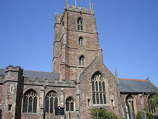
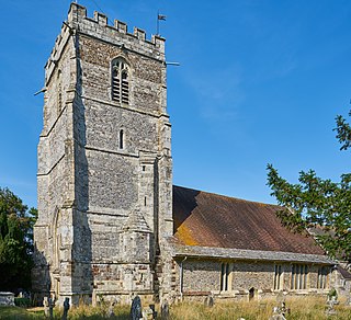
Henstridge is a village and civil parish in Somerset, England, situated 5 miles (8.0 km) east of Sherborne in the South Somerset district, near the border with Dorset. The parish includes the hamlet of Yenston. The village has a population of 1,814.

Somerset County of England

Somerset is a county in South West England which borders Gloucestershire and Bristol to the north, Wiltshire to the east, Dorset to the south-east and Devon to the south-west. It is bounded to the north and west by the Severn Estuary and the Bristol Channel, its coastline facing southeastern Wales. Its traditional border with Gloucestershire is the River Avon. Somerset's county town is Taunton.

England Country in north-west Europe, part of the United Kingdom

England is a country that is part of the United Kingdom. It shares land borders with Wales to the west and Scotland to the north. The Irish Sea lies west of England and the Celtic Sea to the southwest. England is separated from continental Europe by the North Sea to the east and the English Channel to the south. The country covers five-eighths of the island of Great Britain, which lies in the North Atlantic, and includes over 100 smaller islands, such as the Isles of Scilly and the Isle of Wight.

It was a cell of the Abbey of Sever in Normandy, France. It was founded by Hugh d'Avranches, 1st Earl of Chester, who died around 1100 and was also known as Hugh Abrincus, [1] and Hugh Lupus. [2] In 1158 the abbey was confirmed by Pope Adrian IV. [3]

Normandy Administrative region of France

Normandy is the northwesternmost of the 18 regions of France, roughly referring to the historical Duchy of Normandy.

Pope Adrian IV Pope from 1154 to 1159

Pope Adrian IV, also known as Hadrian IV, was Pope from 4 December 1154 to his death in 1159.

Around 1468 it was granted to Eton College. The buildings had been demolished before 1450. [1] and later by Edward Seymour, 1st Duke of Somerset. [3] After the dissolution of the monasteries the land was held by Sir Thomas Bell. [1]
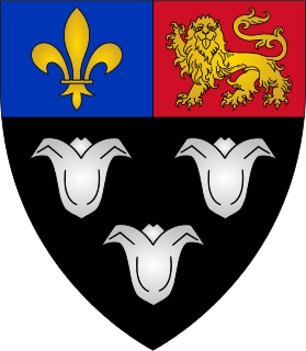
Eton College Independent boarding school in Windsor and Maidenhead, UK

Eton College is a 13–18 independent boarding school and sixth form for boys in the parish of Eton, near Windsor in Berkshire, England. It was founded in 1440 by King Henry VI as Kynge's College of Our Ladye of Eton besyde Windesore , as a sister institution to King's College, Cambridge, making it the 18th-oldest Headmasters' and Headmistresses' Conference school. Eton's history and influence have made Eton one of the most prestigious schools in the world.

Edward Seymour, 1st Duke of Somerset Nobleman

Edward Seymour, 1st Duke of Somerset, was Lord Protector of England during part of the Tudor period from 1547 until 1549 during the minority of his nephew, King Edward VI (1547–1553). Despite his popularity with the common people, his policies often angered the gentry and he was overthrown. He was the eldest brother of Queen Jane Seymour (d. 1537), the third wife of King Henry VIII.

Thomas Bell (Mayor of Gloucester) English merchant and politician

Sir Thomas Bell the Elder (1486–1566) was a cap manufacturer, mayor of Gloucester, and member of Parliament. He was one of the city's largest employers and wealthiest citizens and a great benefactor of the city and its people. He is described in contemporaneous documents as a "capper". He invested much of his wealth in real estate released on the Dissolution of the Monasteries, sometimes in partnership with Richard Duke, of Otterton, Devon, Clerk of the Court of Augmentations.

Stone from the priory was used to build Monmouth House in the village, and traces of its buildings may remain in the outhouses. [4] There are also surface marks in surrounding fields, however these may not be from the building itself but from the excavation of stone. [5]
Related Research Articles

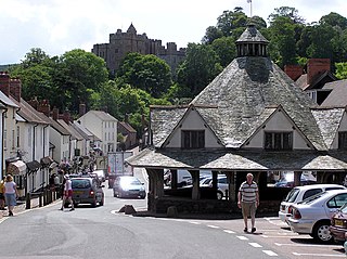
Dunster village, civil parish and former manor within the English county of Somerset

Dunster is a village, civil parish and former manor within the English county of Somerset, today just within the north-eastern boundary of the Exmoor National Park. It lies on the Bristol Channel coast 2.5 miles (4 km) south-southeast of Minehead and 20 miles (32 km) northwest of Taunton. The United Kingdom Census of 2011 recorded a parish population of 817.

Montacute Priory human settlement in United Kingdom

Montacute Priory was a Cluniac priory of the Benedictine order in Montacute, Somerset, England.

Cannington Nunnery human settlement in United Kingdom

Cannington Nunnery was established around 1138 and dissolved in 1536 in Cannington, Somerset, England.

Dunster Priory

Dunster Priory was established as a Benedictine monastery around 1100 in Dunster, Somerset, England.

Cranborne Priory priory in Cranborne, Dorset, UK

Cranborne Priory was a priory in Cranborne in Dorset, England. The priory church survives as Cranborne's parish church, the Church of St Mary and St Bartholomew, and is a Grade I listed building, with parts of the building dating back to the 12th century.

Horton Priory was a priory at Horton in Dorset, England.

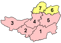
Scheduled monuments in Somerset

There are over 670 scheduled monuments in the ceremonial county of Somerset in South West England. The county consists of a non-metropolitan county, administered by Somerset County Council, which is divided into five districts, and two unitary authorities. The districts of Somerset are West Somerset, South Somerset, Taunton Deane, Mendip and Sedgemoor. The two administratively independent unitary authorities, which were established on 1 April 1996 following the breakup of the county of Avon, are North Somerset and Bath and North East Somerset. These unitary authorities include areas that were once part of Somerset before the creation of Avon in 1974.

References

  1. 1 2 3 "Benedictine priory, Yenston". Somerset Historic Environment Record. Somerset County Council. Retrieved 30 September 2016.
  2. "Henstridge - Herringby', A Topographical Dictionary of England". British History Online. 1848. pp. 482–491. Retrieved 26 September 2010.
  3. 1 2 Baggs, A.P.; Siraut, M.C. "Henstridge In: A History of the County of Somerset: Volume 7, Bruton, Horethorne and Norton Ferris Hundreds". British History Online. Victoria County History. Retrieved 30 September 2016.
  4. "Monmouth House, Henstridge". British Listed Buildings. Retrieved 26 September 2010.
  5. "Monument No. 202479". Pastscape. Historic England. Retrieved 30 September 2016.

Coordinates: 50°59′19″N2°24′39″W / 50.9887°N 2.4107°W / 50.9887; -2.4107

Geographic coordinate system Coordinate system

A geographic coordinate system is a coordinate system that enables every location on Earth to be specified by a set of numbers, letters or symbols. The coordinates are often chosen such that one of the numbers represents a vertical position and two or three of the numbers represent a horizontal position; alternatively, a geographic position may be expressed in a combined three-dimensional Cartesian vector. A common choice of coordinates is latitude, longitude and elevation. To specify a location on a plane requires a map projection.