
The Pacific Ocean is the largest and deepest of Earth's five oceanic divisions. It extends from the Arctic Ocean in the north to the Southern Ocean in the south, and is bounded by the continents of Asia and Oceania in the west and the Americas in the east.

The Philippines, officially the Republic of the Philippines, is an archipelagic country in Southeast Asia. In the western Pacific Ocean, it consists of 7,641 islands which are broadly categorized in three main geographical divisions from north to south: Luzon, Visayas, and Mindanao. The Philippines is bounded by the South China Sea to the west, the Philippine Sea to the east, and the Celebes Sea to the south. It shares maritime borders with Taiwan to the north, Japan to the northeast, Palau to the east and southeast, Indonesia to the south, Malaysia to the southwest, Vietnam to the west, and China to the northwest. It is the world's twelfth-most-populous country, with diverse ethnicities and cultures. Manila is the country's capital, and its most populated city is Quezon City; both are within Metro Manila.
The history of the Philippines dates from the earliest hominin activity in the archipelago at least 709,000 years ago. Homo luzonensis, a species of archaic humans, was present on the island of Luzon at least 67,000 years ago.

Luzon is the largest and most populous island in the Philippines. Located in the northern portion of the Philippines archipelago, it is the economic and political center of the nation, being home to the country's capital city, Manila, as well as Quezon City, the country's most populous city. With a population of 64 million as of 2021, it contains 52.5% of the country's total population and is the 4th most populous island in the world. It is the 15th largest island in the world by land area.

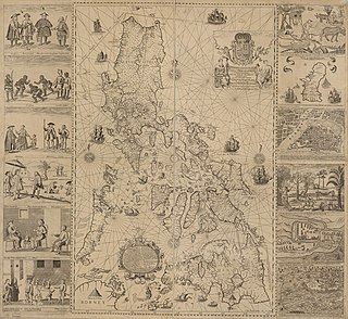
The East Indies is a term used in historical narratives of the Age of Discovery. The Indies refers to various lands in the East or the Eastern hemisphere, particularly the islands and mainlands found in and around the Indian Ocean by Portuguese explorers, soon after the Cape route was discovered. Nowadays, this term is broadly used to refer to the Malay Archipelago, which today comprises the Philippine Archipelago, Indonesian Archipelago, Borneo, and New Guinea. Historically, the term was used in the Age of Discovery to refer to the coasts of the landmasses comprising the Indian subcontinent and the Indochinese Peninsula along with the Malay Archipelago.
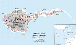
Corregidor is an island located at the entrance of Manila Bay in the southwestern part of Luzon in the Philippines, and is considered part of the Province of Cavite. Due to this location, Corregidor has historically been fortified with coastal artillery batteries to defend the entrance of Manila Bay and Manila itself from attacks by enemy warships. Located 48 kilometres (30 mi) inland, Manila is the nation's largest city and has been the most important seaport in the Philippines for centuries, from the colonial rule of Spain, Japan, and the United States, up through the establishment of the Third Philippine Republic in 1946.
Fort Hughes was built by the Philippine Department of the U.S. Army on Caballo Island in the Philippines in the early 1900s. The fort, which part of the Harbor Defenses of Manila and Subic Bays, was named for Major General Robert Patterson Hughes, a veteran of the American Civil War, Spanish–American War, and the Philippine–American War.

The Philippine–American War, known alternatively as the Philippine Insurrection, Filipino–American War, or Tagalog Insurgency, was fought between the First Philippine Republic and the United States from February 4, 1899, until July 2, 1902. Tensions arose after the United States annexed the Philippines under the Treaty of Paris at the conclusion of the Spanish–American War rather than acknowledging the Philippines' declaration of independence, developing into the eruption of open battle. The war can be seen as a continuation of the Philippine struggle for independence that began in 1896 with the Philippine Revolution against Spanish rule.
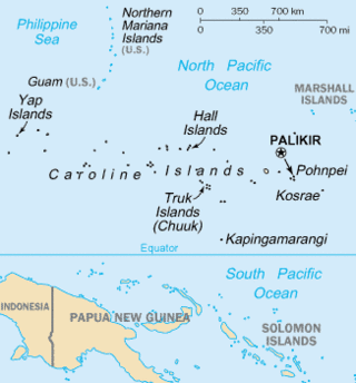
The Caroline Islands are a widely scattered archipelago of tiny islands in the western Pacific Ocean, to the north of New Guinea. Politically, they are divided between the Federated States of Micronesia (FSM) in the central and eastern parts of the group, and Palau at the extreme western end. Historically, this area was also called Nuevas Filipinas or New Philippines, because they were part of the Spanish East Indies and were governed from Manila in the Philippines.

Romblon, officially the Province of Romblon, is an archipelagic province of the Philippines located in the Mimaropa region. Its main islands include Tablas, the largest, which covers nine municipalities; Sibuyan with its three towns; as well as the smaller island municipalities of Corcuera, Banton, Concepcion, San Jose, and the municipality of the same name. The province lies south of Marinduque and Quezon, east of Oriental Mindoro, north of Aklan and Capiz, and west of Masbate. According to the 2020 census, it has a total population of 308,985.
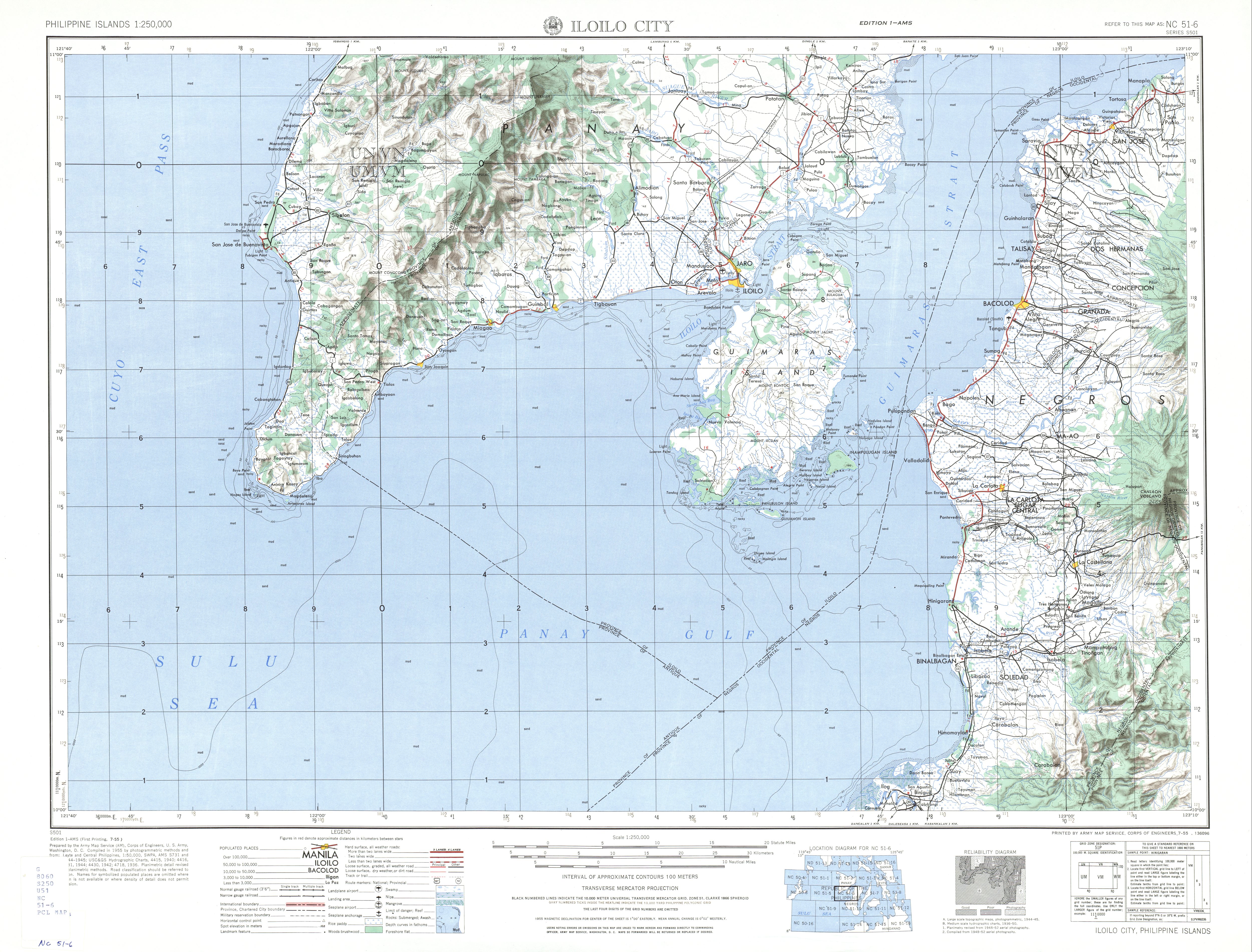
Antique, officially the Province of Antique, is a province in the Philippines located in the Western Visayas region. Its capital is San Jose de Buenavista, the most populous town in Antique. The province is situated in the western section of Panay Island and borders Aklan, Capiz and Iloilo to the east, while facing the Sulu Sea to the west.

Davao Region, formerly called Southern Mindanao, is an administrative region in the Philippines, designated as Region XI. It is situated at the southeastern portion of Mindanao and comprises five provinces: Davao de Oro, Davao del Norte, Davao del Sur, Davao Oriental and Davao Occidental.

The Mariana Islands, also simply the Marianas, are a crescent-shaped archipelago comprising the summits of fourteen longitudinally oriented, mostly dormant volcanic mountains in the northwestern Pacific Ocean, between the 12th and 21st parallels north and along the 145th meridian east. They lie south-southeast of Japan, west-southwest of Hawaii, north of New Guinea and east of the Philippines, demarcating the Philippine Sea's eastern limit. They are found in the northern part of the western Oceanic sub-region of Micronesia, and are politically divided into two jurisdictions of the United States: the Commonwealth of the Northern Mariana Islands and, at the southern end of the chain, the territory of Guam. The islands were named after the influential Spanish queen Mariana of Austria following their colonization in the 17th century.

Leapfrogging, also known as island hopping, was a military strategy employed by the Allies in the Pacific War against the Empire of Japan during World War II. The key idea is to bypass heavily fortified enemy islands instead of trying to capture every island in sequence en route to a final target. The reasoning is that those islands can simply be cut off from their supply chains rather than needing to be overwhelmed by superior force, thus speeding up progress and reducing losses of troops and materiel.

Filipinos are citizens or people identified with the country of the Philippines. The majority of Filipinos today come from various Austronesian peoples, all typically speaking Filipino, English or other Philippine languages. Currently, there are more than 185 ethnolinguistic groups in the Philippines each with its own language, identity, culture, and history.
The history of the Philippines from 1898 to 1946 began with the outbreak of the Spanish–American War in April 1898, when the Philippines was still a colony of the Spanish East Indies, and concluded when the United States formally recognized the independence of the Republic of the Philippines on July 4, 1946.
The Japanese occupation of the Philippines occurred between 1942 and 1945, when Imperial Japan occupied the Commonwealth of the Philippines during World War II.
The history of the Philippines from 1565 to 1898 is known as the Spanish colonial period, during which the Philippine Islands were ruled as the Captaincy General of the Philippines within the Spanish East Indies, initially under the Viceroyalty of New Spain, based in Mexico City, until the independence of the Mexican Empire from Spain in 1821. This resulted in direct Spanish control during a period of governmental instability there. The Philippines was under direct royal governance from 1821 to 1898.

The Insular Government of the Philippine Islands was an unincorporated territory of the United States that was established in 1902 and was reorganized in 1935 in preparation for later independence. The Insular Government was preceded by the United States Military Government of the Philippine Islands and was followed by the Commonwealth of the Philippines.

Paseo de Roxas is a prime commercial artery in the Makati Central Business District of Metro Manila, Philippines. It is a two- to six-lane avenue that cuts through the middle of the business district connecting San Lorenzo Village in the west to Bel-Air Village in the east.