Zalaegerszeg is the administrative center of Zala county in western Hungary.

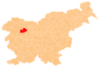
Zala is an administrative county in south-western Hungary. It is named after the Zala River. It shares borders with Croatia and Slovenia and the Hungarian counties Vas, Veszprém and Somogy. The capital of Zala county is Zalaegerszeg. Its area is 3,784 square kilometres (1,461 sq mi). Lake Balaton lies partly in the county.
Prekmurje is a geographically, linguistically, culturally and ethnically defined region settled by Slovenes and a Hungarian minority, lying between the Mur River in Slovenia and the Rába Valley in the most western part of Hungary. It maintains certain specific linguistic, cultural and religious features that differentiate it from other Slovenian traditional regions. It covers an area of 938 km2 and has a population of 78,000 people.

The Zala is a river in south-western Hungary. Its source is in the hills northwest of Szalafő near the borders with Austria and Slovenia. Its length is 139 km and drains water from 2,622 square km. Several smaller rivers feed into it, including the Felső-Válicka, Szentmihályfalvai patak (brook), Szévíz csatorna (channel), Foglár csatorna on the right bank, and Szentjakabi patak, Sárvíz (Zala) patak, Széplaki patak, Csörgető patak and Nádas patak on the left bank. It flows through the city of Zalaegerszeg before flowing into Lake Balaton near Keszthely. The River Zala flows through the Hungarian counties of Vas and Zala.

Lendava is a town and a municipality in Slovenia in the region of Prekmurje. The name of the settlement was changed from Dolnja Lendava to Lendava in 1955. It is close to the border crossing with Hungary at Dolga Vas-Rédics, and Hungarian is one of the official languages of the municipality, along with Slovene.

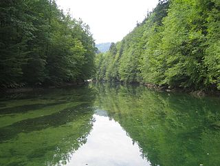
The Krka is a river in southeastern Slovenia, a right tributary of the Sava. With a length of 94.6 km (58.8 mi), it is the second-longest river flowing in its entirety in Slovenia, following the Savinja.
György Zala is a Slovenia sprint canoeist who competed from 1989 to 2001.

Zala was an administrative county (comitatus) of the Kingdom of Hungary. Its territory is now in southwestern Hungary, northern Croatia and eastern Slovenia. The territory of the county comprised what is now the Hungarian county Zala and part of Veszprém county, the Croatian region of Međimurje to the south-west of it, bordered by the river Drave, and a small region around Lendava in Slovenia. The capital of the county was Zalaegerszeg.

Vas was an administrative county (comitatus) of the Kingdom of Hungary. Its territory is now in western Hungary, eastern Austria and eastern Slovenia (Prekmurje). The capital of the county was Szombathely.

Lenti is a town in Zala County, Hungary, located near the border with Austria, Slovenia and Croatia.

Dobri is a village in Zala County, Hungary, close to the border with Slovenia.
Lispeszentadorján is a village of 334 people in Hungary. It lies in the southern part of the Zala hills, close to the Slovenian and Croatian borders. The distance to Budapest is approx. 254 km (158 mi) by car.
The Idrijca is a river flowing through the Idrija Hills and Cerkno Hills. It is 60 kilometres (37 mi) long. It rises near Vojsko, flows towards northeast and after passing through Idrija turns to the northwest. After passing through Spodnja Idrija and Cerkno it joins the Soča in Most na Soči. It has the pluvio-nival regime and belongs to the Adriatic Sea Basin.
The Temenica is a river in Slovenia. It is one of the most typical influent streams of Slovenia's karst terrain.
Szentgyörgyvölgy is a village in Zala County, Hungary. It has a Reform Church built in 1517. It lies on the Slovenian border. It currently has a population of around 500 people. It has a Catholic church. There is one bed and breakfast, called Molnárporta after the owner. Close towns include: Csesztreg, Szílvágy, Porszombat and is one hour away from the capital of Zala county, Zalaegerszeg.
Zala is a small settlement in the hills northeast of Cerknica in the Inner Carniola region of Slovenia.

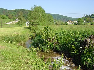
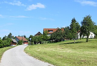
Globoka is a settlement in the hills above the right bank of the Ščavnica River in the Municipality of Ljutomer in northeastern Slovenia, adjacent to the border with Croatia. The area traditionally belonged to the Zala County in the Kingdom of Hungary and is now included in the Mura Statistical Region.

The Municipality of Razkrižje is a small municipality in Slovenia. The seat of the municipality is the town of Razkrižje. It was part of Zala County in the Kingdom of Hungary. It is now included in the Mura Statistical Region.
"Sebi" is a song performed by the Slovenian duo Zala Kralj & Gašper Šantl. On February 16, 2019, it was chosen to represent Slovenia in the Eurovision Song Contest 2019.
Zala Kralj & Gašper Šantl is a Slovenian musical duo from Maribor consisting of vocalist Zala Kralj and multi-instrumentalist Gašper Šantl. The duo will represent Slovenia in the Eurovision Song Contest 2019 with the song "Sebi".