West Forks is a plantation in Somerset County, Maine, United States. The population was 58 at the 2020 census.

Abrams is a town in Oconto County, Wisconsin, United States. The population was 1,960 at the 2020 Census. The census-designated place of Abrams is located in the town. It is located near U.S. Route 41 and U.S. Route 141 8 miles (13 km) south-southeast of Oconto Falls. Abrams has a post office that has been operating since 1882 with ZIP code 54101. As of the 2020 census, the census-designated place had a population of 358.
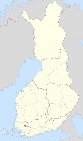
Mellilä is a former municipality of Finland. It was merged to the town of Loimaa on 1 January 2009.

Māʻalaea Bay is a large bay in the southwestern coast of Maui, in the Hawaiian islands. Several small towns are located close to the bay, notably the town of Māʻalaea. The bay is approximately three miles (4.8 km) long.

Celestine is an unincorporated community in Hall Township, Dubois County, in the U.S. state of Indiana.

Division No. 7 is a census division located within the Westman Region in the south western area of the province of Manitoba, Canada. Unlike in some other provinces, census divisions do not reflect the organization of local government in Manitoba. These areas exist solely for the purposes of statistical analysis and presentation; they have no government of their own.

Bilanga is a department or commune of Gnagna Province in northern Burkina Faso. Its capital is the town of Bilanga.
Seth Demonstration Forest is a state forest in the state of Maryland.
Bushwood is an unincorporated community in what is familiarly called the "Seventh District" of St. Mary's County, Maryland, United States. Ocean Hall was listed on the National Register of Historic Places in 1973. The ZIP Code for Bushwood is 20618.
Edgerton is an unincorporated community located in Brunswick County, in the U.S. state of Virginia.
Greentown is an unincorporated community located in Brunswick County, in the U.S. state of Virginia.
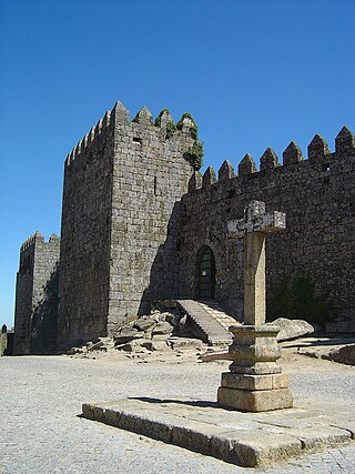
Castelo de Trancoso is a castle in Portugal. It is classified as a National Monument. The castle is in the municipality of Trancoso which is in the Guarda District of Portugal.
Panic is an unincorporated community in Jefferson County, Pennsylvania, United States.
Otsego is an unincorporated community in Wood County, in the U.S. state of Ohio.
Reform is an unincorporated community in southeastern Callaway County, Missouri, United States. The community is located at the intersection of Routes CC and O approximately six miles north of Steedman and the Missouri River. The Reform Conservation Area lies just to the south. The Callaway Nuclear Generating Station is located at Reform.
Graysville is an unincorporated community in eastern Putnam County, in the U.S. state of Missouri.
Mill Creek is a stream in Washington and St. Francois counties of eastern Missouri. It is a tributary of the Big River. The stream source is located at: 37°56′29″N90°43′25″W near Mineral Point and the confluence with Big River is at: 38°02′10″N90°37′11″W just south of Blackwell.
Norfleet is an unincorporated community in Pulaski County, in the U.S. state of Kentucky.
Carnegie is an unincorporated community in Randolph County, in the U.S. state of Georgia.
Sports Leadership and Management Charter School (SLAM) is a public charter school for intermediate and secondary grade levels in Little Havana, Miami, Florida.

