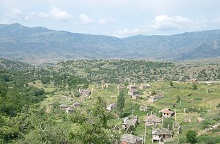
Planica is an Alpine valley in northwestern Slovenia, extending south from the border village of Rateče, not far from another well-known ski resort, Kranjska Gora. Further south, the valley extends into the Tamar Valley, a popular hiking destination in Triglav National Park.

Muqur District is a district located within Badghis Province in the western part of Afghanistan. It is located between the districts of Ab Kamari to the east, Qala i Naw to the south, Qadis to the southeast and Murghab to the northeast. To the north is the national border with Turkmenistan. The district is in a long river valley.
Baljevac is a village in Belgrade region, in the municipality of Obrenovac. According to the 2002 census, Baljevac had 532 inhabitants.

Japonvar is a Brazilian municipality located in the north of the state of Minas Gerais. In 2007 the population was 8,232 in a total area of 376 km². It became a municipality in 1997.

Lusagyugh is a town in the Armavir Province of Armenia.

Tsaghkunk is a town in the Armavir Province of Armenia. The town's church dates from the 19th century.

Tsovazard is a village in the Gegharkunik Province of Armenia. There are Bronze Age burial sites and a church rebuilt in the 19th century in the vicinity.

Przeczno is a village in the administrative district of Gmina Łubianka, within Toruń County, Kuyavian-Pomeranian Voivodeship, in north-central Poland. It lies approximately 17 km (11 mi) north-west of Toruń and 33 km (21 mi) east of Bydgoszcz.

Yaşma is a village in the Khizi Rayon of Azerbaijan. The village forms part of the municipality of Şuraabad.

Bedlno is a village in the administrative district of Gmina Końskie, within Końskie County, Świętokrzyskie Voivodeship, in south-central Poland. It lies approximately 11 kilometres (7 mi) west of Końskie and 44 km (27 mi) north-west of the regional capital Kielce.

Brzeźnica is a village in the administrative district of Gmina Gowarczów, within Końskie County, Świętokrzyskie Voivodeship, in south-central Poland. It lies approximately 4 kilometres (2 mi) east of Gowarczów, 10 km (6 mi) north-east of Końskie, and 44 km (27 mi) north of the regional capital Kielce.

Sonina is a village in the administrative district of Gmina Łańcut, within Łańcut County, Subcarpathian Voivodeship, in south-eastern Poland. It lies approximately 3 kilometres (2 mi) east of Łańcut and 20 km (12 mi) east of the regional capital Rzeszów.

Rybitwy is a village in the administrative district of Gmina Połaniec, within Staszów County, Świętokrzyskie Voivodeship, in south-central Poland. It lies approximately 3 kilometres (2 mi) south of Połaniec, 19 km (12 mi) south-east of Staszów, and 70 km (43 mi) south-east of the regional capital Kielce.

Leśniakowizna is a village in the administrative district of Gmina Wołomin, within Wołomin County, Masovian Voivodeship, in east-central Poland.
Brzeziak is a settlement in the administrative district of Gmina Środa Wielkopolska, within Środa Wielkopolska County, Greater Poland Voivodeship, in west-central Poland.
Jadwiżyn is a settlement in the administrative district of Gmina Bobolice, within Koszalin County, West Pomeranian Voivodeship, in north-western Poland.
Pededze Parish is an administrative unit of the Alūksne Municipality, Latvia.

Babice Gornje is a village in the municipality of Lukavac, Bosnia and Herzegovina.

Mirijevo is a village in the municipality of Žabari, Serbia. According to the 2002 census, the village has a population of 474 people.

Veprčani is a village in Municipality of Prilep.


