Škrilje, Ig

Last updated
Škrilje
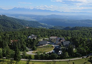
Skrilje Ig Slovenia 1.jpg
Slovenia location map.svg
Red pog.svg
Škrilje
Location in Slovenia
Coordinates: 45°55′2.25″N14°32′27.32″E / 45.9172917°N 14.5409222°E / 45.9172917; 14.5409222 Coordinates: 45°55′2.25″N14°32′27.32″E / 45.9172917°N 14.5409222°E / 45.9172917; 14.5409222
Country Flag of Slovenia.svg Slovenia
Traditional region Inner Carniola
Statistical region Central Slovenia
Municipality Ig
Area
  Total 3.55 km2 (1.37 sq mi)
Elevation 581.3 m (1,907.2 ft)
Population (2002)
  Total 304
[1]

Škrilje (pronounced  [ˈʃkɾiːljɛ] ) is a village in the Municipality of Ig in central Slovenia. The municipality is part of the traditional region of Inner Carniola and is now included in the Central Slovenia Statistical Region. [2]

Village Small clustered human settlement smaller than a town

A village is a clustered human settlement or community, larger than a hamlet but smaller than a town, with a population ranging from a few hundred to a few thousand. Though villages are often located in rural areas, the term urban village is also applied to certain urban neighborhoods. Villages are normally permanent, with fixed dwellings; however, transient villages can occur. Further, the dwellings of a village are fairly close to one another, not scattered broadly over the landscape, as a dispersed settlement.

Municipality of Ig Municipality in Slovenia

The Municipality of Ig is a municipality in central Slovenia. Its seat is the settlement of Ig. It was formed in 1995 from parts of the Municipality of Vič–Rudnik, until then one of the five municipalities that formed the Civic Assembly of Municipalities of Ljubljana. It is part of the traditional region of Inner Carniola and is now included in the Central Slovenia Statistical Region. In the past the area was mostly marshland, but now Ig is a suburban and industrialized municipality. In 2002, it had 5445 inhabitants.

Slovenia republic in Central Europe

Slovenia, officially the Republic of Slovenia, is a sovereign state located in southern Central Europe at a crossroads of important European cultural and trade routes. It is bordered by Italy to the west, Austria to the north, Hungary to the northeast, Croatia to the southeast, and the Adriatic Sea to the southwest. It covers 20,273 square kilometers (7,827 sq mi) and has a population of 2.07 million. One of the successor states of the former Yugoslavia, Slovenia is a parliamentary republic and a member of the United Nations, of the European Union, and of NATO. The capital and largest city is Ljubljana.

The site of an Iron Age fortified settlement has been found on Stražar Hill west of the settlement on a strategic point above the Iška Gorge. [3]

The Iron Age is the final epoch of the three-age system, preceded by the Stone Age (Neolithic) and the Bronze Age. It is an archaeological era in the prehistory and protohistory of Europe and the Ancient Near East, and by analogy also used of other parts of the Old World. The three-age system was introduced in the first half of the 19th century for the archaeology of Europe in particular, and by the later 19th century expanded to the archaeology of the Ancient Near East. Its name harks back to the mythological "Ages of Man" of Hesiod. As an archaeological era it was first introduced for Scandinavia by Christian Jürgensen Thomsen in the 1830s. By the 1860s, it was embraced as a useful division of the "earliest history of mankind" in general and began to be applied in Assyriology. The development of the now-conventional periodization in the archaeology of the Ancient Near East was developed in the 1920s to 1930s. As its name suggests, Iron Age technology is characterized by the production of tools and weaponry by ferrous metallurgy (ironworking), more specifically from carbon steel.

Iška river in Slovenia

The Iška is a river of central Slovenia. Part of the river valley—the Iška Gorge or Iška Canyon —separates Lower Carniola from Inner Carniola. The river is 31 km (19 mi) long. After flowing past Strahomer, the river follows an almost straight line and joins the Ljubljanica River, and therefore belongs to the Sava and Black Sea basins.

Related Research Articles

Municipality of Brezovica Municipality in Slovenia

The Municipality of Brezovica is a municipality in central Slovenia, just south of its capital Ljubljana. It has approximately 9,300 inhabitants. Its administrative centre is the settlement of Brezovica pri Ljubljani. It is the central municipality in the Ljubljana Marshes. The entire municipality is part of the traditional region of Inner Carniola and is now included in the Central Slovenia Statistical Region. To the east, it borders the municipalities of Ljubljana and Ig. To the south, it borders the Municipality of Cerknica, to the west the municipalities of Borovnica and Vrhnika, and to the north the Municipality of Dobrova–Polhov Gradec.

Visoko, Ig Place in Inner Carniola, Slovenia

Visoko is a village in the Municipality of Ig in central Slovenia. The municipality is part of the traditional region of Inner Carniola and is now included in the Central Slovenia Statistical Region. The hamlet west of the main settlement was formerly known as Mokrice.

Škrilje, Metlika in White Carniola, Slovenia

Škrilje is a small settlement on the left bank of the Kolpa River south of Podzemelj in the Municipality of Metlika in the White Carniola area of southeastern Slovenia. The area is part of the traditional region of Lower Carniola and is now included in the Southeast Slovenia Statistical Region.

Dobravica, Ig in Inner Carniola, Slovenia

Dobravica is a settlement in the Municipality of Ig in central Slovenia. The municipality is part of the traditional region of Inner Carniola and is now included in the Central Slovenia Statistical Region.

Golo, Ig Place in Inner Carniola, Slovenia

Golo is a village in the hills south of Ig in central Slovenia. The entire Municipality of Ig is part of the traditional region of Inner Carniola and is now included in the Central Slovenia Statistical Region.

Gornji Ig in Inner Carniola, Slovenia

Gornji Ig is a village in the hills southwest of Iška Vas in the Municipality of Ig in central Slovenia. The entire municipality is part of the traditional region of Inner Carniola and is now included in the Central Slovenia Statistical Region.

Iška Loka in Inner Carniola, Slovenia

Iška Loka is a village in the Municipality of Ig in central Slovenia, in the marshes just south of the capital Ljubljana. The entire municipality is part of the traditional region of Inner Carniola and is now included in the Central Slovenia Statistical Region.

Iška Vas Village in Inner Carniola, Slovenia

Iška Vas is a village on the right bank of the Iška River in the Municipality of Ig in central Slovenia, just south of the capital Ljubljana. The entire municipality is part of the traditional region of Inner Carniola and is now included in the Central Slovenia Statistical Region.

Kot, Ig in Inner Carniola, Slovenia

Kot is a village in the Municipality of Ig in central Slovenia, just south of the capital Ljubljana. The municipality is part of the traditional region of Inner Carniola and is now included in the Central Slovenia Statistical Region.

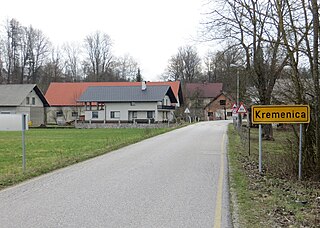
Kremenica in Inner Carniola, Slovenia

Kremenica is a settlement immediately southeast of Ig in central Slovenia. The entire Municipality of Ig is part of the traditional region of Inner Carniola. It is included in the Central Slovenia Statistical Region.

Rogatec nad Želimljami in Inner Carniola, Slovenia

Rogatec nad Želimljami is a small settlement in the hills southeast of Golo in the Municipality of Ig in central Slovenia. The entire municipality is part of the traditional region of Inner Carniola and is now included in the Central Slovenia Statistical Region.

Sarsko in Inner Carniola, Slovenia

Sarsko is a small village southeast of Ig in central Slovenia. The Municipality of Ig is part of the traditional region of Inner Carniola and is now included in the Central Slovenia Statistical Region.

Selnik, Ig in Inner Carniola, Slovenia

Selnik is a village east of Golo in the Municipality of Ig in central Slovenia. The entire municipality is part of the traditional region of Inner Carniola and is now included in the Central Slovenia Statistical Region.

Staje Place in Inner Carniola, Slovenia

Staje is a settlement west of Ig in central Slovenia. The entire Municipality of Ig is part of the traditional region of Inner Carniola and is now included in the Central Slovenia Statistical Region.

Škrilj, Semič Place in Lower Carniola, Slovenia

Škrilj is a remote former settlement in the Municipality of Semič in southern Slovenia. The area is part of the traditional region of Lower Carniola and is now included in the Southeast Slovenia Statistical Region. Its territory is now part of the village of Planina.

Podkraj, Ig in Inner Carniola, Slovenia

Podkraj is a village in the Municipality of Ig in central Slovenia, on the edge of the marshland south of the capital Ljubljana. The municipality is part of the traditional region of Inner Carniola and is now included in the Central Slovenia Statistical Region. It includes the hamlet of Šent Janž.

Draga, Ig Place in Inner Carniola, Slovenia

Draga is a small village in the Municipality of Ig in southeastern Slovenia. Until 2007, the area was part of the settlements of Dobravica and Sarsko. The village is part of the traditional region of Inner Carniola and is included in the Central Slovenia Statistical Region.

Podgozd, Ig Place in Inner Carniola, Slovenia

Podgozd is a small village in the Municipality of Ig in southeastern Slovenia. Until 2007, the area was part of the settlement of Dobravica. The village is part of the traditional region of Inner Carniola and is included in the Central Slovenia Statistical Region.

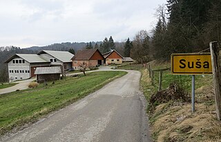
Suša, Ig in Inner Carniola, Slovenia

Suša is a small village in the Municipality of Ig in southeastern Slovenia. Until 2007, the area was part of the settlement of Selnik. The village is part of the traditional region of Inner Carniola and is included in the Central Slovenia Statistical Region.

References